Marilyn · Cairngorms
Meikle Conval
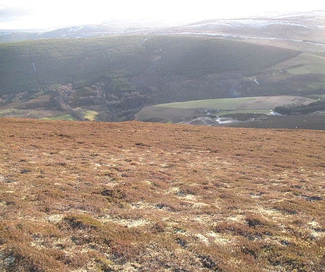
The bigger of the two Conval hills standing sentinel over Dufftown amid the Speyside whisky country. From the trig pillar the silver tongue of the Spey threads north past Glenfiddich, Balvenie and Mortlach distilleries — a panorama with a price list attached.
Quick facts
- Height
- 571m/ 1873ft
- Prominence
- 246 m
- Grid ref
- NJ 29113 37114
- Nearest city
- Inverness· 63km
- Dogs
- Dogs on lead required near livestockDog-friendly guide ↗
Height and prominence cross-checked against the Database of British and Irish Hills (CC BY).
No GPX track yet
Walked this route? Share your track to help other walkers.
Standard route
heather moorland 65% · grass slopes 25% · rocky summit 10%
A clear path runs from the Pittyvaich layby on the B9009 south of Dufftown, gaining the col between the two Convals and then climbing the bigger hill from there. Around 7km return with 350m of ascent — three hours is plenty.
Terrain
A well-used track on the lower slopes leads to grassy uplands with patches of heather. The summit slopes are short, dry turf with a small rocky cap — easy underfoot throughout.
In winter
A reliable winter outing as the Cairngorms proper become hostile. Snow does lie on the upper slopes from January but the well-marked track is rarely difficult to follow.
This hill is in the Northern Cairngorms SAIS forecast area. Check SAIS forecasts in winter (December–April).
Best time of year
Getting there
- Glasgow5h 53m
- Edinburgh4h 48m
OS maps: OS Landranger 28, OS Explorer 424S
Mobile signal: Moderate. EE weak on top; better toward Dufftown.
Current conditions
Daylight Today
- Sunrise
- 05:05
- Sunset
- 21:34
- Civil dawn
- 04:12
- Civil dusk
- 22:27
NOAA Solar Calculator · 30 July 2026
Around Meikle Conval on the SCOT network
Getting there, basing yourself, and what to do off the hill.
Getting there: Aviemore station
Cairngorm plateau; Lairig Ghru; Speyside Way; Glenmore
46km from the hill
tripscot.co.uk
On TripSCOTBase yourself in Dufftown
Speyside whisky town in the eastern Cairngorms
4km from the hill
tripscot.co.uk
On TasteSCOTAfter the hill: Glenfiddich
Dufftown — the world's best-selling single malt; visitor centre on the Speyside Way
4km from the hill
tastescot.co.uk
Meikle Conval — common questions
- Is Meikle Conval a hard climb?
- Meikle Conval is rated 2/5 (moderate) on the OutdoorSCOT scale. Terrain: A well-used track on the lower slopes leads to grassy uplands with patches of heather.
- How prominent is Meikle Conval?
- Meikle Conval has 246m of topographic prominence — the height of its summit above the highest col connecting it to higher ground. Marilyns are defined by that measure: at least 150m of drop on all sides.
- When should I climb Meikle Conval?
- The standard good-weather months for Meikle Conval are March, April, May, June, July, August, September, October. Outside those months, expect winter conditions on the high ground — full mountain kit, navigation skills, and a check of the SAIS avalanche forecast for the relevant region.
- Can I bring my dog up Meikle Conval?
- On a lead only — the route crosses ground with livestock or nesting-bird interest.
- What's mobile reception like on Meikle Conval?
- Moderate. EE weak on top; better toward Dufftown.
- Is Meikle Conval safe in winter?
- A reliable winter outing as the Cairngorms proper become hostile. Snow does lie on the upper slopes from January but the well-marked track is rarely difficult to follow.
Get the OutdoorSCOT weekly
One email a week — new route, hill and bothy guides, seasonal conditions and the odd hard-won lesson. No spam, unsubscribe in one click.