Marilyn · Cairngorms
Knockan
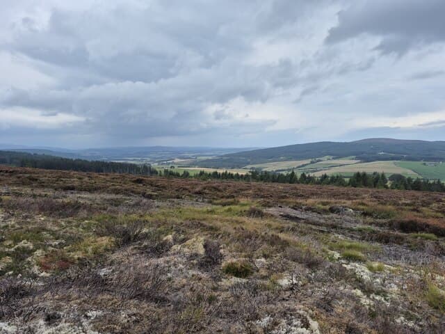
A 372m heather knoll between the lower Spey and the Deveron, sitting in the rolling whisky country of central Banffshire. Modest in altitude but with enough prominence to give the summit cairn a genuine outlook over the woods and farms of Strathisla.
Quick facts
- Height
- 372m/ 1220ft
- Prominence
- 179 m
- Grid ref
- NJ 35101 46471
- Nearest city
- Inverness· 68km
- Dogs
- Dogs on lead required near livestockDog-friendly guide ↗
Height and prominence cross-checked against the Database of British and Irish Hills (CC BY).
No GPX track yet
Walked this route? Share your track to help other walkers.
Standard route
heather moorland 70% · grass slopes 20% · rocky summit 10%
From the unclassified road south of Drummuir, follow farm tracks past Tomnamoon then strike directly up the heather to the broad summit. Around 4km return with 200m of ascent — a brisk hour and a half.
Terrain
Farm tracks lead onto well-managed grouse moor. The summit slopes are short, dry heather with occasional peat patches but little serious bog.
In winter
Snow generally settles only in patches but the heather can mat treacherously when frosted. Useful as a short outing on days when higher hills are out of condition.
Best time of year
Getting there
- Glasgow5h 13m
- Edinburgh4h 2m
OS maps: OS Landranger 28, OS Explorer 424S
Mobile signal: Signal is good; EE rarely drops. Fine Strathisla viewpoint.
Current conditions
Daylight Today
- Sunrise
- 06:40
- Sunset
- 19:36
- Civil dawn
- 06:01
- Civil dusk
- 20:16
NOAA Solar Calculator · 14 September 2026
Around Knockan on the SCOT network
Getting there, basing yourself, and what to do off the hill.
Getting there: Aviemore station
Cairngorm plateau; Lairig Ghru; Speyside Way; Glenmore
56km from the hill
tripscot.co.uk
On TripSCOTBase yourself in Dufftown
Speyside whisky town in the eastern Cairngorms
7km from the hill
tripscot.co.uk
On TasteSCOTAfter the hill: Glenfiddich
Dufftown — the world's best-selling single malt; visitor centre on the Speyside Way
7km from the hill
tastescot.co.uk
Knockan — common questions
- How hard is Knockan?
- We grade Knockan at 1/5, which puts it in easy territory. Underfoot: Farm tracks lead onto well-managed grouse moor.
- What is Knockan's prominence?
- 179m of prominence. That's the vertical drop from the summit to the col that links Knockan to the next higher ground. That drop is what qualifies it as a Marilyn — a hill with at least 150m of descent on every side.
- When is the best time to climb Knockan?
- March, April, May, June, July, August, September, October give the most reliable conditions on Knockan. Beyond that window the high ground turns wintry: carry full mountain kit, be confident navigating, and check the SAIS avalanche forecast for the area.
- Is Knockan dog-friendly?
- Yes, but dogs must be kept on a lead — there is livestock or ground-nesting bird interest on the route.
- Is there mobile signal on Knockan?
- Signal is good; EE rarely drops. Fine Strathisla viewpoint.
- Is Knockan safe in winter?
- Snow generally settles only in patches but the heather can mat treacherously when frosted. Useful as a short outing on days when higher hills are out of condition.
Get the OutdoorSCOT weekly
One email a week — new route, hill and bothy guides, seasonal conditions and the odd hard-won lesson. No spam, unsubscribe in one click.