Graham · Arrochar & Trossachs
The Stob
A small shapely summit overlooking Glen Buckie on the eastern side of Loch Voil in the Balquhidder hills. Forms the western outlier of the Stuc a' Chroin/Beinn Each chain and is often climbed together with the Corbett Beinn an t-Sidhein across the glen.
Quick facts
- Height
- 753.6m/ 2472ft
- Prominence
- 229 m
- Distance
- 14 km
- Ascent
- 617 m
- Time
- 4–6 hrs
- Grid ref
- NN491231
- Parking
- NN535175
- Nearest city
- Stirling· 43km
- Dogs
- Dogs on lead required near livestockDog-friendly guide ↗
Height and prominence cross-checked against the Database of British and Irish Hills (CC BY).
No GPX track yet
Walked this route? Share your track to help other walkers.
Standard route
village path 15% · steep heather 40% · grassy ridge 35% · summit area 10%
Park at Ballimore in Glen Buckie and follow the right of way south up the glen, taking a wet hillside left after a kilometre and ascending grass and bracken to a small rocky summit cone above the corrie.
Terrain
Soft path through pasture and bracken, then trackless wet grass on the upper flanks. A few outcrops near the top but easy walking throughout.
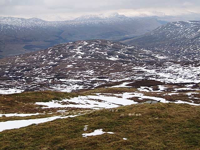
In winter
Wet snow plasters the grassy slopes when a Trossachs front moves through; hidden burn-mouths under softening drifts are the principal hazard. Higher hills shed cornices easily so check the bigger ridges above.
This hill is in the Southern Highlands SAIS forecast area. Check SAIS forecasts in winter (December–April).
Best time of year
Getting there
- Glasgow1h 24m
- Edinburgh2h 56m
OS maps: OS Landranger 51
Mobile signal: Poor signal in this Arrochar/Tarbet area
Current conditions
Daylight Today
- Sunrise
- 04:47
- Sunset
- 22:00
- Civil dawn
- 03:49
- Civil dusk
- 22:59
NOAA Solar Calculator · 13 July 2026
Around The Stob on the SCOT network
Getting there, basing yourself, and what to do off the hill.
The Stob — common questions
- How difficult is The Stob?
- The Stob carries a 3/5 (moderately challenging) grade on the OutdoorSCOT scale. Count on about 14km, 617m of ascent and a 4-6 hour day on the standard route. Underfoot: Soft path through pasture and bracken, then trackless wet grass on the upper flanks.
- What is The Stob's prominence?
- 229m of prominence. That's the vertical drop from the summit to the col that links The Stob to the next higher ground.
- Where do I park for The Stob?
- Most walkers start from NN535175. Verify the grid reference on an OS map before you set off — space is tight on busy summer weekends.
- When is the best time to climb The Stob?
- April, May, June, July, August, September, October give the most reliable conditions on The Stob. Beyond that window the high ground turns wintry: carry full mountain kit, be confident navigating, and check the SAIS avalanche forecast for the area.
- Is The Stob dog-friendly?
- Yes, but dogs must be kept on a lead — there is livestock or ground-nesting bird interest on the route.
- Is there mobile signal on The Stob?
- Poor signal in this Arrochar/Tarbet area
- Is The Stob safe in winter?
- Wet snow plasters the grassy slopes when a Trossachs front moves through; hidden burn-mouths under softening drifts are the principal hazard. Higher hills shed cornices easily so check the bigger ridges above.
Get the OutdoorSCOT weekly
One email a week — new route, hill and bothy guides, seasonal conditions and the odd hard-won lesson. No spam, unsubscribe in one click.