Corbett · Arrochar & Trossachs
Creag Mac Ranaich
Creag Mac Ranaich is a quietly characterful Corbett above Lochearnhead — a hill of rocky outcrops, hidden lochans, and a summit area that feels much more rugged than its 809m height suggests. The name commemorates Mac Ranaich, a freebooter said to have taken refuge in the crags during the 17th century. Most walkers tackle it from Kingshouse on the A84, often combining the day with Meall an t-Seallaidh to the south for a Lochearnhead double. The summit gives a clean view across to Ben Vorlich, Stuc a' Chroin and the Loch Earn corridor.
Gaelic: “crag, son of” · Pronunciation: krayg mac ranaich
Quick facts
- Height
- 808.6m/ 2653ft
- Prominence
- 213 m
- Distance
- ~10 km
- Ascent
- ~730 m
- Time
- 3–5 hrs
- Grid ref
- NN545255
- Parking
- NN567279
- Nearest city
- Stirling· 41km
- Dogs
- Dogs on lead required near livestockDog-friendly guide ↗
Height and prominence cross-checked against the Database of British and Irish Hills (CC BY).
No GPX track yet
Walked this route? Share your track to help other walkers.
Standard route
glen track 20% · stalkers path 30% · heather hillside 35% · summit area 15%
Park at the small car park by the Kingshouse Hotel layby on the A84 (NN567279). Walk north on the cycle path briefly, then take the forestry track that climbs west-north-west onto open hillside. The route gains the broad south-east ridge of Creag Mac Ranaich, weaving between rock outcrops and small lochans to reach the rocky summit. For the double, descend south to Meall an t-Seallaidh. Allow 5–6 hours for Creag Mac Ranaich alone.
Terrain
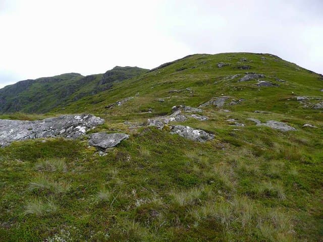
Forestry track on the lower slopes. The upper hill has a profusion of small rocky outcrops, knolls and shallow lochans — pretty country but route-finding through the maze in cloud can be slow. The summit is a small rocky tor; the path skirts around several similar tors that are easy to mistake for the main top.
In winter
A small but interesting winter Corbett — the rocky upper hill holds verglas and the navigation challenge increases under snow. North-facing aspects hold snow longest. No avalanche issues on the standard line. A good winter day for parties wanting a shorter outing than the nearby Stuc a' Chroin / Ben Vorlich Munros.
Kit for this: the winter Munro kit list · which boots take crampons
Best time of year
Getting there
- Glasgow1h 26m
- Edinburgh2h 52m
OS maps: OS Landranger 51
Mobile signal: Poor signal in Glen Lochay area; brief coverage on the summit
Current conditions
Daylight Today
- Sunrise
- 07:47
- Sunset
- 18:20
- Civil dawn
- 07:09
- Civil dusk
- 18:58
NOAA Solar Calculator · 14 October 2026
Pair with
Curated multi-hill combinations from Creag Mac Ranaich.
Around Creag Mac Ranaich on the SCOT network
Getting there, basing yourself, and what to do off the hill.
Getting there: Crianlarich station
Crianlarich Munros — Ben More, Stob Binnein, Ben Lui, Cruach Ardrain
16km from the hill
tripscot.co.uk
On TripSCOTBase yourself in Callander
Trossachs gateway — Ben Ledi, Stuc a Chroin, Rob Roy Way
19km from the hill
tripscot.co.uk
On TasteSCOTAfter the hill: The Glenturret
Crieff — Scotland's oldest working distillery; Famous Grouse Experience
30km from the hill
tastescot.co.uk
Creag Mac Ranaich — common questions
- How hard is Creag Mac Ranaich?
- We grade Creag Mac Ranaich at 2/5, which puts it in moderate territory. The usual route is around 10km with 730m of climbing; allow 3-5 hours. Terrain: Forestry track on the lower slopes.
- How prominent is Creag Mac Ranaich?
- Creag Mac Ranaich has 213m of topographic prominence — the height of its summit above the highest col connecting it to higher ground.
- Where should I park to climb Creag Mac Ranaich?
- Standard parking is at NN567279. Check the parking grid reference on an OS map before travel; informal laybys can fill on summer weekends.
- When should I climb Creag Mac Ranaich?
- The standard good-weather months for Creag Mac Ranaich are April, May, June, July, August, September, October. Outside those months, expect winter conditions on the high ground — full mountain kit, navigation skills, and a check of the SAIS avalanche forecast for the relevant region.
- Can I bring my dog up Creag Mac Ranaich?
- On a lead only — the route crosses ground with livestock or nesting-bird interest.
- What's mobile reception like on Creag Mac Ranaich?
- Poor signal in Glen Lochay area; brief coverage on the summit
- Is Creag Mac Ranaich safe in winter?
- A small but interesting winter Corbett — the rocky upper hill holds verglas and the navigation challenge increases under snow. North-facing aspects hold snow longest. No avalanche issues on the standard line. A good winter day for parties wanting a shorter outing than the nearby Stuc a' Chroin / Ben Vorlich Munros.
Get the OutdoorSCOT weekly
One email a week — new route, hill and bothy guides, seasonal conditions and the odd hard-won lesson. No spam, unsubscribe in one click.