Graham · Glen Coe & Lochaber
Stob na Cruaiche
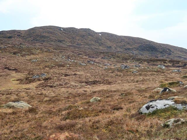
A broad peat-mantled Graham on the south side of Rannoch Moor, looking out over Loch Laidon and the Black Mount. From the Glen Coe road it is barely noticed, but the summit gives one of the strangest views in Scotland — a vast bog horizon punctuated by lochans.
Quick facts
- Height
- 740m/ 2428ft
- Prominence
- 351 m
- Distance
- 14 km
- Ascent
- 607 m
- Time
- 4–7 hrs
- Grid ref
- NN363571
- Parking
- NN313572
- Nearest city
- Fort William· 31km
- Dogs
- Dogs on lead required near livestockDog-friendly guide ↗
Height and prominence cross-checked against the Database of British and Irish Hills (CC BY).
No GPX track yet
Walked this route? Share your track to help other walkers.
Standard route
peninsula path 20% · heather hillside 50% · grassy upper slopes 20% · summit area 10%
Start from the layby just east of Loch Ba on the A82. Cross the moor southwards on faint argocat tracks, picking a line round the worst of the peat hags toward the broad north ridge. The final pull onto the summit plateau is gentle but featureless.
Terrain
Peat, peat and more peat. Even in dry summers the moor holds water and the hags can be waist-deep. Once on the upper plateau the going eases to short heather and moss.
In winter
A serious navigation hill in winter — the featureless plateau and complete absence of shelter make whiteout conditions genuinely disorienting. Frozen bog can actually make the approach faster than in summer.
This hill is in the Glen Coe SAIS forecast area. Check SAIS forecasts in winter (December–April).
Best time of year
Getting there
- Glasgow2h 1m
- Edinburgh3h 36m
OS maps: OS Landranger 41
Mobile signal: No signal on Rannoch Moor; intermittent reception near Loch Ba
Current conditions
Daylight Today
- Sunrise
- 04:52
- Sunset
- 21:58
- Civil dawn
- 03:54
- Civil dusk
- 22:55
NOAA Solar Calculator · 17 July 2026
Around Stob na Cruaiche on the SCOT network
Getting there, basing yourself, and what to do off the hill.
Stob na Cruaiche — common questions
- Is Stob na Cruaiche a hard climb?
- Stob na Cruaiche is rated 4/5 (challenging) on the OutdoorSCOT scale. The standard route covers about 14km with 607m of ascent and takes most walkers 4-7 hours. Terrain: Peat, peat and more peat.
- How prominent is Stob na Cruaiche?
- Stob na Cruaiche has 351m of topographic prominence — the height of its summit above the highest col connecting it to higher ground.
- Where should I park to climb Stob na Cruaiche?
- Standard parking is at NN313572. Check the parking grid reference on an OS map before travel; informal laybys can fill on summer weekends.
- When should I climb Stob na Cruaiche?
- The standard good-weather months for Stob na Cruaiche are April, May, June, July, August, September, October. Outside those months, expect winter conditions on the high ground — full mountain kit, navigation skills, and a check of the SAIS avalanche forecast for the relevant region.
- Can I bring my dog up Stob na Cruaiche?
- On a lead only — the route crosses ground with livestock or nesting-bird interest.
- What's mobile reception like on Stob na Cruaiche?
- No signal on Rannoch Moor; intermittent reception near Loch Ba
- Is Stob na Cruaiche safe in winter?
- A serious navigation hill in winter — the featureless plateau and complete absence of shelter make whiteout conditions genuinely disorienting. Frozen bog can actually make the approach faster than in summer.
Get the OutdoorSCOT weekly
One email a week — new route, hill and bothy guides, seasonal conditions and the odd hard-won lesson. No spam, unsubscribe in one click.