Graham · Kintail
Slat Bheinn
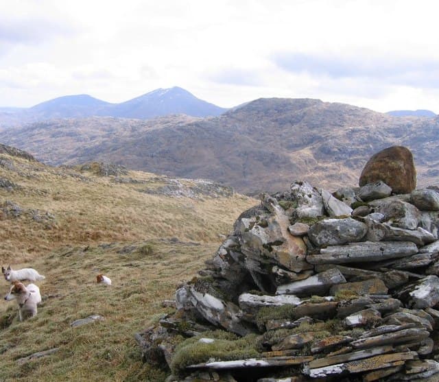
Slat Bheinn (700m) is a remote schist hill at the head of Loch Hourn, set in the NG90 square on the Knoydart-Glenelg border. Its name means the long staff hill — a reference to the slender summit ridge angled north-east. Standing well back from the road, it sees few visitors despite a fine view across the loch to Beinn Sgritheall.
Quick facts
- Height
- 700.6m/ 2299ft
- Prominence
- 270 m
- Distance
- 13 km
- Ascent
- 574 m
- Time
- 4–6 hrs
- Grid ref
- NG910027
- Parking
- NG905019
- Nearest city
- Fort William· 35km
- Dogs
- Dogs on lead required near livestockDog-friendly guide ↗
Height and prominence cross-checked against the Database of British and Irish Hills (CC BY).
No GPX track yet
Walked this route? Share your track to help other walkers.
Standard route
heather and bog 55% · rocky hillside 30% · grass slopes 15%
The standard approach is from Kinloch Hourn at the road end. Follow the coastal path west for 4km to the Skiary cottage, then strike up the north-east shoulder on heather and slabby outcrops. The crest is a delight: a thin ribbon of schist with one airy spot before the summit outcrop.
Terrain
Coastal path on bracken-strewn slope, then heather and exposed schist slabs above 400m. The slanted summit outcrop tilts steeply enough to need a hand in the wet. Pathless above the cottage with deer trods the only assistance.
In winter
Loch Hourn's microclimate combines maritime wet with sudden Atlantic squalls — snow is intermittent but the schist slabs verglas viciously after rain. The walk-in from Kinloch Hourn is a serious commitment in short December daylight, and there is no quick exit from the upper ridge.
Best time of year
Getting there
- Glasgow3h 57m
- Edinburgh4h 35m
OS maps: OS Landranger 33
Mobile signal: Poor. Ardnamurchan peninsula location with very limited coverage.
Current conditions
Daylight Today
- Sunrise
- 04:46
- Sunset
- 22:09
- Civil dawn
- 03:45
- Civil dusk
- 23:10
NOAA Solar Calculator · 13 July 2026
Around Slat Bheinn on the SCOT network
Getting there, basing yourself, and what to do off the hill.
Slat Bheinn — common questions
- How hard is Slat Bheinn?
- We grade Slat Bheinn at 4/5, which puts it in challenging territory. The usual route is around 13km with 574m of climbing; allow 4-6 hours. Ground conditions: Coastal path on bracken-strewn slope, then heather and exposed schist slabs above 400m.
- How much drop does Slat Bheinn have?
- The drop is 270m: measured from the summit of Slat Bheinn down to the saddle joining it to higher terrain.
- Where's the parking for Slat Bheinn?
- Park at NG905019. Double-check the grid reference on an OS map first; informal laybys here fill early in high season.
- What's the best month to climb Slat Bheinn?
- Aim for May, June, July, August, September on Slat Bheinn. In the remaining months treat it as a winter hill — full kit, solid navigation, and a look at the relevant SAIS avalanche forecast before you go.
- Can dogs go up Slat Bheinn?
- Dogs are fine on a lead. The route passes livestock or ground-nesting bird habitat, so keep them close throughout.
- Will I get phone signal on Slat Bheinn?
- Poor. Ardnamurchan peninsula location with very limited coverage.
- Is Slat Bheinn safe in winter?
- Loch Hourn's microclimate combines maritime wet with sudden Atlantic squalls — snow is intermittent but the schist slabs verglas viciously after rain. The walk-in from Kinloch Hourn is a serious commitment in short December daylight, and there is no quick exit from the upper ridge.
Get the OutdoorSCOT weekly
One email a week — new route, hill and bothy guides, seasonal conditions and the odd hard-won lesson. No spam, unsubscribe in one click.