Graham · Central Highlands
Creag Ruadh
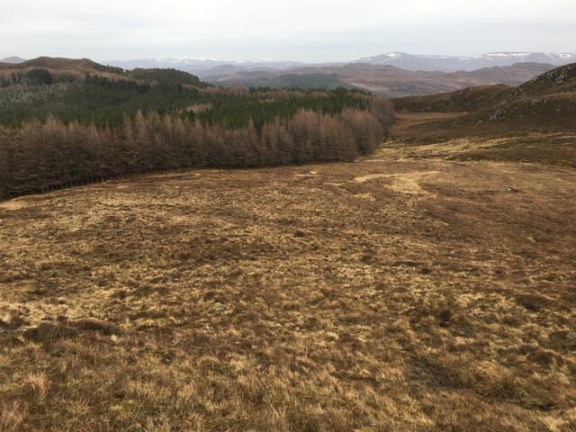
Creag Ruadh (622m), the red crag, rises above Loch Laggan in the NN59 square, between Strath Mashie and Aberarder. The reddish granite-and-schist trig point sits on a small rocky cone that gives an unexpectedly fine close-up view of the Creag Meagaidh massif across the loch. The hill is short and accessible from the A86 and works well as a half-day stop on the way west.
Gaelic: “crag, red” · Pronunciation: krayg roo-ah
Quick facts
- Height
- 622.2m/ 2041ft
- Prominence
- 310 m
- Distance
- 12 km
- Ascent
- 466 m
- Time
- 3–5 hrs
- Grid ref
- NN558913
- Parking
- NN531909
- Nearest city
- Fort William· 48km
- Dogs
- Dogs on lead required near livestockDog-friendly guide ↗
Height and prominence cross-checked against the Database of British and Irish Hills (CC BY).
No GPX track yet
Walked this route? Share your track to help other walkers.
Standard route
heather moorland 55% · rocky hillside 30% · grass and sedge 15%
Pull off at NN531909 by the lay-by on the A86 and pick up the estate track running north into the lower glen. Above the deer fence climb directly onto the heather flank toward the trig point, which becomes visible as the gradient eases. About three hours round trip with the descent on the same line, keeping clear of the broken crags on the south-east face.
Terrain
Heather, mat-grass and rounded rock ribs make up the bulk of the climb. The estate track gives a clean start before the slope steepens onto open hillside. A scattering of granite blocks marks the upper hill and the trig point sits on the firmest of these.
In winter
Loch Laggan is a snow trap and Creag Ruadh stands directly in its weather. Drifted snow can lie deep on the eastern flanks and the red rock becomes treacherous when verglassed. The walk is short enough for a settled winter day, but the A86 itself can shut briefly during heavy storms.
This hill is in the Creag Meagaidh SAIS forecast area. Check SAIS forecasts in winter (December–April).
Best time of year
Getting there
- Glasgow3h 41m
- Edinburgh3h 54m
OS maps: OS Landranger 35
Mobile signal: Variable. EE intermittent above 500m; better signal on A86 corridor.
Current conditions
Daylight Today
- Sunrise
- 04:42
- Sunset
- 22:04
- Civil dawn
- 03:41
- Civil dusk
- 23:05
NOAA Solar Calculator · 13 July 2026
Around Creag Ruadh on the SCOT network
Getting there, basing yourself, and what to do off the hill.
Getting there: Dalwhinnie station
Highest mainline station; Drumochter Munros; Ben Alder approach
10km from the hill
tripscot.co.uk
On TripSCOTBase yourself in Aviemore
Cairngorms base — Strathspey valley, ski centre, train
40km from the hill
tripscot.co.uk
On TasteSCOTAfter the hill: Dalwhinnie
Dalwhinnie — Scotland's highest distillery on the Drumochter pass
10km from the hill
tastescot.co.uk
Creag Ruadh — common questions
- Is Creag Ruadh a hard climb?
- Creag Ruadh is rated 3/5 (moderately challenging) on the OutdoorSCOT scale. The standard route covers about 12km with 466m of ascent and takes most walkers 3-5 hours. Terrain: Heather, mat-grass and rounded rock ribs make up the bulk of the climb.
- How prominent is Creag Ruadh?
- Creag Ruadh has 310m of topographic prominence — the height of its summit above the highest col connecting it to higher ground.
- Where should I park to climb Creag Ruadh?
- Standard parking is at NN531909. Check the parking grid reference on an OS map before travel; informal laybys can fill on summer weekends.
- When should I climb Creag Ruadh?
- The standard good-weather months for Creag Ruadh are March, April, May, June, July, August, September, October, November. Outside those months, expect winter conditions on the high ground — full mountain kit, navigation skills, and a check of the SAIS avalanche forecast for the relevant region.
- Can I bring my dog up Creag Ruadh?
- On a lead only — the route crosses ground with livestock or nesting-bird interest.
- What's mobile reception like on Creag Ruadh?
- Variable. EE intermittent above 500m; better signal on A86 corridor.
- Is Creag Ruadh safe in winter?
- Loch Laggan is a snow trap and Creag Ruadh stands directly in its weather. Drifted snow can lie deep on the eastern flanks and the red rock becomes treacherous when verglassed. The walk is short enough for a settled winter day, but the A86 itself can shut briefly during heavy storms.
Get the OutdoorSCOT weekly
One email a week — new route, hill and bothy guides, seasonal conditions and the odd hard-won lesson. No spam, unsubscribe in one click.