Graham · Central Highlands
Binnein Shuas
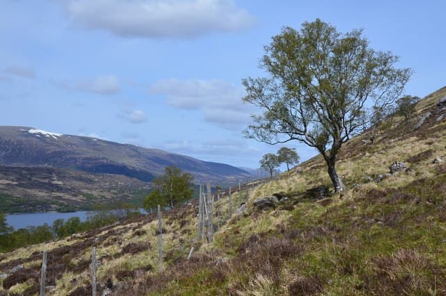
A striking schist crag overlooking Lochan na h-Earba, paired with the slimmer Binnein Shios on the north side of Loch Laggan. The south face of Binnein Shuas is one of the best rock-climbing venues in central Scotland, with the famous Ardverikie Wall its showpiece.
Quick facts
- Height
- 747.2m/ 2451ft
- Prominence
- 391 m
- Distance
- 14 km
- Ascent
- 613 m
- Time
- 4–7 hrs
- Grid ref
- NN462826
- Parking
- NN433830
- Nearest city
- Fort William· 37km
- Dogs
- Dogs on lead required near livestockDog-friendly guide ↗
Height and prominence cross-checked against the Database of British and Irish Hills (CC BY).
No GPX track yet
Walked this route? Share your track to help other walkers.
Standard route
loch-side path 20% · steep heather 35% · rocky upper section 35% · summit area 10%
Park at the bridge over the River Pattack and follow the estate track in past Lochan na h-Earba. Skirt the foot of the south face on a path and round to the gentler east side for a grassy walk-up to the summit cairn.
Terrain
Good landrover track in to the lochans, then a stalkers' line round the south face. The east shoulder above gives short grass and bilberry to the cairn.
In winter
The crag faces are a serious mixed proposition in cold winters but the walker's line stays on safe ground throughout. Wet snow on the schist slabs is the main issue when the freezing level dances around the summit.
This hill is in the Creag Meagaidh SAIS forecast area. Check SAIS forecasts in winter (December–April).
Best time of year
Getting there
- Glasgow3h 30m
- Edinburgh3h 52m
OS maps: OS Landranger 34, OS Landranger 42
Mobile signal: No signal near Loch Laggan/Kinlochlaggan area
Current conditions
Daylight Today
- Sunrise
- 04:43
- Sunset
- 22:04
- Civil dawn
- 03:43
- Civil dusk
- 23:05
NOAA Solar Calculator · 13 July 2026
Pair with
Curated multi-hill combinations from Binnein Shuas.
Around Binnein Shuas on the SCOT network
Getting there, basing yourself, and what to do off the hill.
Getting there: Tulloch station
Loch Treig; Beinn na Lap; Stob Coire Easain / Stob a Choire Mheadhoin approach
13km from the hill
tripscot.co.uk
On TripSCOTBase yourself in Fort William
Ben Nevis base, West Highland Line, gateway to Lochaber
37km from the hill
tripscot.co.uk
On TasteSCOTAfter the hill: Dalwhinnie
Dalwhinnie — Scotland's highest distillery on the Drumochter pass
17km from the hill
tastescot.co.uk
Binnein Shuas — common questions
- How difficult is Binnein Shuas?
- Binnein Shuas carries a 4/5 (challenging) grade on the OutdoorSCOT scale. Count on about 14km, 613m of ascent and a 4-7 hour day on the standard route. Ground conditions: Good landrover track in to the lochans, then a stalkers' line round the south face.
- How much drop does Binnein Shuas have?
- The drop is 391m: measured from the summit of Binnein Shuas down to the saddle joining it to higher terrain.
- Where's the parking for Binnein Shuas?
- Park at NN433830. Double-check the grid reference on an OS map first; informal laybys here fill early in high season.
- What's the best month to climb Binnein Shuas?
- Aim for April, May, June, July, August, September, October on Binnein Shuas. In the remaining months treat it as a winter hill — full kit, solid navigation, and a look at the relevant SAIS avalanche forecast before you go.
- Can dogs go up Binnein Shuas?
- Dogs are fine on a lead. The route passes livestock or ground-nesting bird habitat, so keep them close throughout.
- Will I get phone signal on Binnein Shuas?
- No signal near Loch Laggan/Kinlochlaggan area
- Is Binnein Shuas safe in winter?
- The crag faces are a serious mixed proposition in cold winters but the walker's line stays on safe ground throughout. Wet snow on the schist slabs is the main issue when the freezing level dances around the summit.
Get the OutdoorSCOT weekly
One email a week — new route, hill and bothy guides, seasonal conditions and the odd hard-won lesson. No spam, unsubscribe in one click.