Corbett · Central Highlands
Meall na h-Aisre
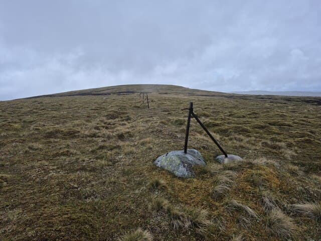
Meall na h-Aisre is a broad-shouldered Monadhliath Corbett south of the Corrieyairack Pass — the historic high-level military road built by General Wade to link Fort Augustus and Speyside. At 862m it is a hill of rolling peat and short heather rather than dramatic relief, with a slab of rock at the high point of a wide green dome. The view east into the heart of the Monadhliath plateau and west across the Great Glen to the Loch Lochy Munros gives it more presence than the gentle terrain might suggest.
Quick facts
- Height
- 862.1m/ 2828ft
- Prominence
- 155 m
- Distance
- 15 km
- Ascent
- 759 m
- Time
- 5–7 hrs
- Grid ref
- NH515000
- Parking
- NN462960
- Nearest city
- Inverness· 48km
- Dogs
- Dogs on lead required near livestockDog-friendly guide ↗
Height and prominence cross-checked against the Database of British and Irish Hills (CC BY).
No GPX track yet
Walked this route? Share your track to help other walkers.
Standard route
military road 30% · open moor 40% · broad dome 25% · summit slab 5%
Drive up the public road from Laggan Bridge to the gate near Melgarve at the foot of the Corrieyairack Pass. Walk up the old military road for around 3km then leave it on its eastern bend and head up open heather and grass directly onto the broad south ridge of Meall na h-Aisre. Roughly 15km out-and-back with 759m of ascent. Many parties extend over Carn Dearg or Carn Ban for a Monadhliath double.
Terrain
The military road is one of the finest historic walking surfaces in the country — wide, gravelled and well drained. Off the track the ground is short heather and peat with patches of wet bog around small burns. The summit dome is short grass and crowberry with the slab cairn at the highest point. Featureless on the plateau in mist; navigation by bearing only.
In winter
A bleak winter Corbett — the Corrieyairack catches huge volumes of drifting snow and the high road itself is closed to vehicles year-round above Melgarve. The summit dome is featureless under fresh snow and disorientation is the main risk. The Laggan road in is single-track and not gritted past Garva Bridge; in heavy snow approach by snowshoe or ski becomes the only option.
This hill is in the Creag Meagaidh SAIS forecast area. Check SAIS forecasts in winter (December–April).
Best time of year
Getting there
- Glasgow3h 52m
- Edinburgh3h 7m
OS maps: OS Landranger 35
Mobile signal: No signal on the Corrieyairack plateau
Current conditions
Daylight Today
- Sunrise
- 04:42
- Sunset
- 22:05
- Civil dawn
- 03:41
- Civil dusk
- 23:06
NOAA Solar Calculator · 13 July 2026
Pair with
Curated multi-hill combinations from Meall na h-Aisre.
Around Meall na h-Aisre on the SCOT network
Getting there, basing yourself, and what to do off the hill.
Getting there: Dalwhinnie station
Highest mainline station; Drumochter Munros; Ben Alder approach
19km from the hill
tripscot.co.uk
On TripSCOTBase yourself in Aviemore
Cairngorms base — Strathspey valley, ski centre, train
40km from the hill
tripscot.co.uk
On TasteSCOTAfter the hill: Dalwhinnie
Dalwhinnie — Scotland's highest distillery on the Drumochter pass
19km from the hill
tastescot.co.uk
Meall na h-Aisre — common questions
- How hard is Meall na h-Aisre?
- We grade Meall na h-Aisre at 3/5, which puts it in moderately challenging territory. The usual route is around 15km with 759m of climbing; allow 5-7 hours. Terrain: The military road is one of the finest historic walking surfaces in the country — wide, gravelled and well drained.
- How prominent is Meall na h-Aisre?
- Meall na h-Aisre has 155m of topographic prominence — the height of its summit above the highest col connecting it to higher ground.
- Where should I park to climb Meall na h-Aisre?
- Standard parking is at NN462960. Check the parking grid reference on an OS map before travel; informal laybys can fill on summer weekends.
- When should I climb Meall na h-Aisre?
- The standard good-weather months for Meall na h-Aisre are May, June, July, August, September, October. Outside those months, expect winter conditions on the high ground — full mountain kit, navigation skills, and a check of the SAIS avalanche forecast for the relevant region.
- Can I bring my dog up Meall na h-Aisre?
- On a lead only — the route crosses ground with livestock or nesting-bird interest.
- What's mobile reception like on Meall na h-Aisre?
- No signal on the Corrieyairack plateau
- Is Meall na h-Aisre safe in winter?
- A bleak winter Corbett — the Corrieyairack catches huge volumes of drifting snow and the high road itself is closed to vehicles year-round above Melgarve. The summit dome is featureless under fresh snow and disorientation is the main risk. The Laggan road in is single-track and not gritted past Garva Bridge; in heavy snow approach by snowshoe or ski becomes the only option.
Get the OutdoorSCOT weekly
One email a week — new route, hill and bothy guides, seasonal conditions and the odd hard-won lesson. No spam, unsubscribe in one click.