Corbett · Central Highlands
Carn na Saobhaidhe
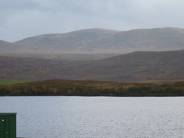
Càrn na Saobhaidhe — 'the cairn of the fox's den' — is the central Monadhliath Corbett standing roughly mid-way between the Spey valley and Loch Mhor. At 811m it sits as the high point of an enormous rolling moorland, with no rocky character at all — just heather, peat, and immense skies. The summit cairn is unmarked and easy to miss on the broad plateau. The hill is rarely climbed for its own sake; most parties bag it via long-distance bike or as part of a Monadhliath traverse.
Quick facts
- Height
- 811.1m/ 2661ft
- Prominence
- 170 m
- Distance
- 22 km
- Ascent
- 600 m
- Time
- 5–7 hrs
- Grid ref
- NH598143
- Parking
- NH560224
- Nearest city
- Inverness· 32km
- Dogs
- Dogs on lead required near livestockDog-friendly guide ↗
Height and prominence cross-checked against the Database of British and Irish Hills (CC BY).
No GPX track yet
Walked this route? Share your track to help other walkers.
Standard route
estate track 30% · heather moorland 45% · grassy plateau 15% · summit area 10%
Park near Errogie on the B862 (NH560224), where a forestry track climbs south-west into the Monadhliath. Cycle the long track for around 8km, then leave the bike at the track end and walk south-east across the plateau to the Carn na Saobhaidhe summit cairn. Navigation across the featureless moor demands accurate compass work. Allow 6 hours on bike-and-foot, considerably longer on foot alone.
Terrain
An extensive Land Rover estate route along the approach — best ridden. Beyond the track, open peat moorland with no path. The summit area is wide and gently rolling; the cairn is small and unmarked on most maps. Bring a GPS — the broad top has subtle subsidiary tops that all look the same in cloud.
In winter
A long winter day in featureless country. The estate track holds drift in north-east winds; bike becomes useless once snow is on it. Snow lies long on the plateau. Navigation in whiteout is the real winter hazard — the broad summit has nothing for terrain reference. Bring compass and GPS, and do not start late.
This hill is in the Creag Meagaidh SAIS forecast area. Check SAIS forecasts in winter (December–April).
Best time of year
Getting there
- Glasgow3h 10m
- Edinburgh3h 59m
OS maps: OS Landranger 35
Mobile signal: Zero signal in this remote Atholl/Badenoch watershed area
Current conditions
Daylight Today
- Sunrise
- 04:41
- Sunset
- 22:06
- Civil dawn
- 03:39
- Civil dusk
- 23:07
NOAA Solar Calculator · 13 July 2026
Around Carn na Saobhaidhe on the SCOT network
Getting there, basing yourself, and what to do off the hill.
Getting there: Kingussie station
Cairngorms south side; Glen Feshie; Insh Marshes; Monadhliath access
21km from the hill
tripscot.co.uk
On TripSCOTBase yourself in Aviemore
Cairngorms base — Strathspey valley, ski centre, train
30km from the hill
tripscot.co.uk
On TasteSCOTAfter the hill: Tomatin
Tomatin — large Highland distillery just off the A9, south of Inverness
25km from the hill
tastescot.co.uk
Carn na Saobhaidhe — common questions
- How hard is Carn na Saobhaidhe?
- We grade Carn na Saobhaidhe at 2/5, which puts it in moderate territory. The usual route is around 22km with 600m of climbing; allow 5-7 hours. Terrain: An extensive Land Rover estate route along the approach — best ridden.
- How prominent is Carn na Saobhaidhe?
- Carn na Saobhaidhe has 170m of topographic prominence — the height of its summit above the highest col connecting it to higher ground.
- Where should I park to climb Carn na Saobhaidhe?
- Standard parking is at NH560224. Check the parking grid reference on an OS map before travel; informal laybys can fill on summer weekends.
- When should I climb Carn na Saobhaidhe?
- The standard good-weather months for Carn na Saobhaidhe are April, May, June, July, August, September, October. Outside those months, expect winter conditions on the high ground — full mountain kit, navigation skills, and a check of the SAIS avalanche forecast for the relevant region.
- Can I bring my dog up Carn na Saobhaidhe?
- On a lead only — the route crosses ground with livestock or nesting-bird interest.
- What's mobile reception like on Carn na Saobhaidhe?
- Zero signal in this remote Atholl/Badenoch watershed area
- Is Carn na Saobhaidhe safe in winter?
- A long winter day in featureless country. The estate track holds drift in north-east winds; bike becomes useless once snow is on it. Snow lies long on the plateau. Navigation in whiteout is the real winter hazard — the broad summit has nothing for terrain reference. Bring compass and GPS, and do not start late.
Get the OutdoorSCOT weekly
One email a week — new route, hill and bothy guides, seasonal conditions and the odd hard-won lesson. No spam, unsubscribe in one click.