Graham · Arrochar & Trossachs
Cnoc Coinnich
Arrochar Graham overshadowed by The Brack and The Cobbler next door. Quieter than its big-name neighbours and a useful round combined with The Brack for a longer day. The 761 m top sits in the arrochar trossachs; reckon on 10 km and 720 m of ascent for the round trip.
Quick facts
- Height
- 763.5m/ 2505ft
- Distance
- 10 km
- Ascent
- 720 m
- Time
- 2–5 hrs
- Grid ref
- NN236008
- Parking
- NN271028
- Nearest city
- Oban
- Dogs
- Dogs on lead required near livestockDog-friendly guide ↗
No GPX track yet
Walked this route? Share your track to help other walkers.
Standard route
glen track 30% · heather hillside 40% · grassy ridge 20% · summit area 10%
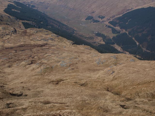
Approach from Ardgartan via the Cowal Way path, then break off west to gain the open ridge. Forest tracks above Loch Long give way to heather slopes before the grassy crest leading to the summit cairn.
Terrain
Forest tracks then open hillside. Boggy in places.
In winter
Manageable winter outing in stable conditions. The summit ridge collects snow.
This hill is in the Lochaber SAIS forecast area. Check SAIS forecasts in winter (December–April).
Best time of year
Getting there
- Glasgow1h 5m
- Edinburgh2h 50m
OS maps: OS Explorer 364
Mobile signal: No signal in this remote Kintail/Loch Long area
Current conditions
Daylight Today
- Sunrise
- 04:41
- Sunset
- 21:53
- Civil dawn
- 03:43
- Civil dusk
- 22:50
NOAA Solar Calculator · 31 May 2026
On a long-distance route
Cnoc Coinnich sits within 5km of these named long-distance walks — useful for trail-pack rest days or section extensions.
Around Cnoc Coinnich on the SCOT network
Getting there, basing yourself, and what to do off the hill.
Getting there: Arrochar & Tarbet station
Arrochar Alps — The Cobbler, Beinn Ime, Beinn Narnain, Ben Vane, Ben Vorlich
6km from the hill
tripscot.co.uk
On TripSCOTBase yourself in Luss
West Loch Lomond village — Highland Boundary, Loch Lomond Way
16km from the hill
tripscot.co.uk
On TasteSCOTAfter the hill: Loch Lomond
Alexandria — sprawling distillery on the south end of the loch
28km from the hill
tastescot.co.uk
Cnoc Coinnich — common questions
- How hard is Cnoc Coinnich?
- Cnoc Coinnich is rated 2/5 (moderate) on the OutdoorSCOT scale. The standard route covers about 10km with 720m of ascent and takes most walkers 2-5 hours. Terrain: Forest tracks then open hillside.
- Where do I park for Cnoc Coinnich?
- Standard parking is at NN271028 near Glasgow. Check the parking grid reference on an OS map before travel; informal laybys can fill on summer weekends.
- When is the best time to climb Cnoc Coinnich?
- The standard good-weather months for Cnoc Coinnich are April, May, June, July, August, September, October. Outside those months, expect winter conditions on the high ground — full mountain kit, navigation skills, and a check of the SAIS avalanche forecast for the relevant region.
- Can I bring my dog up Cnoc Coinnich?
- Yes, but dogs must be kept on a lead — there is livestock or ground-nesting bird interest on the route.
- Is there mobile signal on Cnoc Coinnich?
- No signal in this remote Kintail/Loch Long area
- Is Cnoc Coinnich safe in winter?
- Manageable winter outing in stable conditions. The summit ridge collects snow.