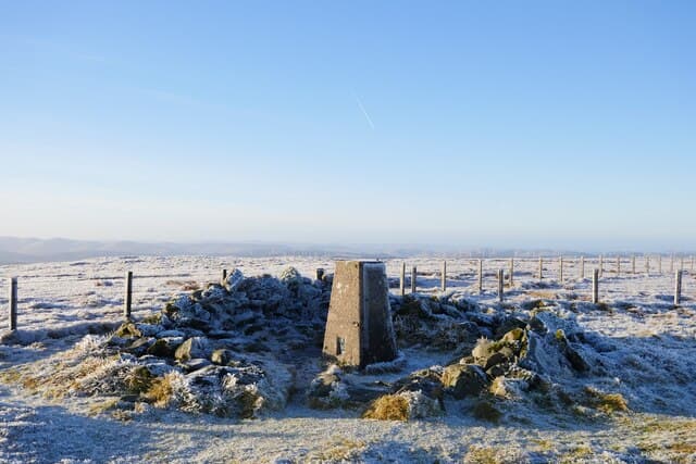
Donald · Borders
Hart Fell
Twin of White Coomb across the Moffat Hills, with the famous Devil's Beef Tub on its western flank — the steep amphitheatre that hid Border reivers and their stolen cattle.
Quick facts
- Height
- 808m/ 2651ft
- Prominence
- 200 m
- Distance
- ~13 km
- Ascent
- ~650 m
- Time
- 2–4 hrs
- Grid ref
- NT113135
- Parking
- NT063128
- Nearest
- Moffat· Dumfries 40km
- Dogs
- Dogs on lead required near livestockDog-friendly guide ↗
Height and prominence cross-checked against the Database of British and Irish Hills (CC BY).
No GPX track yet
Walked this route? Share your track to help other walkers.
Standard route
grass moorland 60% · heather slopes 25% · rocky summit 15%
Approach from the A701 layby above the Devil's Beef Tub. Follow the path along the rim onto Annanhead Hill, then the broad grassy ridge over Great Hill to the summit. The rim above the Beef Tub gives the most dramatic line, edging the steep amphitheatre all the way to the summit shelter.
Terrain
Pathless grass and heather. Easy navigation in good weather.
In winter
Featureless dome — winter navigation can be testing.
Kit for this: the winter Munro kit list · which boots take crampons
Best time of year
Getting there
- Glasgow2h 35m
- Edinburgh1h 15m
OS maps: OS Explorer 330
Mobile signal: Decent up top; EE reliable with clear views to the Borders.
Current conditions
Daylight Today
- Sunrise
- 07:41
- Sunset
- 18:18
- Civil dawn
- 07:04
- Civil dusk
- 18:55
NOAA Solar Calculator · 14 October 2026
Pair with
Curated multi-hill combinations from Hart Fell.
Around Hart Fell on the SCOT network
Getting there, basing yourself, and what to do off the hill.
Hart Fell — common questions
- How hard is Hart Fell?
- We grade Hart Fell at 2/5, which puts it in moderate territory. The usual route is around 13km with 650m of climbing; allow 2-4 hours. Ground conditions: Pathless grass and heather.
- How much drop does Hart Fell have?
- The drop is 200m: measured from the summit of Hart Fell down to the saddle joining it to higher terrain.
- Where's the parking for Hart Fell?
- Park at NT063128 near Moffat. Double-check the grid reference on an OS map first; informal laybys here fill early in high season.
- What's the best month to climb Hart Fell?
- Aim for April, May, June, July, August, September, October on Hart Fell. In the remaining months treat it as a winter hill — full kit, solid navigation, and a look at the relevant SAIS avalanche forecast before you go.
- Can dogs go up Hart Fell?
- Dogs are fine on a lead. The route passes livestock or ground-nesting bird habitat, so keep them close throughout.
- Will I get phone signal on Hart Fell?
- Decent up top; EE reliable with clear views to the Borders.
- Is Hart Fell safe in winter?
- Featureless dome — winter navigation can be testing.
Get the OutdoorSCOT weekly
One email a week — new route, hill and bothy guides, seasonal conditions and the odd hard-won lesson. No spam, unsubscribe in one click.