Donald · Borders
Swatte Fell
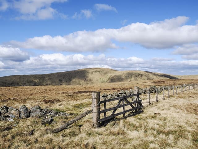
Swatte Fell sits on the rim of the Devil's Beef Tub — the great glacial amphitheatre above the source of the River Annan. The unmarked top lies a few paces from a pair of ruined wall stubs and looks straight down a 250-metre drop into the Tub.
Quick facts
- Height
- 729.9m/ 2395ft
- Prominence
- 36 m
- Distance
- 13 km
- Ascent
- 598 m
- Time
- 3–6 hrs
- Grid ref
- NT118113
- Parking
- NT121130
- Nearest city
- Dumfries· 38km
- Dogs
- Dogs on lead required near livestockDog-friendly guide ↗
Height and prominence cross-checked against the Database of British and Irish Hills (CC BY).
No GPX track yet
Walked this route? Share your track to help other walkers.
Standard route
grass moorland 80% · heather patches 15% · summit area 5%
A short steep approach from the A701 lay-by above the Beef Tub takes you onto the rim. From there walk the airy edge north-east to the summit. Continuing to Hart Fell gives a fine half-day rim walk.
Terrain
Open sward right from the lay-by; the only sustained climb is the first 200 metres above the road. Trip hazard is the bracken-hidden mole runs that pock the slope.
In winter
The rim of the Beef Tub develops genuinely substantial cornices in north-east blizzards. Stay back from the edge; people have gone over here in white-out conditions. SAIS Southern Uplands gives the corrie forecast for the inner Moffats.
Best time of year
Getting there
- Glasgow2h 47m
- Edinburgh2h 31m
OS maps: OS Landranger 78
Mobile signal: Coverage is solid; EE behaves well. Southern Uplands watershed.
Current conditions
Daylight Today
- Sunrise
- 04:55
- Sunset
- 21:44
- Civil dawn
- 04:02
- Civil dusk
- 22:38
NOAA Solar Calculator · 17 July 2026
Around Swatte Fell on the SCOT network
Getting there, basing yourself, and what to do off the hill.
Swatte Fell — common questions
- How difficult is Swatte Fell?
- Swatte Fell carries a 3/5 (moderately challenging) grade on the OutdoorSCOT scale. Count on about 13km, 598m of ascent and a 3-6 hour day on the standard route. Underfoot: Open sward right from the lay-by; the only sustained climb is the first 200 metres above the road.
- What is Swatte Fell's prominence?
- 36m of prominence. That's the vertical drop from the summit to the col that links Swatte Fell to the next higher ground.
- Where do I park for Swatte Fell?
- Most walkers start from NT121130. Verify the grid reference on an OS map before you set off — space is tight on busy summer weekends.
- When is the best time to climb Swatte Fell?
- April, May, June, July, August, September, October give the most reliable conditions on Swatte Fell. Beyond that window the high ground turns wintry: carry full mountain kit, be confident navigating, and check the SAIS avalanche forecast for the area.
- Is Swatte Fell dog-friendly?
- Yes, but dogs must be kept on a lead — there is livestock or ground-nesting bird interest on the route.
- Is there mobile signal on Swatte Fell?
- Coverage is solid; EE behaves well. Southern Uplands watershed.
- Is Swatte Fell safe in winter?
- The rim of the Beef Tub develops genuinely substantial cornices in north-east blizzards. Stay back from the edge; people have gone over here in white-out conditions. SAIS Southern Uplands gives the corrie forecast for the inner Moffats.
Get the OutdoorSCOT weekly
One email a week — new route, hill and bothy guides, seasonal conditions and the odd hard-won lesson. No spam, unsubscribe in one click.