Donald · Borders
Under Saddle Yoke
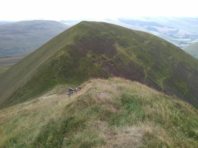
Under Saddle Yoke rises sharply from Capplegill above the Moffat Water, the southern bookend of the long arête that runs north over Saddle Yoke proper to Hart Fell. The unmarked top sits at the edge of the spectacular Black Hope hanging valley.
Quick facts
- Height
- 745m/ 2444ft
- Prominence
- 128 m
- Distance
- 14 km
- Ascent
- 611 m
- Time
- 4–6 hrs
- Grid ref
- NT142126
- Parking
- NT145146
- Nearest city
- Dumfries· 40km
- Dogs
- Dogs on lead required near livestockDog-friendly guide ↗
Height and prominence cross-checked against the Database of British and Irish Hills (CC BY).
No GPX track yet
Walked this route? Share your track to help other walkers.
Standard route
grass moorland 80% · heather patches 15% · summit area 5%
A steep direct ascent leaves the lay-by at Capplegill and pulls straight up the south ridge — short, sharp, and dramatic. Continue the airy connecting ridge to Saddle Yoke and Hart Fell, descending back via Whirly Gill.
Terrain
A grassy nose of steep tussock and slippery rabbit-cropped sward — the ascent is genuinely steep but never serious. The summit ridge narrows briefly with airy views into Black Hope; pleasant in dry, tricky when greasy.
In winter
The Black Hope corrie holds the longest-lasting snowfields in the Moffat Hills and grows substantial cornices in north-westerlies. The descent line is icy in early morning sun. SAIS Southern Uplands should be checked before any winter outing here.
Best time of year
Getting there
- Glasgow2h 49m
- Edinburgh1h 29m
OS maps: OS Landranger 78
Mobile signal: Solid summit coverage; EE behaves well. Fine Moffat Hills viewpoint.
Current conditions
Daylight Today
- Sunrise
- 04:49
- Sunset
- 21:49
- Civil dawn
- 03:54
- Civil dusk
- 22:44
NOAA Solar Calculator · 13 July 2026
Around Under Saddle Yoke on the SCOT network
Getting there, basing yourself, and what to do off the hill.
Under Saddle Yoke — common questions
- How hard is Under Saddle Yoke?
- We grade Under Saddle Yoke at 3/5, which puts it in moderately challenging territory. The usual route is around 14km with 611m of climbing; allow 4-6 hours. Terrain: A grassy nose of steep tussock and slippery rabbit-cropped sward — the ascent is genuinely steep but never serious.
- How prominent is Under Saddle Yoke?
- Under Saddle Yoke has 128m of topographic prominence — the height of its summit above the highest col connecting it to higher ground.
- Where should I park to climb Under Saddle Yoke?
- Standard parking is at NT145146. Check the parking grid reference on an OS map before travel; informal laybys can fill on summer weekends.
- When should I climb Under Saddle Yoke?
- The standard good-weather months for Under Saddle Yoke are April, May, June, July, August, September, October. Outside those months, expect winter conditions on the high ground — full mountain kit, navigation skills, and a check of the SAIS avalanche forecast for the relevant region.
- Can I bring my dog up Under Saddle Yoke?
- On a lead only — the route crosses ground with livestock or nesting-bird interest.
- What's mobile reception like on Under Saddle Yoke?
- Solid summit coverage; EE behaves well. Fine Moffat Hills viewpoint.
- Is Under Saddle Yoke safe in winter?
- The Black Hope corrie holds the longest-lasting snowfields in the Moffat Hills and grows substantial cornices in north-westerlies. The descent line is icy in early morning sun. SAIS Southern Uplands should be checked before any winter outing here.
Get the OutdoorSCOT weekly
One email a week — new route, hill and bothy guides, seasonal conditions and the odd hard-won lesson. No spam, unsubscribe in one click.