Donald · Galloway
Curleywee
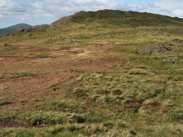
Curleywee — 'the curlew's call' in old Gaelic — is the rocky pyramid above Loch Dee in the Minnigaff hills. Its small summit perches on craggy granite, more like a Highland top than the typical Donald, and the look back to Lamachan from the cairn is the finest view in the group.
Quick facts
- Height
- 674.4m/ 2213ft
- Prominence
- 120 m
- Distance
- 13 km
- Ascent
- 553 m
- Time
- 3–6 hrs
- Grid ref
- NX454769
- Parking
- NX450768
- Nearest city
- Dumfries· 52km
- Dogs
- Dogs on lead required near livestockDog-friendly guide ↗
Height and prominence cross-checked against the Database of British and Irish Hills (CC BY).
No GPX track yet
Walked this route? Share your track to help other walkers.
Standard route
granite boulders 40% · heather moorland 40% · grass moorland 20%
From House on the Brae or from Loch Trool, follow forest roads to the foot of the south ridge then climb a steepening rock-and-grass nose to the cairn. About 12km return with 550m of climb.
Terrain
Wet forest tracks low down, then a fine ridge of rough grass studded with granite slabs. The summit cone has a tiny pocket of mild scrambling on bare rock.
In winter
Granite slabs hold black ice in freeze-thaw and the summit pyramid becomes a serious objective in winter conditions — crampons useful on the upper rocks.
Best time of year
Getting there
- Glasgow2h 54m
- Edinburgh3h 41m
OS maps: OS Landranger 77
Mobile signal: Mixed. EE hit and miss; limited coverage in the Galloway interior.
Current conditions
Daylight Today
- Sunrise
- 04:56
- Sunset
- 21:51
- Civil dawn
- 04:02
- Civil dusk
- 22:45
NOAA Solar Calculator · 13 July 2026
Pair with
Curated multi-hill combinations from Curleywee.
Around Curleywee on the SCOT network
Getting there, basing yourself, and what to do off the hill.
Getting there: Ayr station
Ayrshire coast; Galloway approach via bus/car
46km from the hill
tripscot.co.uk
On TripSCOTBase yourself in Kirkcudbright
Galloway base — Solway coast, Galloway Forest, Mull of Galloway Trail
35km from the hill
tripscot.co.uk
On TasteSCOTAfter the hill: Bladnoch
Wigtown — Galloway's only distillery; Scotland's most southerly
23km from the hill
tastescot.co.uk
Curleywee — common questions
- How hard is Curleywee?
- We grade Curleywee at 3/5, which puts it in moderately challenging territory. The usual route is around 13km with 553m of climbing; allow 3-6 hours. Ground conditions: Wet forest tracks low down, then a fine ridge of rough grass studded with granite slabs.
- How much drop does Curleywee have?
- The drop is 120m: measured from the summit of Curleywee down to the saddle joining it to higher terrain.
- Where's the parking for Curleywee?
- Park at NX450768. Double-check the grid reference on an OS map first; informal laybys here fill early in high season.
- What's the best month to climb Curleywee?
- Aim for March, April, May, June, July, August, September, October, November on Curleywee. In the remaining months treat it as a winter hill — full kit, solid navigation, and a look at the relevant SAIS avalanche forecast before you go.
- Can dogs go up Curleywee?
- Dogs are fine on a lead. The route passes livestock or ground-nesting bird habitat, so keep them close throughout.
- Will I get phone signal on Curleywee?
- Mixed. EE hit and miss; limited coverage in the Galloway interior.
- Is Curleywee safe in winter?
- Granite slabs hold black ice in freeze-thaw and the summit pyramid becomes a serious objective in winter conditions — crampons useful on the upper rocks.
Get the OutdoorSCOT weekly
One email a week — new route, hill and bothy guides, seasonal conditions and the odd hard-won lesson. No spam, unsubscribe in one click.