Donald · Southern Uplands
Blacklorg Hill
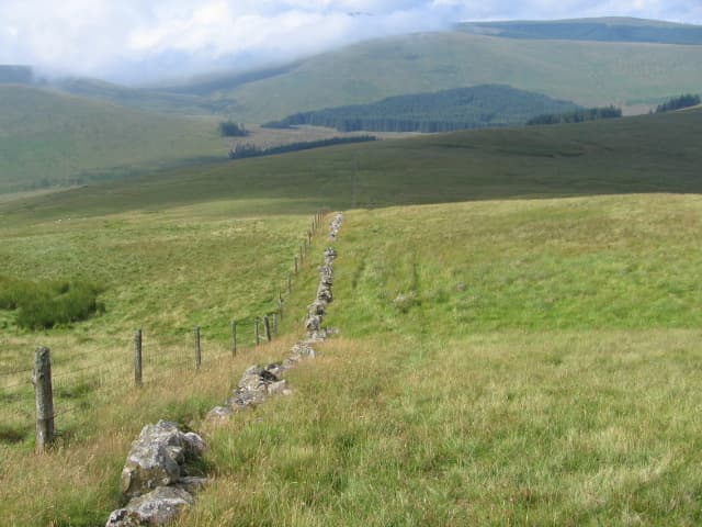
Blacklorg Hill sits on the wild watershed between Glen Afton and the Water of Ken, west of the bigger bulk of Blackcraig Hill. A cairn beside an iron fence-post marks the top of a long ridge of dark heather running south towards Cairnsmore of Carsphairn.
Quick facts
- Height
- 681m/ 2234ft
- Prominence
- 148 m
- Distance
- 13 km
- Ascent
- 558 m
- Time
- 3–6 hrs
- Grid ref
- NS653042
- Parking
- NS649055
- Nearest city
- Dumfries· 43km
- Dogs
- Dogs on lead required near livestockDog-friendly guide ↗
Height and prominence cross-checked against the Database of British and Irish Hills (CC BY).
No GPX track yet
Walked this route? Share your track to help other walkers.
Standard route
heather moorland 60% · grass moorland 30% · rocky summit 10%
Approach from the Afton dam or from the road end at Glenmuckloch, both involving rough heather and forest ride walking before the open ridge. Around 14km return with 550m of climb.
Terrain
Deep heather and tussock low down — slow going — giving way to thinner grass and bilberry on the upper ridge. The summit dome itself is a flat moss-and-grass crown.
In winter
The Afton glen funnels low cloud and freezing drizzle for days at a time. SAIS Southern Uplands seldom flags this group but verglas on dark heather stems makes the descent treacherous.
Best time of year
Getting there
- Glasgow1h 28m
- Edinburgh2h 58m
OS maps: OS Landranger 77
Mobile signal: Signal is good; EE works well. Northern Galloway Range viewpoint.
Current conditions
Daylight Today
- Sunrise
- 04:53
- Sunset
- 21:52
- Civil dawn
- 03:58
- Civil dusk
- 22:46
NOAA Solar Calculator · 13 July 2026
Pair with
Curated multi-hill combinations from Blacklorg Hill.
Around Blacklorg Hill on the SCOT network
Getting there, basing yourself, and what to do off the hill.
Blacklorg Hill — common questions
- Is Blacklorg Hill a hard climb?
- Blacklorg Hill is rated 3/5 (moderately challenging) on the OutdoorSCOT scale. The standard route covers about 13km with 558m of ascent and takes most walkers 3-6 hours. Ground conditions: Deep heather and tussock low down — slow going — giving way to thinner grass and bilberry on the upper ridge.
- How much drop does Blacklorg Hill have?
- The drop is 148m: measured from the summit of Blacklorg Hill down to the saddle joining it to higher terrain.
- Where's the parking for Blacklorg Hill?
- Park at NS649055. Double-check the grid reference on an OS map first; informal laybys here fill early in high season.
- What's the best month to climb Blacklorg Hill?
- Aim for March, April, May, June, July, August, September, October, November on Blacklorg Hill. In the remaining months treat it as a winter hill — full kit, solid navigation, and a look at the relevant SAIS avalanche forecast before you go.
- Can dogs go up Blacklorg Hill?
- Dogs are fine on a lead. The route passes livestock or ground-nesting bird habitat, so keep them close throughout.
- Will I get phone signal on Blacklorg Hill?
- Signal is good; EE works well. Northern Galloway Range viewpoint.
- Is Blacklorg Hill safe in winter?
- The Afton glen funnels low cloud and freezing drizzle for days at a time. SAIS Southern Uplands seldom flags this group but verglas on dark heather stems makes the descent treacherous.
Get the OutdoorSCOT weekly
One email a week — new route, hill and bothy guides, seasonal conditions and the odd hard-won lesson. No spam, unsubscribe in one click.