Donald · Southern Uplands
Alhang
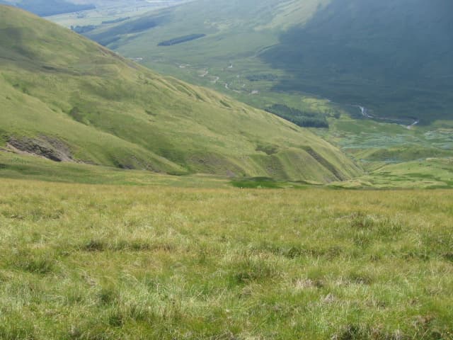
Alhang (642m) sits on the Dumfriesshire–Ayrshire watershed between Glen Afton and the Scaur Water, a smooth grassy whaleback at the western end of the Lowther–Carsphairn chain. It is overshadowed by Blackcraig Hill to the north and Windy Standard's wind farm to the south, yet retains a quiet character — broad pastoral slopes rising into open moor crowned by a small turf-grown cairn.
Quick facts
- Height
- 642m/ 2106ft
- Prominence
- 91 m
- Distance
- 12 km
- Ascent
- 482 m
- Time
- 3–5 hrs
- Grid ref
- NS642010
- Parking
- NS655025
- Nearest city
- Dumfries· 41km
- Dogs
- Dogs on lead required near livestockDog-friendly guide ↗
Height and prominence cross-checked against the Database of British and Irish Hills (CC BY).
No GPX track yet
Walked this route? Share your track to help other walkers.
Standard route
grass moorland 80% · heather patches 15% · summit area 5%
Most parties start from the road end above Glen Afton Reservoir and follow the old hill fence south-east over Meikledodd Hill onto Alhang's broad north ridge. The walk covers 12km with 482m of ascent on improved hill pasture, blanket bog and short cropped grass. The cairn is small and easy to miss in poor visibility; the fence line continuing onto Alwhat is the natural navigational handrail.
Terrain
Underfoot is sheep-grazed pasture giving way higher up to molinia tussock and short bog cotton. The march fence between Dumfriesshire and Ayrshire runs over or near the summit and is the most reliable navigational feature; quad tracks are sporadic and end abruptly. Forest plantations on the southern flank constrain escape routes in bad weather.
In winter
Wind off the Galloway moors is the constant in winter and Alhang has nowhere to hide. The grassy slopes ice into hard nevé where verglas forms on flattened bog cotton. Whiteouts roll in fast off the Solway and the absence of crags makes spatial orientation difficult. Carry a compass — and trust it over instinct on the featureless plateau.
Best time of year
Getting there
- Glasgow2h 32m
- Edinburgh2h 2m
OS maps: OS Landranger 77
Mobile signal: Solid summit coverage; count on EE. Smooth Moffat Hills area hill.
Current conditions
Daylight Today
- Sunrise
- 04:59
- Sunset
- 21:47
- Civil dawn
- 04:06
- Civil dusk
- 22:40
NOAA Solar Calculator · 17 July 2026
Around Alhang on the SCOT network
Getting there, basing yourself, and what to do off the hill.
Alhang — common questions
- How hard is Alhang?
- We grade Alhang at 3/5, which puts it in moderately challenging territory. The usual route is around 12km with 482m of climbing; allow 3-5 hours. Ground conditions: Underfoot is sheep-grazed pasture giving way higher up to molinia tussock and short bog cotton.
- How much drop does Alhang have?
- The drop is 91m: measured from the summit of Alhang down to the saddle joining it to higher terrain.
- Where's the parking for Alhang?
- Park at NS655025. Double-check the grid reference on an OS map first; informal laybys here fill early in high season.
- What's the best month to climb Alhang?
- Aim for March, April, May, June, July, August, September, October, November on Alhang. In the remaining months treat it as a winter hill — full kit, solid navigation, and a look at the relevant SAIS avalanche forecast before you go.
- Can dogs go up Alhang?
- Dogs are fine on a lead. The route passes livestock or ground-nesting bird habitat, so keep them close throughout.
- Will I get phone signal on Alhang?
- Solid summit coverage; count on EE. Smooth Moffat Hills area hill.
- Is Alhang safe in winter?
- Wind off the Galloway moors is the constant in winter and Alhang has nowhere to hide. The grassy slopes ice into hard nevé where verglas forms on flattened bog cotton. Whiteouts roll in fast off the Solway and the absence of crags makes spatial orientation difficult. Carry a compass — and trust it over instinct on the featureless plateau.
Get the OutdoorSCOT weekly
One email a week — new route, hill and bothy guides, seasonal conditions and the odd hard-won lesson. No spam, unsubscribe in one click.