Graham · Southern Uplands
Windy Standard
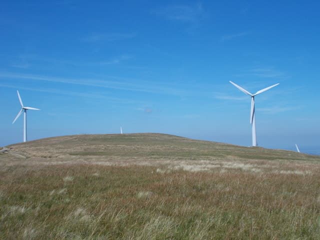
Windy Standard (697m) is the highest of the wind-farmed uplands east of Loch Doon, set in the NS60 square on the Carsphairn watershed. The summit hosts a fenced trig and a constellation of turbines stretching south toward the Afton reservoir. From the top the view runs west to Merrick and east into Nithsdale.
Quick facts
- Height
- 697.9m/ 2290ft
- Prominence
- 212 m
- Distance
- 13 km
- Ascent
- 572 m
- Time
- 3–6 hrs
- Grid ref
- NS620014
- Parking
- NS632014
- Nearest city
- Dumfries· 44km
- Dogs
- Dogs on lead required near livestockDog-friendly guide ↗
Height and prominence cross-checked against the Database of British and Irish Hills (CC BY).
No GPX track yet
Walked this route? Share your track to help other walkers.
Standard route
grass moorland 60% · forestry edge 25% · heather slopes 15%
Park at the Lamloch parking area south-east of Carsphairn and join the wind-farm service road heading north. A wide gravel track climbs steadily through the turbine array onto the broad summit ridge. The trig sits on a slight bump beside a fence corner about 500m west of the highest road.
Terrain
Gravel service road throughout the ascent — easy walking even in poor weather. The ground off the road is tussock grass and short heather, usable in either direction. The summit area is fenced off in places to protect peat restoration zones.
In winter
The hill lives up to its name — exposed to the prevailing south-westerly with no shelter for miles. Service roads are kept clear of snow by the wind-farm operators which makes winter access surprisingly easy. The real hazard is wind chill on the bare plateau, not avalanche.
Best time of year
Getting there
- Glasgow2h 31m
- Edinburgh2h 3m
OS maps: OS Landranger 77
Mobile signal: Moderate. EE intermittent on the broad top; better on the south-western approach from Straiton.
Current conditions
Daylight Today
- Sunrise
- 04:53
- Sunset
- 21:52
- Civil dawn
- 03:59
- Civil dusk
- 22:46
NOAA Solar Calculator · 13 July 2026
Pair with
Curated multi-hill combinations from Windy Standard.
Around Windy Standard on the SCOT network
Getting there, basing yourself, and what to do off the hill.
Windy Standard — common questions
- Is Windy Standard a hard climb?
- Windy Standard is rated 3/5 (moderately challenging) on the OutdoorSCOT scale. The standard route covers about 13km with 572m of ascent and takes most walkers 3-6 hours. Ground conditions: Gravel service road throughout the ascent — easy walking even in poor weather.
- How much drop does Windy Standard have?
- The drop is 212m: measured from the summit of Windy Standard down to the saddle joining it to higher terrain.
- Where's the parking for Windy Standard?
- Park at NS632014. Double-check the grid reference on an OS map first; informal laybys here fill early in high season.
- What's the best month to climb Windy Standard?
- Aim for March, April, May, June, July, August, September, October, November on Windy Standard. In the remaining months treat it as a winter hill — full kit, solid navigation, and a look at the relevant SAIS avalanche forecast before you go.
- Can dogs go up Windy Standard?
- Dogs are fine on a lead. The route passes livestock or ground-nesting bird habitat, so keep them close throughout.
- Will I get phone signal on Windy Standard?
- Moderate. EE intermittent on the broad top; better on the south-western approach from Straiton.
- Is Windy Standard safe in winter?
- The hill lives up to its name — exposed to the prevailing south-westerly with no shelter for miles. Service roads are kept clear of snow by the wind-farm operators which makes winter access surprisingly easy. The real hazard is wind chill on the bare plateau, not avalanche.
Get the OutdoorSCOT weekly
One email a week — new route, hill and bothy guides, seasonal conditions and the odd hard-won lesson. No spam, unsubscribe in one click.