Donald · Borders
Blackhope Scar
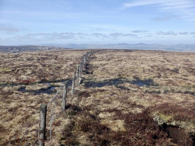
Blackhope Scar is the second-highest of the Moorfoot Hills, a broad rounded top above the Gladhouse Reservoir and the upper Esk. The summit is unmarked but for a small cairn at the crown of the moor — a fine wild spot within sight of Edinburgh.
Quick facts
- Height
- 651.8m/ 2138ft
- Prominence
- 283 m
- Distance
- 13 km
- Ascent
- 534 m
- Time
- 3–6 hrs
- Grid ref
- NT315483
- Parking
- NT347465
- Nearest city
- Edinburgh· 26km
- Dogs
- Dogs on lead required near livestockDog-friendly guide ↗
Height and prominence cross-checked against the Database of British and Irish Hills (CC BY).
No GPX track yet
Walked this route? Share your track to help other walkers.
Standard route
grass moorland 80% · heather patches 15% · summit area 5%
From the Glentress or Gladhouse road end, climb the east ridge onto the broad plateau and follow it to the cairn. Around 12km return with 480m of climb.
Terrain
Heather and bog cotton on the plateau; the upper ridge has firmer turf. Faint estate tracks run partway up the hill.
In winter
Snow lingers in the corrie heads above the Glentress forest. Wind funnels straight off the Pentlands and the top scours bare in easterlies.
Best time of year
Getting there
- Glasgow2h 46m
- Edinburgh1h 37m
OS maps: OS Landranger 73
Mobile signal: Good summit signal; EE and Vodafone dependable. Fine viewpoint over Tweeddale.
Current conditions
Daylight Today
- Sunrise
- 04:46
- Sunset
- 21:50
- Civil dawn
- 03:50
- Civil dusk
- 22:46
NOAA Solar Calculator · 13 July 2026
Pair with
Curated multi-hill combinations from Blackhope Scar.
Around Blackhope Scar on the SCOT network
Getting there, basing yourself, and what to do off the hill.
Blackhope Scar — common questions
- Is Blackhope Scar a hard climb?
- Blackhope Scar is rated 3/5 (moderately challenging) on the OutdoorSCOT scale. The standard route covers about 13km with 534m of ascent and takes most walkers 3-6 hours. Underfoot: Heather and bog cotton on the plateau; the upper ridge has firmer turf.
- What is Blackhope Scar's prominence?
- 283m of prominence. That's the vertical drop from the summit to the col that links Blackhope Scar to the next higher ground.
- Where do I park for Blackhope Scar?
- Most walkers start from NT347465. Verify the grid reference on an OS map before you set off — space is tight on busy summer weekends.
- When is the best time to climb Blackhope Scar?
- March, April, May, June, July, August, September, October, November give the most reliable conditions on Blackhope Scar. Beyond that window the high ground turns wintry: carry full mountain kit, be confident navigating, and check the SAIS avalanche forecast for the area.
- Is Blackhope Scar dog-friendly?
- Yes, but dogs must be kept on a lead — there is livestock or ground-nesting bird interest on the route.
- Is there mobile signal on Blackhope Scar?
- Good summit signal; EE and Vodafone dependable. Fine viewpoint over Tweeddale.
- Is Blackhope Scar safe in winter?
- Snow lingers in the corrie heads above the Glentress forest. Wind funnels straight off the Pentlands and the top scours bare in easterlies.
Get the OutdoorSCOT weekly
One email a week — new route, hill and bothy guides, seasonal conditions and the odd hard-won lesson. No spam, unsubscribe in one click.