Donald · Borders
Dundreich
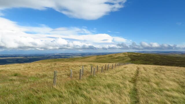
Dundreich (623m) is the highest of the southern Moorfoots, a heather-clad pyramid rising directly behind the village of Eddleston in the Tweed Valley. A neat summit cairn caps the broad top, with views down to Portmore Loch and across to the Pentlands. The hill carries the remains of an Iron Age fort on its lower spur — a reminder that this ground has been walked and watched for millennia.
Quick facts
- Height
- 623m/ 2044ft
- Prominence
- 68 m
- Distance
- 12 km
- Ascent
- 467 m
- Time
- 3–5 hrs
- Grid ref
- NT274490
- Parking
- NT285481
- Nearest city
- Edinburgh· 25km
- Dogs
- Dogs on lead required near livestockDog-friendly guide ↗
Height and prominence cross-checked against the Database of British and Irish Hills (CC BY).
No GPX track yet
Walked this route? Share your track to help other walkers.
Standard route
heather moorland 50% · grass moorland 40% · rocky summit 10%
The standard line starts from Portmore Loch at NT250500 and follows the public path through estate woodland onto open moor, then climbs the north-west ridge to the summit cairn. The walk is around 12km with 467m of ascent. The lower track gives quick height gain; the upper slopes are heather with a faint path winding among hag systems. The cairn is a fine viewpoint over Tweeddale.
Terrain
Mixed terrain — estate woodland, rough pasture and a long heather pull. The lower path is well-trodden but the upper slopes are tussocky and slow. Hag systems on the summit ridge force minor diversions in wet weather. The fort earthworks on the lower spur are an interesting feature to navigate by on misty descents.
In winter
Sheltered from the worst Atlantic weather by the higher Pentlands to the west, Dundreich nonetheless catches easterly haar and lying snow. The heather flattens under a snowpack and walking becomes faster than in summer, but bog holes hidden beneath drift can be calf-deep. Portmore Loch occasionally freezes hard enough to ski across — a clue to the local cold.
Best time of year
Getting there
- Glasgow2h 40m
- Edinburgh1h 36m
OS maps: OS Landranger 73
Mobile signal: Solid summit coverage; EE is dependable. Moorfoot Hills viewpoint.
Current conditions
Daylight Today
- Sunrise
- 04:52
- Sunset
- 21:46
- Civil dawn
- 03:58
- Civil dusk
- 22:40
NOAA Solar Calculator · 17 July 2026
Around Dundreich on the SCOT network
Getting there, basing yourself, and what to do off the hill.
Dundreich — common questions
- How difficult is Dundreich?
- Dundreich carries a 3/5 (moderately challenging) grade on the OutdoorSCOT scale. Count on about 12km, 467m of ascent and a 3-5 hour day on the standard route. Terrain: Mixed terrain — estate woodland, rough pasture and a long heather pull.
- How prominent is Dundreich?
- Dundreich has 68m of topographic prominence — the height of its summit above the highest col connecting it to higher ground.
- Where should I park to climb Dundreich?
- Standard parking is at NT285481. Check the parking grid reference on an OS map before travel; informal laybys can fill on summer weekends.
- When should I climb Dundreich?
- The standard good-weather months for Dundreich are March, April, May, June, July, August, September, October, November. Outside those months, expect winter conditions on the high ground — full mountain kit, navigation skills, and a check of the SAIS avalanche forecast for the relevant region.
- Can I bring my dog up Dundreich?
- On a lead only — the route crosses ground with livestock or nesting-bird interest.
- What's mobile reception like on Dundreich?
- Solid summit coverage; EE is dependable. Moorfoot Hills viewpoint.
- Is Dundreich safe in winter?
- Sheltered from the worst Atlantic weather by the higher Pentlands to the west, Dundreich nonetheless catches easterly haar and lying snow. The heather flattens under a snowpack and walking becomes faster than in summer, but bog holes hidden beneath drift can be calf-deep. Portmore Loch occasionally freezes hard enough to ski across — a clue to the local cold.
Get the OutdoorSCOT weekly
One email a week — new route, hill and bothy guides, seasonal conditions and the odd hard-won lesson. No spam, unsubscribe in one click.