Corbett · Ardnamurchan
Druim Tarsuinn (Stob a' Bhealach an Sgriodain)
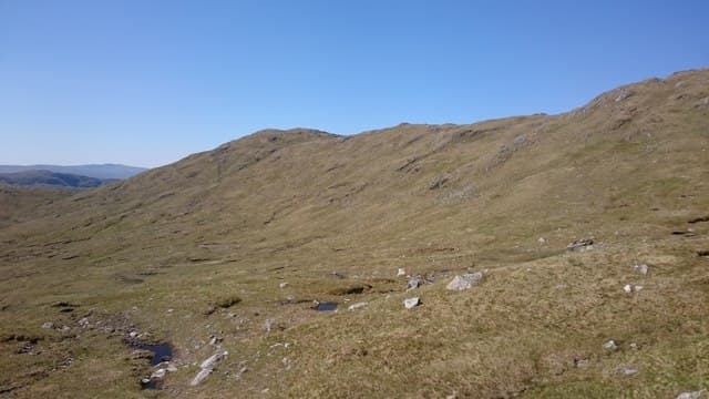
Druim Tarsuinn — "the cross ridge", with the proper summit named Stob a' Bhealach an Sgriodain — is a long undulating Corbett deep in Ardgour, between the upper reaches of Glen Hurich and Glen Scaddle. The 771m summit is a small cairn on a rocky knoll along a 2km grass-and-rock ridge. The hill sits in some of the wildest country in mainland Lochaber, with no nearby Munros and very few visitors. Often combined with neighbouring Carn na Nathrach for a long Ardgour day.
Quick facts
- Height
- 771.9m/ 2532ft
- Prominence
- 261 m
- Distance
- 14 km
- Ascent
- 632 m
- Time
- 4–7 hrs
- Grid ref
- NM874727
- Parking
- NM832638
- Nearest city
- Fort William· 23km
- Dogs
- Dogs on lead required near livestockDog-friendly guide ↗
Height and prominence cross-checked against the Database of British and Irish Hills (CC BY).
No GPX track yet
Walked this route? Share your track to help other walkers.
Standard route
glen track 20% · heather and bog 50% · grassy upper slopes 20% · summit area 10%
From the same A861 start at Sallachan as Carn na Nathrach, walk the long Glen Hurich forestry track north for 5–6km. Where the track ends near Resourie, push east-south-east up pathless heather and grass to gain the broad west ridge of Druim Tarsuinn. Total 14km out-and-back with 632m of climbing. Often combined with Carn na Nathrach across the high bealach.
Terrain
The Glen Hurich forestry track gives a firm approach. Beyond it the hillside turns to bog, bracken and rough heather — pathless and slow. The upper ridge is short grass and small rock outcrops; the summit cairn is on the highest of several bumps. Navigation across the wide undulating top demands attention in mist. No exposure or scrambling.
In winter
A long winter day rather than a technically demanding one — open ridge takes full Atlantic loading, but no avalanche slopes or cornicing of consequence. The Corran ferry can be cancelled in storms, and the A861 around the peninsula is single-track and slow. Phone signal absent throughout the day.
This hill is in the Glen Coe SAIS forecast area. Check SAIS forecasts in winter (December–April).
Best time of year
Getting there
- Glasgow3h 45m
- Edinburgh3h 16m
OS maps: OS Landranger 40
Mobile signal: No signal in Ardgour interior; intermittent at Sallachan
Current conditions
Daylight Today
- Sunrise
- 04:54
- Sunset
- 22:02
- Civil dawn
- 03:56
- Civil dusk
- 23:00
NOAA Solar Calculator · 17 July 2026
Pair with
Curated multi-hill combinations from Druim Tarsuinn (Stob a' Bhealach an Sgriodain).
Got a photo of Druim Tarsuinn (Stob a' Bhealach an Sgriodain)?
30 seconds, helps other walkers.
Submit a photoAround Druim Tarsuinn (Stob a' Bhealach an Sgriodain) on the SCOT network
Getting there, basing yourself, and what to do off the hill.
Getting there: Glenfinnan station
Glenfinnan Viaduct; Streap, Sgurr Thuilm, Glen Finnan Munros
9km from the hill
tripscot.co.uk
On TripSCOTBase yourself in Fort William
Ben Nevis base, West Highland Line, gateway to Lochaber
23km from the hill
tripscot.co.uk
On TasteSCOTAfter the hill: Ben Nevis Distillery
Fort William — Lochaber distillery at the foot of the Ben; long-aged Japanese-owned classics
25km from the hill
tastescot.co.uk
Druim Tarsuinn (Stob a' Bhealach an Sgriodain) — common questions
- How hard is Druim Tarsuinn (Stob a' Bhealach an Sgriodain)?
- We grade Druim Tarsuinn (Stob a' Bhealach an Sgriodain) at 2/5, which puts it in moderate territory. The usual route is around 14km with 632m of climbing; allow 4-7 hours. Ground conditions: The Glen Hurich forestry track gives a firm approach.
- How much drop does Druim Tarsuinn (Stob a' Bhealach an Sgriodain) have?
- The drop is 261m: measured from the summit of Druim Tarsuinn (Stob a' Bhealach an Sgriodain) down to the saddle joining it to higher terrain.
- Where's the parking for Druim Tarsuinn (Stob a' Bhealach an Sgriodain)?
- Park at NM832638. Double-check the grid reference on an OS map first; informal laybys here fill early in high season.
- What's the best month to climb Druim Tarsuinn (Stob a' Bhealach an Sgriodain)?
- Aim for May, June, July, August, September on Druim Tarsuinn (Stob a' Bhealach an Sgriodain). In the remaining months treat it as a winter hill — full kit, solid navigation, and a look at the relevant SAIS avalanche forecast before you go.
- Can dogs go up Druim Tarsuinn (Stob a' Bhealach an Sgriodain)?
- Dogs are fine on a lead. The route passes livestock or ground-nesting bird habitat, so keep them close throughout.
- Will I get phone signal on Druim Tarsuinn (Stob a' Bhealach an Sgriodain)?
- No signal in Ardgour interior; intermittent at Sallachan
- Is Druim Tarsuinn (Stob a' Bhealach an Sgriodain) safe in winter?
- A long winter day rather than a technically demanding one — open ridge takes full Atlantic loading, but no avalanche slopes or cornicing of consequence. The Corran ferry can be cancelled in storms, and the A861 around the peninsula is single-track and slow. Phone signal absent throughout the day.
Get the OutdoorSCOT weekly
One email a week — new route, hill and bothy guides, seasonal conditions and the odd hard-won lesson. No spam, unsubscribe in one click.