Corbett · North-West Highlands
Beinn an Eoin
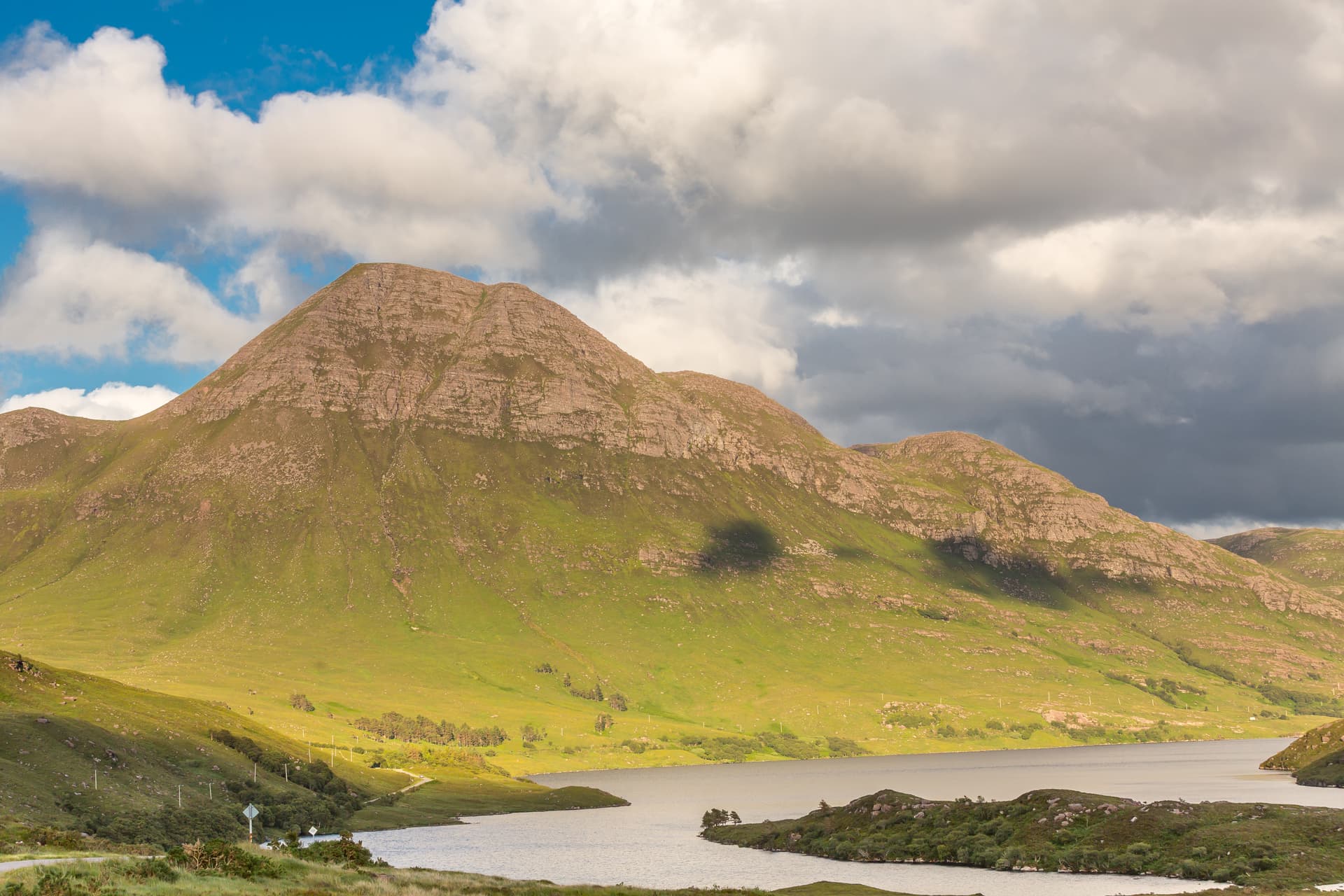
Beinn an Eoin — the "hill of the bird" — sits across Loch na h-Oidhche from Baosbheinn in the Flowerdale Forest, an island of Torridonian sandstone surrounded by lochans and bog. Its 855m highest point, Sgurr Deas, is a steep little peak with a sharper profile than its bulkier neighbour. The view east to Beinn Eighe across the wild watershed country is among the best in Wester Ross. The hill is normally tackled as a partner day with Baosbheinn though either makes a full day on its own.
Quick facts
- Height
- 855m/ 2805ft
- Prominence
- 434 m
- Distance
- ~15 km
- Ascent
- ~752 m
- Time
- 5–8 hrs
- Grid ref
- NG905646
- Parking
- NG857721
- Nearest
- Ullapool· Inverness 78km
- Dogs
- Dogs on lead required near livestockDog-friendly guide ↗
Height and prominence cross-checked against the Database of British and Irish Hills (CC BY).
No GPX track yet
Walked this route? Share your track to help other walkers.
Standard route
moorland path 25% · heather hillside 35% · rocky ridge 30% · summit area 10%
Walk in from the small Red Barn parking area between Gairloch and Loch Maree, taking the Flowerdale stalkers path that runs south-east toward Loch na h-Oidhche for around 5km. At the loch outflow, leave the path and climb the steep north-west flank of Beinn an Eoin to gain the ridge between Sgorr Tuath and Sgurr Deas. A short traverse south-east leads to the summit. Around 15km return with 752m of ascent; combine with Baosbheinn across the loch for the classic two-Corbett day.
Terrain
The Flowerdale path is firm and well drained — a real pleasure for the approach. Off the path the ground is wet around the loch and the climb onto the ridge is steep with loose sandstone scree in places. The ridge itself is narrow with airy positions over the loch though no exposed scrambling. Care needed crossing the bealach between the two main tops where blocks of weathered sandstone are loose underfoot.
In winter
In winter the steep north-west flank above the loch is the technical crux and becomes a serious snow slope after westerly storms — avalanche risk is real and the run-out into the frozen lochan is not somewhere to be carried into. The sandstone ridge ices up quickly. Most parties save Beinn an Eoin and Baosbheinn for late spring when the long days and cleaner snow lines make the double traverse feasible.
Kit for this: the winter Munro kit list · which boots take crampons
This hill is in the Torridon SAIS forecast area. Check SAIS forecasts in winter (December–April).
Best time of year
Getting there
- Glasgow4h 3m
- Edinburgh4h 29m
OS maps: OS Landranger 19
Mobile signal: No signal in this Torridon/Gairloch area hill
Current conditions
Daylight Today
- Sunrise
- 07:53
- Sunset
- 18:23
- Civil dawn
- 07:14
- Civil dusk
- 19:02
NOAA Solar Calculator · 14 October 2026
Pair with
Curated multi-hill combinations from Beinn an Eoin.
Around Beinn an Eoin on the SCOT network
Getting there, basing yourself, and what to do off the hill.
Beinn an Eoin — common questions
- How difficult is Beinn an Eoin?
- Beinn an Eoin carries a 5/5 (very challenging) grade on the OutdoorSCOT scale. Count on about 15km, 752m of ascent and a 5-8 hour day on the standard route. Terrain: The Flowerdale path is firm and well drained — a real pleasure for the approach.
- How prominent is Beinn an Eoin?
- Beinn an Eoin has 434m of topographic prominence — the height of its summit above the highest col connecting it to higher ground.
- Where should I park to climb Beinn an Eoin?
- Standard parking is at NG857721 near Ullapool. Check the parking grid reference on an OS map before travel; informal laybys can fill on summer weekends.
- When should I climb Beinn an Eoin?
- The standard good-weather months for Beinn an Eoin are May, June, July, August, September. Outside those months, expect winter conditions on the high ground — full mountain kit, navigation skills, and a check of the SAIS avalanche forecast for the relevant region.
- Can I bring my dog up Beinn an Eoin?
- On a lead only — the route crosses ground with livestock or nesting-bird interest.
- What's mobile reception like on Beinn an Eoin?
- No signal in this Torridon/Gairloch area hill
- Is Beinn an Eoin safe in winter?
- In winter the steep north-west flank above the loch is the technical crux and becomes a serious snow slope after westerly storms — avalanche risk is real and the run-out into the frozen lochan is not somewhere to be carried into. The sandstone ridge ices up quickly. Most parties save Beinn an Eoin and Baosbheinn for late spring when the long days and cleaner snow lines make the double traverse feasible.
Get the OutdoorSCOT weekly
One email a week — new route, hill and bothy guides, seasonal conditions and the odd hard-won lesson. No spam, unsubscribe in one click.