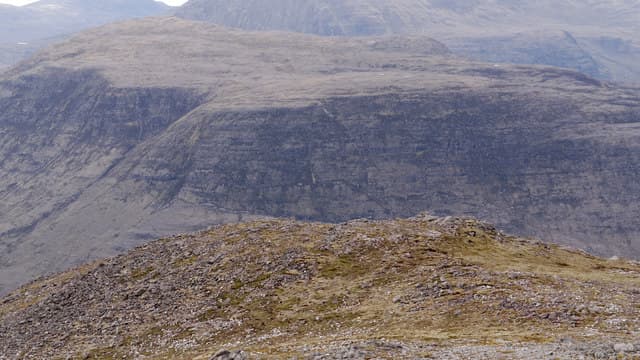
Corbett · North-West Highlands
Meall a' Ghiuthais (Meall a' Ghiubhais)
Meall a' Ghiubhais — "hill of the pine" — is the standalone quartzite-capped Corbett on the south side of Loch Maree, just east of the great Beinn Eighe massif. It sits within the Beinn Eighe National Nature Reserve, Britain's oldest, and is reached by the famous mountain trail that winds through Caledonian pine remnants from the visitor centre at Aultroy. At 887m the summit is a broad whaleback with a windshelter and one of the best lochside panoramas in Wester Ross — Slioch directly across the loch and An Teallach in the distance.
Quick facts
- Height
- 887m/ 2910ft
- Prominence
- 418 m
- Distance
- ~16 km
- Ascent
- ~781 m
- Time
- 6–9 hrs
- Grid ref
- NG976634
- Parking
- NH001650
- Nearest
- Ullapool· Inverness 71km
- Dogs
- Dogs on lead required near livestockDog-friendly guide ↗
Height and prominence cross-checked against the Database of British and Irish Hills (CC BY).
No GPX track yet
Walked this route? Share your track to help other walkers.
Standard route
woodland path 20% · moorland path 35% · rocky hillside 35% · summit area 10%
Start from the Coille na Glas-Leitire car park on the A832 south of Kinlochewe and follow the Beinn Eighe Mountain Trail. After around 2km, branch right off the marked trail and climb the broad heathery shoulder north-west onto the summit dome. Around 16km return with 781m of ascent if extended over the rough ground beyond. The trail itself is well-built; off the trail the ground is rough but never technical. The natural pairing is a low-effort circuit using the trail descent.
Terrain
The Mountain Trail is famously well-engineered with stone steps and gravel surface — one of the finest interpreted paths in Scotland. Off the trail the ground is heather, peat and quartzite scree underfoot. The summit dome itself is broad and stony with a windshelter at the highest point. No exposure or scrambling; the only real difficulty is bog-trotting in wet conditions between the trail and the open hill.
In winter
A more benign winter Corbett than its bigger Beinn Eighe neighbours — the gentle gradients keep avalanche risk low and the trail can be followed even with snow cover. The quartzite summit is exposed to wind but free of cornices. The A832 is gritted and the visitor centre car park reliably accessible all winter. Excellent introductory winter hill for those new to the area.
Kit for this: the winter Munro kit list · which boots take crampons
This hill is in the Torridon SAIS forecast area. Check SAIS forecasts in winter (December–April).
Best time of year
Getting there
- Glasgow4h 59m
- Edinburgh4h 23m
OS maps: OS Landranger 19
Mobile signal: No signal — Loch Maree area, poor connectivity throughout
Current conditions
Daylight Today
- Sunrise
- 07:53
- Sunset
- 18:22
- Civil dawn
- 07:14
- Civil dusk
- 19:02
NOAA Solar Calculator · 14 October 2026
Pair with
Curated multi-hill combinations from Meall a' Ghiuthais (Meall a' Ghiubhais).
Got a photo of Meall a' Ghiuthais (Meall a' Ghiubhais)?
30 seconds, helps other walkers.
Submit a photoAround Meall a' Ghiuthais (Meall a' Ghiubhais) on the SCOT network
Getting there, basing yourself, and what to do off the hill.
Meall a' Ghiuthais (Meall a' Ghiubhais) — common questions
- How hard is Meall a' Ghiuthais (Meall a' Ghiubhais)?
- We grade Meall a' Ghiuthais (Meall a' Ghiubhais) at 3/5, which puts it in moderately challenging territory. The usual route is around 16km with 781m of climbing; allow 6-9 hours. Terrain: The Mountain Trail is famously well-engineered with stone steps and gravel surface — one of the finest interpreted paths in Scotland.
- How prominent is Meall a' Ghiuthais (Meall a' Ghiubhais)?
- Meall a' Ghiuthais (Meall a' Ghiubhais) has 418m of topographic prominence — the height of its summit above the highest col connecting it to higher ground.
- Where should I park to climb Meall a' Ghiuthais (Meall a' Ghiubhais)?
- Standard parking is at NH001650 near Ullapool. Check the parking grid reference on an OS map before travel; informal laybys can fill on summer weekends.
- When should I climb Meall a' Ghiuthais (Meall a' Ghiubhais)?
- The standard good-weather months for Meall a' Ghiuthais (Meall a' Ghiubhais) are May, June, July, August, September. Outside those months, expect winter conditions on the high ground — full mountain kit, navigation skills, and a check of the SAIS avalanche forecast for the relevant region.
- Can I bring my dog up Meall a' Ghiuthais (Meall a' Ghiubhais)?
- On a lead only — the route crosses ground with livestock or nesting-bird interest.
- What's mobile reception like on Meall a' Ghiuthais (Meall a' Ghiubhais)?
- No signal — Loch Maree area, poor connectivity throughout
- Is Meall a' Ghiuthais (Meall a' Ghiubhais) safe in winter?
- A more benign winter Corbett than its bigger Beinn Eighe neighbours — the gentle gradients keep avalanche risk low and the trail can be followed even with snow cover. The quartzite summit is exposed to wind but free of cornices. The A832 is gritted and the visitor centre car park reliably accessible all winter. Excellent introductory winter hill for those new to the area.
Get the OutdoorSCOT weekly
One email a week — new route, hill and bothy guides, seasonal conditions and the odd hard-won lesson. No spam, unsubscribe in one click.