Graham · Galloway
Craignaw
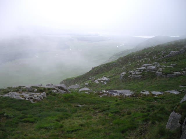
Craignaw (646m) sits at the core of the Dungeon Range in the NX48 square, a wild Galloway summit between Loch Enoch and Loch Neldricken. A cairn perches on top of a large granite boulder at the high point — the famous "Devil's Bowling Green" of glaciated slabs lies a short stroll north.
Quick facts
- Height
- 646m/ 2119ft
- Prominence
- 151 m
- Distance
- 12 km
- Ascent
- 484 m
- Time
- 3–5 hrs
- Grid ref
- NX459833
- Parking
- NX415803
- Nearest city
- Dumfries· 52km
- Dogs
- Dogs on lead required near livestockDog-friendly guide ↗
Height and prominence cross-checked against the Database of British and Irish Hills (CC BY).
No GPX track yet
Walked this route? Share your track to help other walkers.
Standard route
granite boulders 40% · heather moorland 40% · bog and wet grass 20%
Park at Bruce's Stone near Loch Trool and follow the Merrick path up Buchan burn. Branch east at the Culsharg bothy onto a faint moorland trail across the Murder Hole pass between Loch Enoch and Loch Neldricken. From the col, climb the south spur of Craignaw on slabs and granite blocks to the boulder cairn.
Terrain
Tourist path up Buchan burn at the start, then rough pathless moor across the Murder Hole. The granite slabs of the south spur are angled but secure dry; on the summit plateau, water-worn rock slabs make a memorable approach to the boulder.
In winter
The Galloway granite holds ice spectacularly well after south-westerly storms followed by a clearance. Craignaw's slabs become Welsh-style verglas terrain in cold spells and the open ground around Loch Enoch is notoriously disorienting in mist. Carry full kit even for a "low" hill day.
Best time of year
Getting there
- Glasgow2h 46m
- Edinburgh3h 34m
OS maps: OS Landranger 77
Mobile signal: Mixed. EE patchy up high; better on south-facing slopes.
Current conditions
Daylight Today
- Sunrise
- 06:08
- Sunset
- 20:32
- Civil dawn
- 05:28
- Civil dusk
- 21:12
NOAA Solar Calculator · 24 August 2026
Pair with
Curated multi-hill combinations from Craignaw.
On a long-distance route
Craignaw sits within 5km of these named long-distance walks — useful for trail-pack rest days or section extensions.
Around Craignaw on the SCOT network
Getting there, basing yourself, and what to do off the hill.
Getting there: Ayr station
Ayrshire coast; Galloway approach via bus/car
40km from the hill
tripscot.co.uk
On TripSCOTBase yourself in Kirkcudbright
Galloway base — Solway coast, Galloway Forest, Mull of Galloway Trail
39km from the hill
tripscot.co.uk
On TasteSCOTAfter the hill: Bladnoch
Wigtown — Galloway's only distillery; Scotland's most southerly
29km from the hill
tastescot.co.uk
Craignaw — common questions
- How difficult is Craignaw?
- Craignaw carries a 3/5 (moderately challenging) grade on the OutdoorSCOT scale. Count on about 12km, 484m of ascent and a 3-5 hour day on the standard route. Ground conditions: Tourist path up Buchan burn at the start, then rough pathless moor across the Murder Hole.
- How much drop does Craignaw have?
- The drop is 151m: measured from the summit of Craignaw down to the saddle joining it to higher terrain.
- Where's the parking for Craignaw?
- Park at NX415803. Double-check the grid reference on an OS map first; informal laybys here fill early in high season.
- What's the best month to climb Craignaw?
- Aim for March, April, May, June, July, August, September, October, November on Craignaw. In the remaining months treat it as a winter hill — full kit, solid navigation, and a look at the relevant SAIS avalanche forecast before you go.
- Can dogs go up Craignaw?
- Dogs are fine on a lead. The route passes livestock or ground-nesting bird habitat, so keep them close throughout.
- Will I get phone signal on Craignaw?
- Mixed. EE patchy up high; better on south-facing slopes.
- Is Craignaw safe in winter?
- The Galloway granite holds ice spectacularly well after south-westerly storms followed by a clearance. Craignaw's slabs become Welsh-style verglas terrain in cold spells and the open ground around Loch Enoch is notoriously disorienting in mist. Carry full kit even for a "low" hill day.
Get the OutdoorSCOT weekly
One email a week — new route, hill and bothy guides, seasonal conditions and the odd hard-won lesson. No spam, unsubscribe in one click.