Corbett · Ardgour
Creach Bheinn
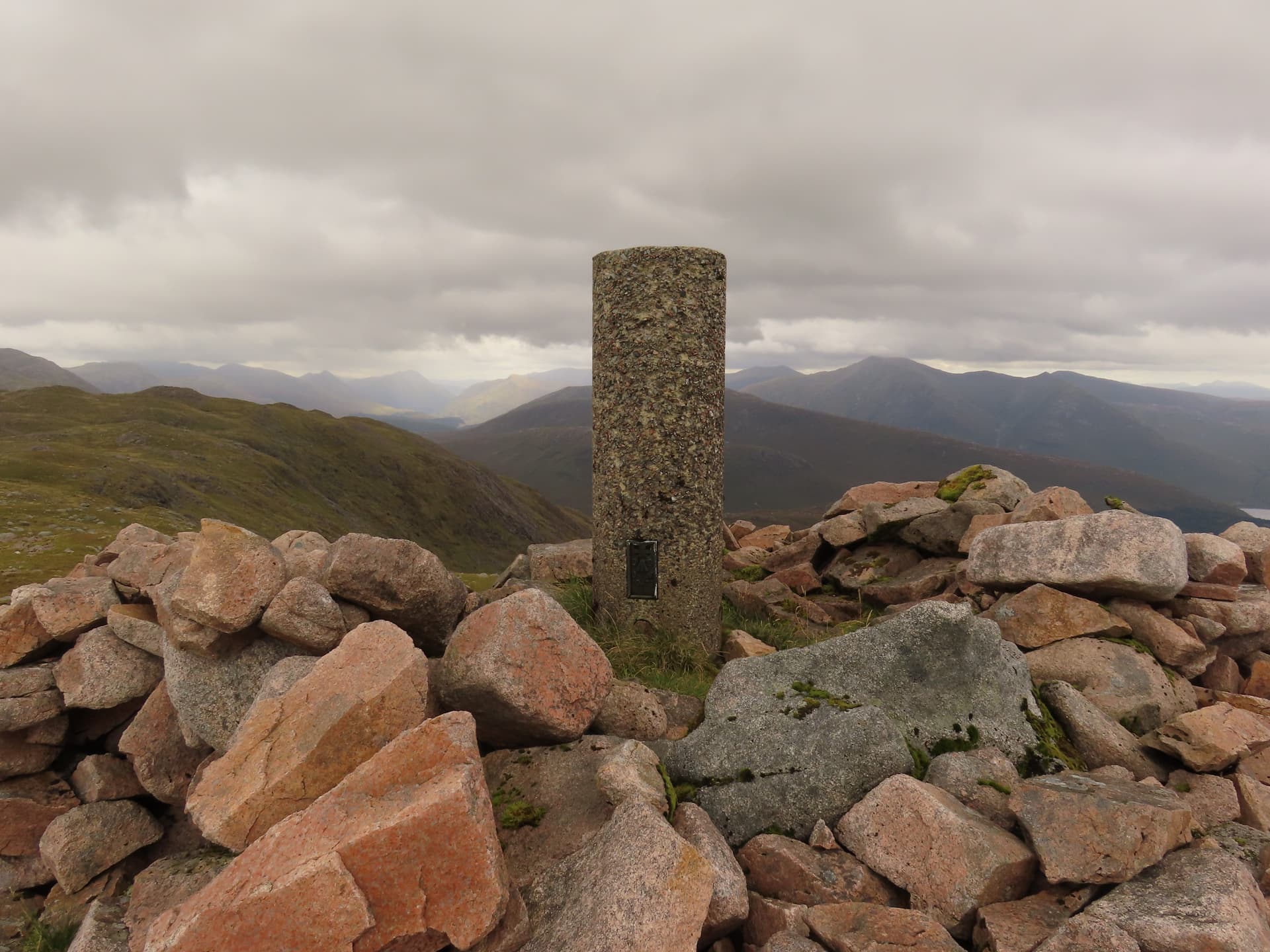
The Appin Creach Bheinn — the better-known of the two Creach Bheinns of Argyll, distinct from the Morvern hill — rises north of Loch Creran between Glen Etive and Glen Creran. At 810m it is a multi-topped hill with a huge boulder cairn at the highest point and a long broken summit ridge. Its position above the Glen Etive road gives an unobstructed view of Buachaille Etive Mor and the head of Glen Coe — one of the great close-range vistas of the Glen Coe area.
Quick facts
- Height
- 810m/ 2657ft
- Prominence
- 245 m
- Distance
- 15 km
- Ascent
- 713 m
- Time
- 4–7 hrs
- Grid ref
- NN023422
- Parking
- NN036488
- Nearest city
- Oban· 20km
- Dogs
- Dogs on lead required near livestockDog-friendly guide ↗
Height and prominence cross-checked against the Database of British and Irish Hills (CC BY).
No GPX track yet
Walked this route? Share your track to help other walkers.
Standard route
estate track 30% · steep heather 30% · broken ridge 30% · summit boulder 10%
The classic line is from the small parking area at the head of Loch Creran near Elleric, following the estate track up Glen Creran for around 4km before climbing east onto the open hillside. The route ascends steeply through rough heather to gain the south ridge then follows it to the boulder summit. Around 15km return with 713m of ascent. Often combined with neighbouring Fuar Bheinn for a Glen Creran double.
Terrain
The Glen Creran estate track is firm gravel. Off the track the lower hillside is bracken and bog with no path; the steep climb onto the south ridge is on tussocky grass. The summit ridge is broken rock and short turf with the huge boulder cairn at the high point unmistakable. The drop east into Glen Etive is crag-broken; navigate south on descent to avoid the cliffs.
In winter
A surprisingly serious winter Corbett — the steep south face accumulates avalanche-prone snow after westerly storms, and the summit ridge develops cornices on the east side above Glen Etive. The boulder cairn in rime makes a striking landmark. The Glen Creran road can drift up; the A828 is gritted.
This hill is in the Glencoe SAIS forecast area. Check SAIS forecasts in winter (December–April).
Best time of year
Getting there
- Glasgow2h 2m
- Edinburgh3h 0m
OS maps: OS Landranger 50
Mobile signal: Intermittent at Elleric; nothing on the summit ridge
Current conditions
Daylight Today
- Sunrise
- 06:07
- Sunset
- 20:39
- Civil dawn
- 05:26
- Civil dusk
- 21:21
NOAA Solar Calculator · 24 August 2026
Pair with
Curated multi-hill combinations from Creach Bheinn.
Around Creach Bheinn on the SCOT network
Getting there, basing yourself, and what to do off the hill.
Getting there: Loch Awe station
East shore Loch Awe; Ben Cruachan; Kilchurn Castle
18km from the hill
tripscot.co.uk
On TripSCOTBase yourself in Glencoe
Three Sisters, Aonach Eagach and the Lost Valley — village base on Loch Leven
19km from the hill
tripscot.co.uk
On TasteSCOTAfter the hill: Oban
Oban town centre — tiny two-still distillery bridging Highland and West Coast styles
21km from the hill
tastescot.co.uk
Creach Bheinn — common questions
- How hard is Creach Bheinn?
- We grade Creach Bheinn at 3/5, which puts it in moderately challenging territory. The usual route is around 15km with 713m of climbing; allow 4-7 hours. Ground conditions: The Glen Creran estate track is firm gravel.
- How much drop does Creach Bheinn have?
- The drop is 245m: measured from the summit of Creach Bheinn down to the saddle joining it to higher terrain.
- Where's the parking for Creach Bheinn?
- Park at NN036488. Double-check the grid reference on an OS map first; informal laybys here fill early in high season.
- What's the best month to climb Creach Bheinn?
- Aim for April, May, June, July, August, September, October on Creach Bheinn. In the remaining months treat it as a winter hill — full kit, solid navigation, and a look at the relevant SAIS avalanche forecast before you go.
- Can dogs go up Creach Bheinn?
- Dogs are fine on a lead. The route passes livestock or ground-nesting bird habitat, so keep them close throughout.
- Will I get phone signal on Creach Bheinn?
- Intermittent at Elleric; nothing on the summit ridge
- Is Creach Bheinn safe in winter?
- A surprisingly serious winter Corbett — the steep south face accumulates avalanche-prone snow after westerly storms, and the summit ridge develops cornices on the east side above Glen Etive. The boulder cairn in rime makes a striking landmark. The Glen Creran road can drift up; the A828 is gritted.
Get the OutdoorSCOT weekly
One email a week — new route, hill and bothy guides, seasonal conditions and the odd hard-won lesson. No spam, unsubscribe in one click.