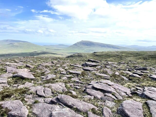
Marilyn · North-West Highlands
Beinn Dearg
This Beinn Dearg — the red hill — is the 424m Cape Wrath summit at NC 279 658, not to be confused with the Munro of the same name far to the south. The red sandstone bands that give it its name run in horizontal terraces across the south face, glowing especially in evening light.
Gaelic: “mountain, red” · Pronunciation: bine jerr-ak
Quick facts
- Height
- 423.8m/ 1390ft
- Prominence
- 151 m
- Grid ref
- NC 27975 65804
- Dogs
- Dogs on lead required near livestockDog-friendly guide ↗
Height and prominence cross-checked against the Database of British and Irish Hills (CC BY).
No GPX track yet
Walked this route? Share your track to help other walkers.
Standard route
blanket bog 40% · Torridonian sandstone 35% · quartzite 25%
Approached from the A838 near Eriboll, with a 5km walk-in across rough moor before the climb. Often combined with Creag Riabhach in a long Cape Wrath day. Allow 6-7 hours.
Terrain
Torridonian sandstone over Lewisian gneiss — the geological boundary is visible as a colour change on the south face. Above the sandstone, quartzite caps the summit area with a scattering of pale blocks.
In winter
Disambiguated from the southern Beinn Dearg Munro by the much lower altitude and Cape Wrath location. Snow cover is intermittent but freezing rain on the sandstone terraces creates serious slip hazards.
This hill is in the Torridon SAIS forecast area. Check SAIS forecasts in winter (December–April).
Best time of year
Getting there
- Glasgow7h 11m
- Edinburgh8h 8m
OS maps: OS Landranger 9, OS Explorer 446
Mobile signal: Very poor. Extreme NW Sutherland; virtually no mobile coverage.
Current conditions
Daylight Today
- Sunrise
- 05:05
- Sunset
- 21:48
- Civil dawn
- 04:08
- Civil dusk
- 22:44
NOAA Solar Calculator · 30 July 2026
Around Beinn Dearg on the SCOT network
Getting there, basing yourself, and what to do off the hill.
Beinn Dearg — common questions
- Is Beinn Dearg a hard climb?
- Beinn Dearg is rated 1/5 (easy) on the OutdoorSCOT scale. Underfoot: Torridonian sandstone over Lewisian gneiss — the geological boundary is visible as a colour change on the south face.
- What is Beinn Dearg's prominence?
- 151m of prominence. That's the vertical drop from the summit to the col that links Beinn Dearg to the next higher ground. That drop is what qualifies it as a Marilyn — a hill with at least 150m of descent on every side.
- When is the best time to climb Beinn Dearg?
- March, April, May, June, July, August, September, October give the most reliable conditions on Beinn Dearg. Beyond that window the high ground turns wintry: carry full mountain kit, be confident navigating, and check the SAIS avalanche forecast for the area.
- Is Beinn Dearg dog-friendly?
- Yes, but dogs must be kept on a lead — there is livestock or ground-nesting bird interest on the route.
- Is there mobile signal on Beinn Dearg?
- Very poor. Extreme NW Sutherland; virtually no mobile coverage.
- Is Beinn Dearg safe in winter?
- Disambiguated from the southern Beinn Dearg Munro by the much lower altitude and Cape Wrath location. Snow cover is intermittent but freezing rain on the sandstone terraces creates serious slip hazards.
Get the OutdoorSCOT weekly
One email a week — new route, hill and bothy guides, seasonal conditions and the odd hard-won lesson. No spam, unsubscribe in one click.