Marilyn · North-West Highlands
An Grianan
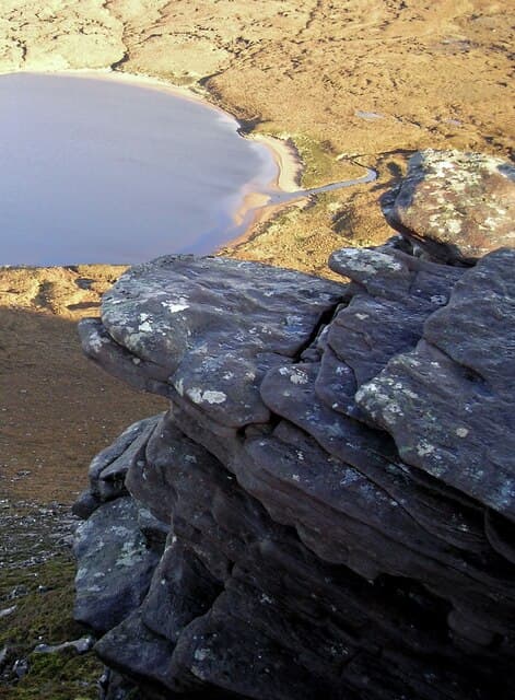
An Grianan — the sunny place — stands 467m at NC 264 626 on the Cape Wrath peninsula, immediately west of Creag Riabhach. The Gaelic name marks south-facing slopes that catch first sun; the hilltop was historically used as a daytime gathering point for shepherds.
Quick facts
- Height
- 467m/ 1532ft
- Grid ref
- NC 26468 62691
- Dogs
- Dogs on lead required near livestockDog-friendly guide ↗
No GPX track yet
Walked this route? Share your track to help other walkers.
Standard route
blanket bog 45% · quartzite scree 35% · rocky summit 20%
Most often combined with Creag Riabhach in a single circuit from the A838. The intervening bealach is wet but the climb itself is on firmer ground. Add 1-2 hours to the Creag Riabhach day for the double.
Terrain
Lewisian gneiss with extensive blanket bog on the approach. The summit dome is firmer ground of cropped grass and lichen-covered rock; the south-facing aspect that gives the hill its name is steeper than the north.
In winter
South-facing slopes catch what winter sun there is at this latitude and clear of snow faster than the surrounding moor. A useful winter target paired with Creag Riabhach, though the approach bog freezes-and-thaws into treacherous ice.
This hill is in the Torridon SAIS forecast area. Check SAIS forecasts in winter (December–April).
Best time of year
Getting there
- Glasgow7h 8m
- Edinburgh8h 6m
OS maps: OS Landranger 9, OS Explorer 446
Mobile signal: Very poor. Remote NW Sutherland near Durness; virtually no coverage.
Current conditions
Daylight Today
- Sunrise
- 04:14
- Sunset
- 22:32
- Civil dawn
- 02:54
- Civil dusk
- 23:52
NOAA Solar Calculator · 27 June 2026
Around An Grianan on the SCOT network
Getting there, basing yourself, and what to do off the hill.
An Grianan — common questions
- How hard is An Grianan?
- An Grianan is rated 1/5 (easy) on the OutdoorSCOT scale. Terrain: Lewisian gneiss with extensive blanket bog on the approach.
- When is the best time to climb An Grianan?
- The standard good-weather months for An Grianan are March, April, May, June, July, August, September, October. Outside those months, expect winter conditions on the high ground — full mountain kit, navigation skills, and a check of the SAIS avalanche forecast for the relevant region.
- Can I bring my dog up An Grianan?
- Yes, but dogs must be kept on a lead — there is livestock or ground-nesting bird interest on the route.
- Is there mobile signal on An Grianan?
- Very poor. Remote NW Sutherland near Durness; virtually no coverage.
- Is An Grianan safe in winter?
- South-facing slopes catch what winter sun there is at this latitude and clear of snow faster than the surrounding moor. A useful winter target paired with Creag Riabhach, though the approach bog freezes-and-thaws into treacherous ice.
Get the OutdoorSCOT weekly
One email a week — new route, hill and bothy guides, seasonal conditions and the odd hard-won lesson. No spam, unsubscribe in one click.