Marilyn · North-West Highlands
Fashven
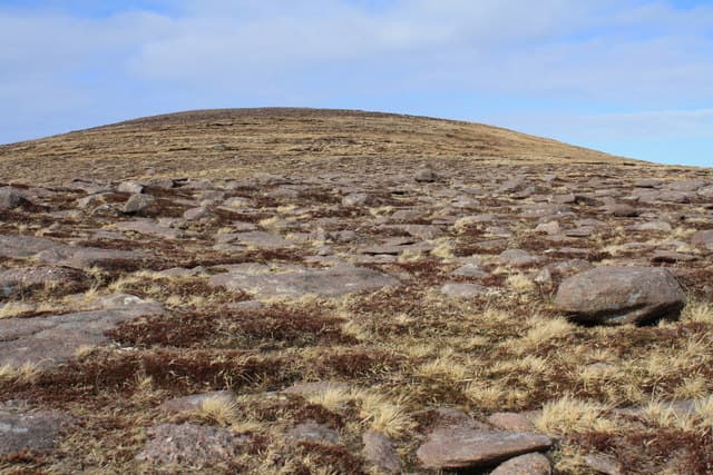
Fashven — a Norse-derived name meaning something like fish hill — stands 460m at NC 313 675 on the Cape Wrath peninsula, midway between Cape Wrath itself and Loch Eriboll. The hill looks west to the lighthouse and east to Whiten Head — full-coast views of the most rugged shoreline in mainland Britain.
Quick facts
- Height
- 460m/ 1509ft
- Prominence
- 212 m
- Grid ref
- NC 31388 67500
- Dogs
- Dogs on lead required near livestockDog-friendly guide ↗
Height and prominence cross-checked against the Database of British and Irish Hills (CC BY).
No GPX track yet
Walked this route? Share your track to help other walkers.
Standard route
blanket bog 55% · heather moorland 30% · rocky summit 15%
The shortest approach is from the road end at Keoldale, taking the Cape Wrath ferry and minibus to Daill before walking onto the hill. Total time including transport is 6-8 hours; check ferry and bus timetables.
Terrain
Quartzite and Cambrian sandstone over Lewisian basement. The summit is a flat plateau of bare rock and patches of montane grass; the surrounding ground is among the wettest in Britain — true Atlantic flow country.
In winter
The ferry service does not operate in winter so access is via the long peat road from Rhiconich. At 460m the summit catches everything the Atlantic throws at it; winds over 100mph have been recorded at Cape Wrath in midwinter.
This hill is in the Torridon SAIS forecast area. Check SAIS forecasts in winter (December–April).
Best time of year
Getting there
- Glasgow7h 12m
- Edinburgh8h 5m
OS maps: OS Landranger 9, OS Explorer 446
Mobile signal: Poor. Remote Sutherland/Caithness edge; limited coverage.
Current conditions
Daylight Today
- Sunrise
- 05:05
- Sunset
- 21:47
- Civil dawn
- 04:08
- Civil dusk
- 22:44
NOAA Solar Calculator · 30 July 2026
Around Fashven on the SCOT network
Getting there, basing yourself, and what to do off the hill.
Fashven — common questions
- Is Fashven a hard climb?
- Fashven is rated 1/5 (easy) on the OutdoorSCOT scale. Terrain: Quartzite and Cambrian sandstone over Lewisian basement.
- How prominent is Fashven?
- Fashven has 212m of topographic prominence — the height of its summit above the highest col connecting it to higher ground. Marilyns are defined by that measure: at least 150m of drop on all sides.
- When should I climb Fashven?
- The standard good-weather months for Fashven are March, April, May, June, July, August, September, October. Outside those months, expect winter conditions on the high ground — full mountain kit, navigation skills, and a check of the SAIS avalanche forecast for the relevant region.
- Can I bring my dog up Fashven?
- On a lead only — the route crosses ground with livestock or nesting-bird interest.
- What's mobile reception like on Fashven?
- Poor. Remote Sutherland/Caithness edge; limited coverage.
- Is Fashven safe in winter?
- The ferry service does not operate in winter so access is via the long peat road from Rhiconich. At 460m the summit catches everything the Atlantic throws at it; winds over 100mph have been recorded at Cape Wrath in midwinter.
Get the OutdoorSCOT weekly
One email a week — new route, hill and bothy guides, seasonal conditions and the odd hard-won lesson. No spam, unsubscribe in one click.