Marilyn · North-West Highlands
Sgribhis-bheinn
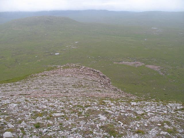
Sgribhis-bheinn — possibly the scratched hill — rises to 371m at NC 319 713 on the Cape Wrath peninsula, the most northerly Marilyn in mainland Britain. The Gaelic name may refer to glacial striations still visible on the bare summit rock.
Quick facts
- Height
- 371m/ 1217ft
- Prominence
- 217 m
- Grid ref
- NC 31931 71339
- Dogs
- Dogs on lead required near livestockDog-friendly guide ↗
Height and prominence cross-checked against the Database of British and Irish Hills (CC BY).
No GPX track yet
Walked this route? Share your track to help other walkers.
Standard route
blanket bog 55% · heather moorland 30% · rocky summit 15%
Approached from Daill via the Cape Wrath ferry and minibus, then 4km of walking onto the hill. The ferry runs Easter to September only; outside that window the walk-in from Rhiconich approaches 20km each way.
Terrain
Cambrian quartzite cap over Lewisian gneiss — the summit pavement is heavily glaciated with the parallel scratches that may give the hill its name. Surrounding ground is the wettest blanket bog in Britain.
In winter
The most northerly Marilyn in mainland Britain and as exposed as anywhere on the British mainland — Atlantic storms drive directly onto its summit. The ferry does not run, making the hill effectively inaccessible from December to March for day walkers.
This hill is in the Torridon SAIS forecast area. Check SAIS forecasts in winter (December–April).
Best time of year
Getting there
- Glasgow7h 17m
- Edinburgh8h 9m
OS maps: OS Landranger 9, OS Explorer 446
Mobile signal: Poor. Remote north Sutherland; very limited coverage.
Current conditions
Daylight Today
- Sunrise
- 05:04
- Sunset
- 21:48
- Civil dawn
- 04:08
- Civil dusk
- 22:44
NOAA Solar Calculator · 30 July 2026
Around Sgribhis-bheinn on the SCOT network
Getting there, basing yourself, and what to do off the hill.
Sgribhis-bheinn — common questions
- How difficult is Sgribhis-bheinn?
- Sgribhis-bheinn carries a 1/5 (easy) grade on the OutdoorSCOT scale. Ground conditions: Cambrian quartzite cap over Lewisian gneiss — the summit pavement is heavily glaciated with the parallel scratches that may give the hill its name.
- How much drop does Sgribhis-bheinn have?
- The drop is 217m: measured from the summit of Sgribhis-bheinn down to the saddle joining it to higher terrain. Passing the 150m-drop threshold on all sides is exactly what makes it a Marilyn.
- What's the best month to climb Sgribhis-bheinn?
- Aim for March, April, May, June, July, August, September, October on Sgribhis-bheinn. In the remaining months treat it as a winter hill — full kit, solid navigation, and a look at the relevant SAIS avalanche forecast before you go.
- Can dogs go up Sgribhis-bheinn?
- Dogs are fine on a lead. The route passes livestock or ground-nesting bird habitat, so keep them close throughout.
- Will I get phone signal on Sgribhis-bheinn?
- Poor. Remote north Sutherland; very limited coverage.
- Is Sgribhis-bheinn safe in winter?
- The most northerly Marilyn in mainland Britain and as exposed as anywhere on the British mainland — Atlantic storms drive directly onto its summit. The ferry does not run, making the hill effectively inaccessible from December to March for day walkers.
Get the OutdoorSCOT weekly
One email a week — new route, hill and bothy guides, seasonal conditions and the odd hard-won lesson. No spam, unsubscribe in one click.