Munro · Kintail
Sgurr a' Bhealaich Dheirg
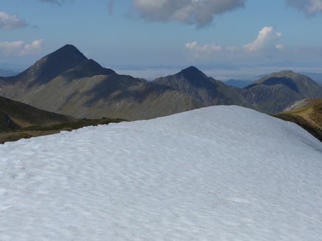
Sgùrr a' Bhealaich Dheirg (1036m) — "peak of the red pass" — is the central Munro of the long South Glen Shiel ridge / Brothers of Kintail group, sitting between Sàileag to the west and Aonach Meadhoin to the east. The hill's most distinctive feature is the great square-topped summit cairn perched dramatically above the deep north corrie. The ridge as a whole gives one of the most sustained high-level traverses in Scotland — almost 10km of continuous walking above 900m.
Quick facts
- Height
- 1036m/ 3399ft
- Prominence
- 311 m
- Distance
- 17 km
- Ascent
- 912 m
- Time
- 6–10 hrs
- Grid ref
- NH035143
- Parking
- NG990135
- Nearest city
- Fort William· 41km
- Dogs
- Dogs on lead required near livestockDog-friendly guide ↗
Height and prominence cross-checked against the Database of British and Irish Hills (CC BY).
No GPX track yet
Walked this route? Share your track to help other walkers.
Standard route
Glen path 30% · Steep hillside 35% · Summit ridge 35%
The classic line is the Brothers of Kintail traverse: park at the Bealach an Lapain layby on the A87 below the Five Sisters. Climb directly south to gain the ridge crest at Sàileag, then traverse east over Sgùrr a' Bhealaich Dheirg (a short out-and-back from the main crest), Aonach Meadhoin and Sgurr nan Spainteach. Descend to the Cluanie Inn or arrange transport. The full traverse covers roughly 14km with around 1500m of cumulative climb.
Terrain
The climb to the Bealach an Lapain rises 700m of unbroken steep grass before any path materialises. The ridge above is narrow turf and broken rock with one or two airy rocky sections. The Sgùrr a' Bhealaich Dheirg out-and-back from the main crest is a 500m walk on rocky ground — easy in clear weather but a navigation puzzle in mist. The drop to the Cluanie Inn descent off Aonach Meadhoin is steep grass on the south-east shoulder.
In winter
A long winter ridge with the same character as the Five Sisters traverse — sustained narrow crest above 900m with continuous cornice formation. The north corries hold significant avalanche risk after southerly loading. The Bealach an Lapain start is committing once gained. The A87 itself stays gritted, though the Cluanie lay-by readily glazes. Reception drops away once you are on the crest. The relevant avalanche forecast is SAIS Northern Highlands.
Best time of year
Getting there
- Glasgow3h 3m
- Edinburgh4h 34m
OS maps: OS Landranger 33
Mobile signal: Dead above 700m. Shiel Bridge has reasonable coverage. Download OS Landranger 33 before leaving.
Current conditions
Daylight Today
- Sunrise
- 05:01
- Sunset
- 21:54
- Civil dawn
- 04:05
- Civil dusk
- 22:50
NOAA Solar Calculator · 23 July 2026
Pair with
Curated multi-hill combinations from Sgurr a' Bhealaich Dheirg.
Around Sgurr a' Bhealaich Dheirg on the SCOT network
Getting there, basing yourself, and what to do off the hill.
Sgurr a' Bhealaich Dheirg — common questions
- Is Sgurr a' Bhealaich Dheirg a hard climb?
- Sgurr a' Bhealaich Dheirg is rated 5/5 (very challenging) on the OutdoorSCOT scale. The standard route covers about 17km with 912m of ascent and takes most walkers 6-10 hours. Underfoot: The climb to the Bealach an Lapain rises 700m of unbroken steep grass before any path materialises.
- What is Sgurr a' Bhealaich Dheirg's prominence?
- 311m of prominence. That's the vertical drop from the summit to the col that links Sgurr a' Bhealaich Dheirg to the next higher ground.
- Where do I park for Sgurr a' Bhealaich Dheirg?
- Most walkers start from NG990135. Verify the grid reference on an OS map before you set off — space is tight on busy summer weekends.
- When is the best time to climb Sgurr a' Bhealaich Dheirg?
- May, June, July, August, September, October give the most reliable conditions on Sgurr a' Bhealaich Dheirg. Beyond that window the high ground turns wintry: carry full mountain kit, be confident navigating, and check the SAIS avalanche forecast for the area.
- Is Sgurr a' Bhealaich Dheirg dog-friendly?
- Yes, but dogs must be kept on a lead — there is livestock or ground-nesting bird interest on the route.
- Is there mobile signal on Sgurr a' Bhealaich Dheirg?
- Dead above 700m. Shiel Bridge has reasonable coverage. Download OS Landranger 33 before leaving.
- Is Sgurr a' Bhealaich Dheirg safe in winter?
- A long winter ridge with the same character as the Five Sisters traverse — sustained narrow crest above 900m with continuous cornice formation. The north corries hold significant avalanche risk after southerly loading. The Bealach an Lapain start is committing once gained. The A87 itself stays gritted, though the Cluanie lay-by readily glazes. Reception drops away once you are on the crest. The relevant avalanche forecast is SAIS Northern Highlands.
Get the OutdoorSCOT weekly
One email a week — new route, hill and bothy guides, seasonal conditions and the odd hard-won lesson. No spam, unsubscribe in one click.