Munro · Cairngorms
Carn an Tuirc
Càrn an Tuirc (1018m) — "hill of the boar" — is the northern Munro of the Glenshee plateau group, sitting on the watershed between Glen Clunie to the north and the Cairnwell to the south. It is most efficiently climbed as part of a long round of four Munros (Càrn an Tuirc, Cairn of Claise, Glas Maol, Creag Leacach) from the Glenshee ski-centre car park, or alternatively as a shorter direct outing from the A93 head of Glen Cluny.
Quick facts
- Height
- 1018.8m/ 3343ft
- Prominence
- 62 m
- Grid ref
- NO174804
- Parking
- NO139780
- Nearest city
- Dundee· 55km
- Dogs
- Dogs on lead required near livestockDog-friendly guide ↗
Height and prominence cross-checked against the Database of British and Irish Hills (CC BY).
No GPX track yet
Walked this route? Share your track to help other walkers.
Standard route
Track / river path 35% · Open plateau 45% · Summit 20%
Start from the small lay-by where the A93 climbs out of Glen Cluny at the head of the glen, above the bridge over the Allt a' Gharbh-choire. Take the rough peaty path east, then climb the broad north shoulder of Càrn an Tuirc onto the plateau and the cairn. From here it is easy to continue south-east across the plateau to Cairn of Claise and onto Glas Maol — the classic four-Munro Mounth round. Direct Càrn an Tuirc is 7km with 540m of ascent.
Terrain
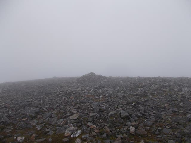
The Glen Cluny path starts boggy and indistinct, becoming clearer higher up. The north shoulder of Càrn an Tuirc is broad heathery hillside with a faint path. Above 900m the ground turns to short turf and gravel. The summit itself is a featureless mossy area with a small cairn. The plateau crossing to Cairn of Claise is a long flat traverse — pleasant in summer but featureless in mist.
In winter
A serious Glenshee winter plateau day. The broad summit and adjoining plateau are fully exposed to easterly continental winds and routinely drift heavily. Cornicing along the Caenlochan corrie rim south of the summit is consistent. The A93 corridor stays gritted but the side road to the ski-centre may close. Phone signal weakens above 900m. SAIS Southern Cairngorms applies.
This hill is in the Northern Cairngorms SAIS forecast area. Check SAIS forecasts in winter (December–April).
Best time of year
Getting there
- Glasgow3h 44m
- Edinburgh2h 16m
OS maps: OS Landranger 43
Mobile signal: Good signal at Auchallater car park near Braemar. Signal diminishes above 900m. Download maps in Braemar before heading south.
Current conditions
Daylight Today
- Sunrise
- 04:55
- Sunset
- 21:45
- Civil dawn
- 04:00
- Civil dusk
- 22:40
NOAA Solar Calculator · 23 July 2026
Pair with
Curated multi-hill combinations from Carn an Tuirc.
Around Carn an Tuirc on the SCOT network
Getting there, basing yourself, and what to do off the hill.
Getting there: Pitlochry station
Schiehallion, Ben Vrackie, Beinn a Ghlo, Edradour distillery
32km from the hill
tripscot.co.uk
On TripSCOTBase yourself in Ballater
Eastern Cairngorms / Royal Deeside
25km from the hill
tripscot.co.uk
On TasteSCOTAfter the hill: Royal Lochnagar
Balmoral — Queen Victoria's favourite; eastern Cairngorms setting
14km from the hill
tastescot.co.uk
Carn an Tuirc — common questions
- How difficult is Carn an Tuirc?
- Carn an Tuirc carries a 4/5 (challenging) grade on the OutdoorSCOT scale. Terrain: The Glen Cluny path starts boggy and indistinct, becoming clearer higher up.
- How prominent is Carn an Tuirc?
- Carn an Tuirc has 62m of topographic prominence — the height of its summit above the highest col connecting it to higher ground.
- Where should I park to climb Carn an Tuirc?
- Standard parking is at NO139780. Check the parking grid reference on an OS map before travel; informal laybys can fill on summer weekends.
- When should I climb Carn an Tuirc?
- The standard good-weather months for Carn an Tuirc are May, June, July, August, September, October. Outside those months, expect winter conditions on the high ground — full mountain kit, navigation skills, and a check of the SAIS avalanche forecast for the relevant region.
- Can I bring my dog up Carn an Tuirc?
- On a lead only — the route crosses ground with livestock or nesting-bird interest.
- What's mobile reception like on Carn an Tuirc?
- Good signal at Auchallater car park near Braemar. Signal diminishes above 900m. Download maps in Braemar before heading south.
- Is Carn an Tuirc safe in winter?
- A serious Glenshee winter plateau day. The broad summit and adjoining plateau are fully exposed to easterly continental winds and routinely drift heavily. Cornicing along the Caenlochan corrie rim south of the summit is consistent. The A93 corridor stays gritted but the side road to the ski-centre may close. Phone signal weakens above 900m. SAIS Southern Cairngorms applies.
Get the OutdoorSCOT weekly
One email a week — new route, hill and bothy guides, seasonal conditions and the odd hard-won lesson. No spam, unsubscribe in one click.