Munro · Cairngorms
Cairn Bannoch
Cairn Bannoch (1011m) is a broad Munro on the southern margin of the White Mounth plateau between the Lochnagar massif and Glen Muick. The hill sits on the historic Mounth drove route used for centuries to drive cattle south. The summit is a small cairn on otherwise featureless mossy turf — its identity comes from its position rather than its profile. Usually combined with Broad Cairn (Munro) on the same plateau, or as part of a longer Lochnagar / White Mounth circuit.
Quick facts
- Height
- 1011.1m/ 3317ft
- Prominence
- 76 m
- Distance
- 17 km
- Ascent
- 890 m
- Time
- 5–8 hrs
- Grid ref
- NO222825
- Parking
- NO309851
- Nearest city
- Dundee· 55km
- Dogs
- Dogs on lead required near livestockDog-friendly guide ↗
Height and prominence cross-checked against the Database of British and Irish Hills (CC BY).
No GPX track yet
Walked this route? Share your track to help other walkers.
Standard route
Track / estate path 35% · Open plateau 50% · Summit 15%
From the Spittal of Glenmuick car park, follow the well-built path west past Loch Muick to the head of the loch and the Glas-allt Shiel ruin (Queen Victoria's shooting lodge). Climb the Streak of Lightning path onto the White Mounth, then turn south-west across the plateau to Broad Cairn first, then north-west over Cairn Bannoch. Return via the same plateau and the lochside path. Around 22km with 920m of ascent for the pair.
Terrain
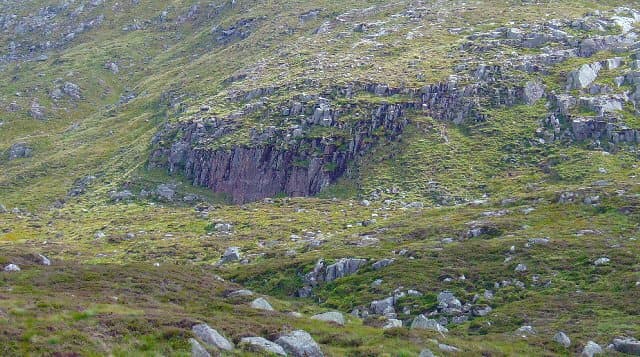
The Glen Muick path past the loch is excellent restored pitching. The Glas-allt path beyond the lodge ruin is rough but clearly defined. Above it the Streak of Lightning climbs steeply on a mix of loose scree and short grass. The plateau itself is a vast expanse of mossy turf with the Cairn Bannoch summit a small cairn at an unremarkable high point. Navigation across the plateau in cloud is the principal challenge. The Broad Cairn area has scattered granite boulders.
In winter
A serious extended plateau day in the eastern Cairngorms in winter. The White Mounth sits exposed to easterly continental weather and gathers heavy drifts. Cornicing along the corrie rims (Coire Loch nan Eun, Lochnagar) is consistent through the season. The Glen Muick approach is reliably accessible. SAIS Southern Cairngorms applies. Phone signal absent above the treeline. Confident compass-and-pace navigation essential.
This hill is in the Northern Cairngorms SAIS forecast area. Check SAIS forecasts in winter (December–April).
Best time of year
Getting there
- Glasgow3h 50m
- Edinburgh2h 19m
OS maps: OS Landranger 44
Mobile signal: No reception above 800m on the White Mounth plateau. Auchallater on the A93 has occasional coverage. Download maps in Braemar.
Current conditions
Daylight Today
- Sunrise
- 04:55
- Sunset
- 21:44
- Civil dawn
- 04:00
- Civil dusk
- 22:40
NOAA Solar Calculator · 23 July 2026
Pair with
Curated multi-hill combinations from Cairn Bannoch.
Around Cairn Bannoch on the SCOT network
Getting there, basing yourself, and what to do off the hill.
Getting there: Pitlochry station
Schiehallion, Ben Vrackie, Beinn a Ghlo, Edradour distillery
37km from the hill
tripscot.co.uk
On TripSCOTBase yourself in Ballater
Eastern Cairngorms / Royal Deeside
20km from the hill
tripscot.co.uk
On TasteSCOTAfter the hill: Royal Lochnagar
Balmoral — Queen Victoria's favourite; eastern Cairngorms setting
9km from the hill
tastescot.co.uk
Cairn Bannoch — common questions
- Is Cairn Bannoch a hard climb?
- Cairn Bannoch is rated 4/5 (challenging) on the OutdoorSCOT scale. The standard route covers about 17km with 890m of ascent and takes most walkers 5-8 hours. Ground conditions: The Glen Muick path past the loch is excellent restored pitching.
- How much drop does Cairn Bannoch have?
- The drop is 76m: measured from the summit of Cairn Bannoch down to the saddle joining it to higher terrain.
- Where's the parking for Cairn Bannoch?
- Park at NO309851. Double-check the grid reference on an OS map first; informal laybys here fill early in high season.
- What's the best month to climb Cairn Bannoch?
- Aim for May, June, July, August, September, October on Cairn Bannoch. In the remaining months treat it as a winter hill — full kit, solid navigation, and a look at the relevant SAIS avalanche forecast before you go.
- Can dogs go up Cairn Bannoch?
- Dogs are fine on a lead. The route passes livestock or ground-nesting bird habitat, so keep them close throughout.
- Will I get phone signal on Cairn Bannoch?
- No reception above 800m on the White Mounth plateau. Auchallater on the A93 has occasional coverage. Download maps in Braemar.
- Is Cairn Bannoch safe in winter?
- A serious extended plateau day in the eastern Cairngorms in winter. The White Mounth sits exposed to easterly continental weather and gathers heavy drifts. Cornicing along the corrie rims (Coire Loch nan Eun, Lochnagar) is consistent through the season. The Glen Muick approach is reliably accessible. SAIS Southern Cairngorms applies. Phone signal absent above the treeline. Confident compass-and-pace navigation essential.
Get the OutdoorSCOT weekly
One email a week — new route, hill and bothy guides, seasonal conditions and the odd hard-won lesson. No spam, unsubscribe in one click.