Munro · Cairngorms
Ben Macdui (Beinn Macduibh)
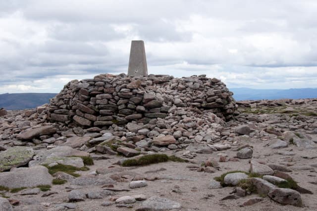
Ben Macdui — Beinn Macduibh — is the second-highest mountain in the British Isles at 1309m, sitting at the heart of the Cairngorms plateau across Lairig Ghru from Braeriach. Until the 1840s it was actually believed to be the highest, and the Victorian summit shelter and trig pillar are a legacy of the long debate. The plateau here is the largest expanse of arctic-alpine ground in Britain, home to ptarmigan and snow buntings, with the Cairngorm reindeer herd often grazing nearby. The summit is also legendary as the haunt of the Big Grey Man — the Am Fear Liath Mòr ghost reported by climbers in mist for over a century.
Quick facts
- Height
- 1309.3m/ 4296ft
- Prominence
- 950 m
- Distance
- 17.5 km
- Ascent
- 950 m
- Time
- 6–8 hrs
- Grid ref
- NN988989
- Parking
- NH989060
- Nearest city
- Inverness· 56km
- Dogs
- Dogs on lead required near livestockDog-friendly guide ↗
Height and prominence cross-checked against the Database of British and Irish Hills (CC BY).
No GPX track yet
Walked this route? Share your track to help other walkers.
Standard route
Good path 40% · Mountain path 30% · Plateau / boulder field 30%
The shortest line is from the Cairngorm Mountain ski area at Coire Cas, taking the path up onto the Cairn Gorm plateau before turning south-west across the broad granite tableland to Macdui. Around 17.5km return with 950m of ascent for the round over Cairn Gorm. A finer alternative is the long walk in from the Linn of Dee via Glen Lui to the Robber's Copse, climbing into Coire Sputan Dearg from the south.
Terrain
The Coire Cas path is well-built but the plateau beyond is open featureless ground where the path is intermittent at best. Granite boulders, peat hag and patches of mossy turf characterise the high ground. Snow patches persist into July in the corries below the summit. The Cairn Lochan / Coire an t-Sneachda edge is unfenced and undercut by cornices much of the year.
In winter
The Cairngorm plateau in winter is one of the most demanding environments in Britain — vast, featureless, swept by arctic-style storms and home to several fatal whiteout navigation accidents each decade. Set bearings before stepping onto the plateau and trust them. The summit shelter is a useful waymark but does not constitute safe accommodation. Cornices on every corrie edge. SAIS reports the Cairngorms range daily through the season; check before going.
This hill is in the Northern Cairngorms SAIS forecast area. Check SAIS forecasts in winter (December–April).
Best time of year
Getting there
- Glasgow3h 58m
- Edinburgh3h 43m
OS maps: OS Landranger 36, OS Landranger 43
Mobile signal: Reasonable signal (EE, Vodafone) at the Cairngorm ski area car park (Coire Cas). Coverage drops significantly on the plateau above 1100m. Emergency signal only at summit. Download offline maps before setting off.
Current conditions
Daylight Today
- Sunrise
- 04:55
- Sunset
- 21:47
- Civil dawn
- 04:00
- Civil dusk
- 22:43
NOAA Solar Calculator · 23 July 2026
Pair with
Curated multi-hill combinations from Ben Macdui (Beinn Macduibh).
Around Ben Macdui (Beinn Macduibh) on the SCOT network
Getting there, basing yourself, and what to do off the hill.
Getting there: Aviemore station
Cairngorm plateau; Lairig Ghru; Speyside Way; Glenmore
17km from the hill
tripscot.co.uk
On TripSCOTBase yourself in Aviemore
Cairngorms base — Strathspey valley, ski centre, train
17km from the hill
tripscot.co.uk
On TasteSCOTAfter the hill: Tomintoul
Tomintoul village — the gentle Speysider in the eastern Cairngorms
26km from the hill
tastescot.co.uk
Ben Macdui (Beinn Macduibh) — common questions
- How difficult is Ben Macdui (Beinn Macduibh)?
- Ben Macdui (Beinn Macduibh) carries a 4/5 (challenging) grade on the OutdoorSCOT scale. Count on about 17.5km, 950m of ascent and a 6-8 hour day on the standard route. Terrain: The Coire Cas path is well-built but the plateau beyond is open featureless ground where the path is intermittent at best.
- How prominent is Ben Macdui (Beinn Macduibh)?
- Ben Macdui (Beinn Macduibh) has 950m of topographic prominence — the height of its summit above the highest col connecting it to higher ground.
- Where should I park to climb Ben Macdui (Beinn Macduibh)?
- Standard parking is at NH989060. Check the parking grid reference on an OS map before travel; informal laybys can fill on summer weekends.
- When should I climb Ben Macdui (Beinn Macduibh)?
- The standard good-weather months for Ben Macdui (Beinn Macduibh) are May, June, July, August, September, October. Outside those months, expect winter conditions on the high ground — full mountain kit, navigation skills, and a check of the SAIS avalanche forecast for the relevant region.
- Can I bring my dog up Ben Macdui (Beinn Macduibh)?
- On a lead only — the route crosses ground with livestock or nesting-bird interest.
- What's mobile reception like on Ben Macdui (Beinn Macduibh)?
- Reasonable signal (EE, Vodafone) at the Cairngorm ski area car park (Coire Cas). Coverage drops significantly on the plateau above 1100m. Emergency signal only at summit. Download offline maps before setting off.
- Is Ben Macdui (Beinn Macduibh) safe in winter?
- The Cairngorm plateau in winter is one of the most demanding environments in Britain — vast, featureless, swept by arctic-style storms and home to several fatal whiteout navigation accidents each decade. Set bearings before stepping onto the plateau and trust them. The summit shelter is a useful waymark but does not constitute safe accommodation. Cornices on every corrie edge. SAIS reports the Cairngorms range daily through the season; check before going.
Get the OutdoorSCOT weekly
One email a week — new route, hill and bothy guides, seasonal conditions and the odd hard-won lesson. No spam, unsubscribe in one click.