Graham · Far North
Sabhal Beag
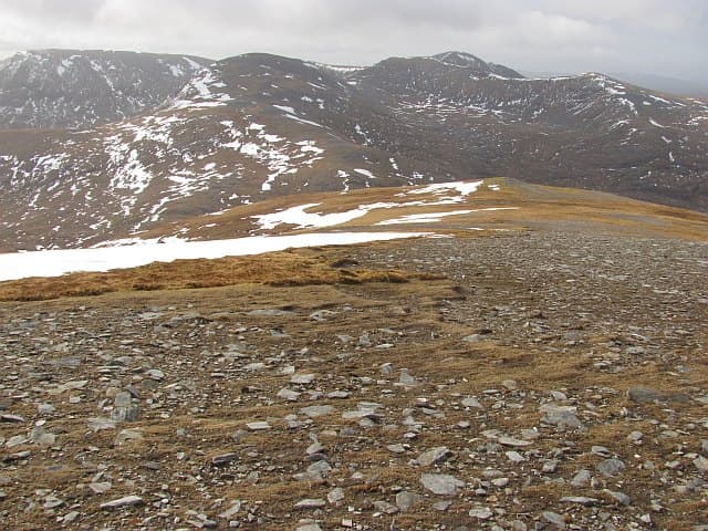
A remote Sutherland Graham buried in the Reay Forest, surrounded by the Foinaven and Arkle massifs. The walk-in alone is a half-day, but the summit rewards with one of the loneliest views in mainland Britain.
Gaelic: “small” · Pronunciation: sabhal bek
Quick facts
- Height
- 730.4m/ 2396ft
- Prominence
- 168 m
- Distance
- 13 km
- Ascent
- 599 m
- Time
- 4–6 hrs
- Grid ref
- NC373429
- Parking
- NC295398
- Nearest
- Ullapool
- Dogs
- Dogs on lead required near livestockDog-friendly guide ↗
Height and prominence cross-checked against the Database of British and Irish Hills (CC BY).
No GPX track yet
Walked this route? Share your track to help other walkers.
Standard route
lodge track 20% · heather moorland 40% · rocky slopes 30% · summit area 10%
Start at the locked gate at Achfary on the A838. Follow the estate road east toward Loch Stack, then south up Strath Stack onto the broad western flank of the hill. The summit is a quartzite cap.
Terrain
Long estate road approach, then rough heather, peat and bog. The upper slopes turn to bright quartzite scree characteristic of the Reay Forest hills.
In winter
Far enough north that Atlantic storms hit hard. Sutherland's short December days make a winter ascent feasible only with early starts. The estate track is the most reliable approach when the moor freezes.
Best time of year
Getting there
- Glasgow5h 21m
- Edinburgh5h 26m
OS maps: OS Landranger 9
Mobile signal: No signal in Reay Forest; reception only at Achfary lodge
Current conditions
Daylight Today
- Sunrise
- 04:33
- Sunset
- 22:16
- Civil dawn
- 03:25
- Civil dusk
- 23:24
NOAA Solar Calculator · 13 July 2026
On a long-distance route
Sabhal Beag sits within 5km of these named long-distance walks — useful for trail-pack rest days or section extensions.
Around Sabhal Beag on the SCOT network
Getting there, basing yourself, and what to do off the hill.
Sabhal Beag — common questions
- How hard is Sabhal Beag?
- We grade Sabhal Beag at 4/5, which puts it in challenging territory. The usual route is around 13km with 599m of climbing; allow 4-6 hours. Terrain: Long estate road approach, then rough heather, peat and bog.
- How prominent is Sabhal Beag?
- Sabhal Beag has 168m of topographic prominence — the height of its summit above the highest col connecting it to higher ground.
- Where should I park to climb Sabhal Beag?
- Standard parking is at NC295398 near Ullapool. Check the parking grid reference on an OS map before travel; informal laybys can fill on summer weekends.
- When should I climb Sabhal Beag?
- The standard good-weather months for Sabhal Beag are May, June, July, August, September. Outside those months, expect winter conditions on the high ground — full mountain kit, navigation skills, and a check of the SAIS avalanche forecast for the relevant region.
- Can I bring my dog up Sabhal Beag?
- On a lead only — the route crosses ground with livestock or nesting-bird interest.
- What's mobile reception like on Sabhal Beag?
- No signal in Reay Forest; reception only at Achfary lodge
- Is Sabhal Beag safe in winter?
- Far enough north that Atlantic storms hit hard. Sutherland's short December days make a winter ascent feasible only with early starts. The estate track is the most reliable approach when the moor freezes.
Get the OutdoorSCOT weekly
One email a week — new route, hill and bothy guides, seasonal conditions and the odd hard-won lesson. No spam, unsubscribe in one click.