Graham · Central Highlands
Meall Mor
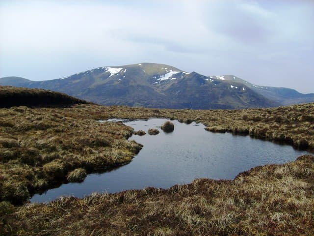
A bulky Graham forming the watershed between Strathglass and Glen Strathfarrar, north of Struy. A pleasant rolling top reached by long forestry approaches — the kind of hill that rewards local knowledge of estate gates.
Gaelic: “rounded hill, big” · Pronunciation: myowl more
Quick facts
- Height
- 738m/ 2421ft
- Prominence
- 263 m
- Distance
- 14 km
- Ascent
- 605 m
- Time
- 4–7 hrs
- Grid ref
- NH515745
- Nearest city
- Inverness· 33km
- Dogs
- Dogs on lead required near livestockDog-friendly guide ↗
Height and prominence cross-checked against the Database of British and Irish Hills (CC BY).
No GPX track yet
Walked this route? Share your track to help other walkers.
Standard route
glen track 25% · heather hillside 45% · grassy ridge 20% · summit area 10%
Permitted access via the locked Strathfarrar gate at Inchmore (note opening times). From Culligran follow estate tracks north-east into the Allt na Criche woodland and climb the south-east shoulder onto the broad summit ridge.
Terrain
Forestry roads for the lower half, then long heather and bracken on the open hill. Boggy patches around the upper bealach. The plateau is wide and grassy.
In winter
Strathfarrar gate hours shrink dramatically in winter and the access road can be blocked by snow. The hill itself is straightforward but timing the descent before the gate closes is the planning crux.
This hill is in the Creag Meagaidh SAIS forecast area. Check SAIS forecasts in winter (December–April).
Best time of year
Getting there
- Glasgow4h 1m
- Edinburgh4h 6m
OS maps: OS Landranger 21, OS Explorer 437
Mobile signal: No signal in Strathfarrar beyond Struy; satellite messenger advisable
Current conditions
Daylight Today
- Sunrise
- 04:37
- Sunset
- 22:10
- Civil dawn
- 03:33
- Civil dusk
- 23:15
NOAA Solar Calculator · 13 July 2026
Around Meall Mor on the SCOT network
Getting there, basing yourself, and what to do off the hill.
Getting there: Dingwall station
Ben Wyvis approach; Easter Ross; junction for Kyle and Far North lines
16km from the hill
tripscot.co.uk
On TripSCOTBase yourself in Inverness
Highland capital — gateway to Cairngorms, Affric, Far North
33km from the hill
tripscot.co.uk
On TasteSCOTAfter the hill: The Dalmore
Alness — sherried Highland flagship; stately Cromarty Firth setting
15km from the hill
tastescot.co.uk
Meall Mor — common questions
- Is Meall Mor a hard climb?
- Meall Mor is rated 4/5 (challenging) on the OutdoorSCOT scale. The standard route covers about 14km with 605m of ascent and takes most walkers 4-7 hours. Underfoot: Forestry roads for the lower half, then long heather and bracken on the open hill.
- What is Meall Mor's prominence?
- 263m of prominence. That's the vertical drop from the summit to the col that links Meall Mor to the next higher ground.
- When is the best time to climb Meall Mor?
- May, June, July, August, September give the most reliable conditions on Meall Mor. Beyond that window the high ground turns wintry: carry full mountain kit, be confident navigating, and check the SAIS avalanche forecast for the area.
- Is Meall Mor dog-friendly?
- Yes, but dogs must be kept on a lead — there is livestock or ground-nesting bird interest on the route.
- Is there mobile signal on Meall Mor?
- No signal in Strathfarrar beyond Struy; satellite messenger advisable
- Is Meall Mor safe in winter?
- Strathfarrar gate hours shrink dramatically in winter and the access road can be blocked by snow. The hill itself is straightforward but timing the descent before the gate closes is the planning crux.
Get the OutdoorSCOT weekly
One email a week — new route, hill and bothy guides, seasonal conditions and the odd hard-won lesson. No spam, unsubscribe in one click.