Graham · North-West Highlands
Beinn nan Ramh
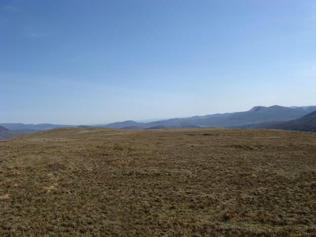
Beinn nan Ramh (711m) — the hill of the oars — lies at NH13 in the Letterewe-Fisherfield hinterland east of Loch Maree, surrounded by far better-known Munros and Corbetts. Its 386m re-ascent secures Graham status on a sandstone shoulder above empty wilderness. The cairn looks west across Loch a' Bhraoin's sister lochans to An Teallach's pinnacled crest and north toward the Fannichs.
Quick facts
- Height
- 711m/ 2333ft
- Prominence
- 386 m
- Distance
- 13 km
- Ascent
- 583 m
- Time
- 4–6 hrs
- Grid ref
- NH139661
- Parking
- NH097686
- Nearest
- Ullapool· Inverness 56km
- Dogs
- Dogs on lead required near livestockDog-friendly guide ↗
Height and prominence cross-checked against the Database of British and Irish Hills (CC BY).
No GPX track yet
Walked this route? Share your track to help other walkers.
Standard route
heather and bog 60% · grass and bracken 20% · rocky ridgeline 20%
Start from the A832 at the Loch a' Bhraoin track-end (NH097686). A landrover track runs west along the loch shore for several kilometres before the route breaks south up rough open hill toward the cairn. 13km on the upland portion with 583m of ascent — but add another 8km of track-walking each way to reach the foot of the climb. A bike is a strong asset here.
Terrain
Loch a' Bhraoin track is reasonable for biking as far as the loch outflow. Beyond, a faint stalkers' line then pathless deer-grass and wet sandstone slabs. The cairn sits on a small rocky plinth with a steep north face — keep well clear in mist.
In winter
Atlantic snowfall buries the sandstone slabs and the upper north face holds windslab through any westerly storm. SAIS Northern Highlands covers the surrounding region directly. December daylight drops below seven hours at this latitude and the long track approach eats into the available daylight — many parties wild-camp at the loch end.
This hill is in the Torridon SAIS forecast area. Check SAIS forecasts in winter (December–April).
Best time of year
Getting there
- Glasgow4h 57m
- Edinburgh4h 16m
OS maps: OS Landranger 19
Mobile signal: Very poor. Remote Letterewe location with no reliable coverage on any network.
Current conditions
Daylight Today
- Sunrise
- 04:47
- Sunset
- 22:06
- Civil dawn
- 03:45
- Civil dusk
- 23:08
NOAA Solar Calculator · 17 July 2026
Around Beinn nan Ramh on the SCOT network
Getting there, basing yourself, and what to do off the hill.
Beinn nan Ramh — common questions
- How hard is Beinn nan Ramh?
- We grade Beinn nan Ramh at 4/5, which puts it in challenging territory. The usual route is around 13km with 583m of climbing; allow 4-6 hours. Underfoot: Loch a' Bhraoin track is reasonable for biking as far as the loch outflow.
- What is Beinn nan Ramh's prominence?
- 386m of prominence. That's the vertical drop from the summit to the col that links Beinn nan Ramh to the next higher ground.
- Where do I park for Beinn nan Ramh?
- Most walkers start from NH097686 near Ullapool. Verify the grid reference on an OS map before you set off — space is tight on busy summer weekends.
- When is the best time to climb Beinn nan Ramh?
- May, June, July, August, September give the most reliable conditions on Beinn nan Ramh. Beyond that window the high ground turns wintry: carry full mountain kit, be confident navigating, and check the SAIS avalanche forecast for the area.
- Is Beinn nan Ramh dog-friendly?
- Yes, but dogs must be kept on a lead — there is livestock or ground-nesting bird interest on the route.
- Is there mobile signal on Beinn nan Ramh?
- Very poor. Remote Letterewe location with no reliable coverage on any network.
- Is Beinn nan Ramh safe in winter?
- Atlantic snowfall buries the sandstone slabs and the upper north face holds windslab through any westerly storm. SAIS Northern Highlands covers the surrounding region directly. December daylight drops below seven hours at this latitude and the long track approach eats into the available daylight — many parties wild-camp at the loch end.
Get the OutdoorSCOT weekly
One email a week — new route, hill and bothy guides, seasonal conditions and the odd hard-won lesson. No spam, unsubscribe in one click.