Donald · Borders
Ettrick Pen
Ettrick Pen rises at the head of the Ettrick Water on the watershed with Annandale, the most southerly significant Donald in the Borders. A round cairn sits on a slope of peat-cropped grass, with the dark forestry plantations of Eskdalemuir reaching well up the southern flank.
Quick facts
- Height
- 691.8m/ 2270ft
- Prominence
- 356 m
- Distance
- 9 km
- Ascent
- 475 m
- Time
- 3–4 hrs
- Grid ref
- NT199076
- Parking
- NT201160
- Nearest city
- Dumfries· 38km
- Dogs
- Dogs on lead required near livestockDog-friendly guide ↗
Height and prominence cross-checked against the Database of British and Irish Hills (CC BY).
No GPX track yet
Walked this route? Share your track to help other walkers.
Standard route
grass moorland 75% · heather slopes 15% · summit plateau 10%
The usual line starts from Over Phawhope bothy or the road end at Potburn, following a forest break onto the open ridge. The final climb crosses tussocky grass to a small col before the summit dome — about 9km return with 480m of climb.
Terrain
Lower ground is plantation forestry and waterlogged peat between the rows. Above the treeline a short heather belt gives way to a smooth grass crown. Old wire fences are the only handrails on top.
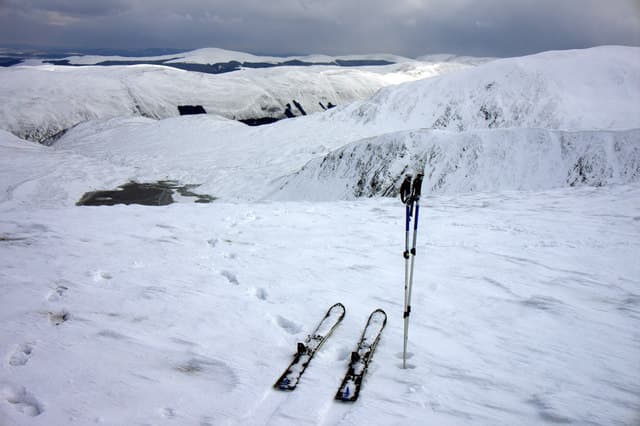
In winter
Snow gathers in the col south of the summit and lingers into late March. SAIS does not cover Ettrick but cornice formation on the east-facing edge above Selcoth Burn is a known hazard after south-westerly storms.
Best time of year
Getting there
- Glasgow2h 47m
- Edinburgh2h 35m
OS maps: OS Landranger 79
Mobile signal: Good summit signal; EE reliable. Fine views across the Ettrick Forest.
Current conditions
Daylight Today
- Sunrise
- 04:49
- Sunset
- 21:49
- Civil dawn
- 03:54
- Civil dusk
- 22:43
NOAA Solar Calculator · 13 July 2026
Pair with
Curated multi-hill combinations from Ettrick Pen.
Around Ettrick Pen on the SCOT network
Getting there, basing yourself, and what to do off the hill.
Ettrick Pen — common questions
- How difficult is Ettrick Pen?
- Ettrick Pen carries a 3/5 (moderately challenging) grade on the OutdoorSCOT scale. Count on about 9km, 475m of ascent and a 3-4 hour day on the standard route. Underfoot: Lower ground is plantation forestry and waterlogged peat between the rows.
- What is Ettrick Pen's prominence?
- 356m of prominence. That's the vertical drop from the summit to the col that links Ettrick Pen to the next higher ground.
- Where do I park for Ettrick Pen?
- Most walkers start from NT201160. Verify the grid reference on an OS map before you set off — space is tight on busy summer weekends.
- When is the best time to climb Ettrick Pen?
- March, April, May, June, July, August, September, October, November give the most reliable conditions on Ettrick Pen. Beyond that window the high ground turns wintry: carry full mountain kit, be confident navigating, and check the SAIS avalanche forecast for the area.
- Is Ettrick Pen dog-friendly?
- Yes, but dogs must be kept on a lead — there is livestock or ground-nesting bird interest on the route.
- Is there mobile signal on Ettrick Pen?
- Good summit signal; EE reliable. Fine views across the Ettrick Forest.
- Is Ettrick Pen safe in winter?
- Snow gathers in the col south of the summit and lingers into late March. SAIS does not cover Ettrick but cornice formation on the east-facing edge above Selcoth Burn is a known hazard after south-westerly storms.
Get the OutdoorSCOT weekly
One email a week — new route, hill and bothy guides, seasonal conditions and the odd hard-won lesson. No spam, unsubscribe in one click.