Donald · Borders
Loch Fell
Loch Fell crowns the small group of hills west of the Ettrick Pen plateau, looking down to the quiet hollow of Loch of the Lowes and Saint Mary's Loch. The top is barely a swelling on a broad grassy roof, marked by a wee pile of stones north of the watershed fence.
Quick facts
- Height
- 688.3m/ 2258ft
- Prominence
- 126 m
- Distance
- 13 km
- Ascent
- 564 m
- Time
- 3–6 hrs
- Grid ref
- NT170047
- Parking
- NT173059
- Nearest city
- Dumfries· 34km
- Dogs
- Dogs on lead required near livestockDog-friendly guide ↗
Height and prominence cross-checked against the Database of British and Irish Hills (CC BY).
No GPX track yet
Walked this route? Share your track to help other walkers.
Standard route
grass moorland 80% · heather patches 15% · summit area 5%
Most ascents start from Tushielaw or the Berrybush road, taking a long forest break onto the open ridge. Around 12km return with 500m of climb. Often combined with Wind Fell to its east.
Terrain
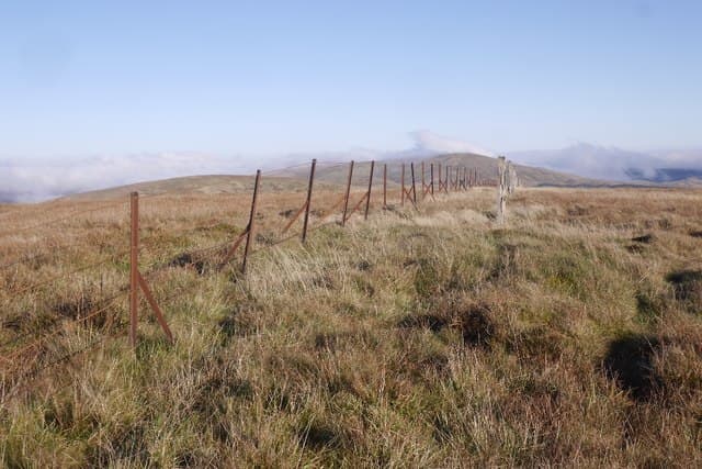
Boot-flattened sheep paths weave between bog cotton and old peat hags. The fence on the watershed is the dependable navigation feature.
In winter
Heavy drifting in the leeward bowls north of the summit when wind comes off the Solway. Frozen peat hags become brutal travel; in a thaw the whole upper plateau turns to a porridge.
Best time of year
Getting there
- Glasgow2h 47m
- Edinburgh2h 40m
OS maps: OS Landranger 79
Mobile signal: Strong summit reception; EE works well. Southern Uplands moorland viewpoint.
Current conditions
Daylight Today
- Sunrise
- 04:49
- Sunset
- 21:49
- Civil dawn
- 03:55
- Civil dusk
- 22:43
NOAA Solar Calculator · 13 July 2026
Around Loch Fell on the SCOT network
Getting there, basing yourself, and what to do off the hill.
Loch Fell — common questions
- How difficult is Loch Fell?
- Loch Fell carries a 3/5 (moderately challenging) grade on the OutdoorSCOT scale. Count on about 13km, 564m of ascent and a 3-6 hour day on the standard route. Underfoot: Boot-flattened sheep paths weave between bog cotton and old peat hags.
- What is Loch Fell's prominence?
- 126m of prominence. That's the vertical drop from the summit to the col that links Loch Fell to the next higher ground.
- Where do I park for Loch Fell?
- Most walkers start from NT173059. Verify the grid reference on an OS map before you set off — space is tight on busy summer weekends.
- When is the best time to climb Loch Fell?
- March, April, May, June, July, August, September, October, November give the most reliable conditions on Loch Fell. Beyond that window the high ground turns wintry: carry full mountain kit, be confident navigating, and check the SAIS avalanche forecast for the area.
- Is Loch Fell dog-friendly?
- Yes, but dogs must be kept on a lead — there is livestock or ground-nesting bird interest on the route.
- Is there mobile signal on Loch Fell?
- Strong summit reception; EE works well. Southern Uplands moorland viewpoint.
- Is Loch Fell safe in winter?
- Heavy drifting in the leeward bowls north of the summit when wind comes off the Solway. Frozen peat hags become brutal travel; in a thaw the whole upper plateau turns to a porridge.
Get the OutdoorSCOT weekly
One email a week — new route, hill and bothy guides, seasonal conditions and the odd hard-won lesson. No spam, unsubscribe in one click.