Donald · Borders
Wind Fell
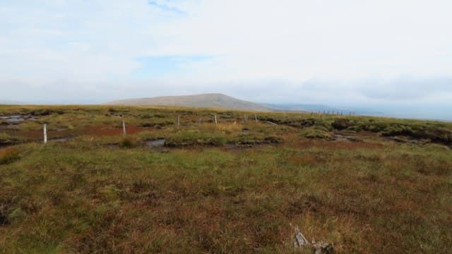
Wind Fell sits east of Loch Fell on the Ettrick watershed, its name justified — the top is fully exposed to anything blowing in from the west. A patch of mossy turf in place of a cairn, with a small windbreak built by passing shepherds.
Quick facts
- Height
- 665.2m/ 2182ft
- Prominence
- 92 m
- Distance
- 13 km
- Ascent
- 545 m
- Time
- 3–6 hrs
- Grid ref
- NT178061
- Parking
- NT191071
- Nearest city
- Dumfries· 36km
- Dogs
- Dogs on lead required near livestockDog-friendly guide ↗
Height and prominence cross-checked against the Database of British and Irish Hills (CC BY).
No GPX track yet
Walked this route? Share your track to help other walkers.
Standard route
grass moorland 80% · heather patches 15% · summit area 5%
Linked routinely with Loch Fell from the Berrybush road, traversing along the watershed fence. About 14km return with 600m of climb for the pair. About 13 km, 545 m of ascent, allow 3.5 hours.
Terrain
A line of broken fence-posts crosses the summit and the ridge alternates between firm turf and short patches of peat hag.
In winter
Famously windswept — wind chill on this top in February is brutal even when valleys are calm. Snow is usually scoured off the crown but accumulates in the col east of the summit.
Best time of year
Getting there
- Glasgow2h 46m
- Edinburgh2h 37m
OS maps: OS Landranger 79
Mobile signal: Solid summit coverage; count on EE. Exposed Southern Uplands watershed.
Current conditions
Daylight Today
- Sunrise
- 04:49
- Sunset
- 21:49
- Civil dawn
- 03:55
- Civil dusk
- 22:43
NOAA Solar Calculator · 13 July 2026
Around Wind Fell on the SCOT network
Getting there, basing yourself, and what to do off the hill.
Wind Fell — common questions
- How difficult is Wind Fell?
- Wind Fell carries a 3/5 (moderately challenging) grade on the OutdoorSCOT scale. Count on about 13km, 545m of ascent and a 3-6 hour day on the standard route. Underfoot: A line of broken fence-posts crosses the summit and the ridge alternates between firm turf and short patches of peat hag.
- What is Wind Fell's prominence?
- 92m of prominence. That's the vertical drop from the summit to the col that links Wind Fell to the next higher ground.
- Where do I park for Wind Fell?
- Most walkers start from NT191071. Verify the grid reference on an OS map before you set off — space is tight on busy summer weekends.
- When is the best time to climb Wind Fell?
- March, April, May, June, July, August, September, October, November give the most reliable conditions on Wind Fell. Beyond that window the high ground turns wintry: carry full mountain kit, be confident navigating, and check the SAIS avalanche forecast for the area.
- Is Wind Fell dog-friendly?
- Yes, but dogs must be kept on a lead — there is livestock or ground-nesting bird interest on the route.
- Is there mobile signal on Wind Fell?
- Solid summit coverage; count on EE. Exposed Southern Uplands watershed.
- Is Wind Fell safe in winter?
- Famously windswept — wind chill on this top in February is brutal even when valleys are calm. Snow is usually scoured off the crown but accumulates in the col east of the summit.
Get the OutdoorSCOT weekly
One email a week — new route, hill and bothy guides, seasonal conditions and the odd hard-won lesson. No spam, unsubscribe in one click.