Donald · Borders
Dun Rig
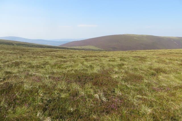
Dun Rig is the prized objective of the long ridge that runs south from Peebles between the Glensax and Manor valleys — wonderful walking country on a clear day. The bare grassy mound at the top is a fine spot to take in the upper Tweed.
Quick facts
- Height
- 742.7m/ 2437ft
- Prominence
- 242 m
- Distance
- 14 km
- Ascent
- 608 m
- Time
- 4–6 hrs
- Grid ref
- NT253315
- Parking
- NT204262
- Nearest city
- Edinburgh· 42km
- Dogs
- Dogs on lead required near livestockDog-friendly guide ↗
Height and prominence cross-checked against the Database of British and Irish Hills (CC BY).
No GPX track yet
Walked this route? Share your track to help other walkers.
Standard route
heather moorland 55% · grass moorland 35% · rocky summit 10%
The classic line is the Glensax Round from Peebles itself, a 22 km horseshoe taking in Hundleshope Heights, Stake Law and Dun Rig before returning along the Birkscairn ridge. Shorter variants start at Kirkhouse on the Manor road.
Terrain
A genuine path runs the length of the Glensax ridge — a rarity in the Borders. The going is short pasture and dry peat with very few wet sections. Easy gradients but a long walk in.
In winter
Easterly snow showers off the North Sea plaster the ridge before the western hills see anything; check Met Office Mountain forecast. Once white, the broad rolling top loses its features and dead reckoning is essential.
Best time of year
Getting there
- Glasgow2h 46m
- Edinburgh1h 1m
OS maps: OS Landranger 73
Current conditions
Daylight Today
- Sunrise
- 04:47
- Sunset
- 21:50
- Civil dawn
- 03:52
- Civil dusk
- 22:45
NOAA Solar Calculator · 13 July 2026
Around Dun Rig on the SCOT network
Getting there, basing yourself, and what to do off the hill.
Dun Rig — common questions
- How difficult is Dun Rig?
- Dun Rig carries a 3/5 (moderately challenging) grade on the OutdoorSCOT scale. Count on about 14km, 608m of ascent and a 4-6 hour day on the standard route. Terrain: A genuine path runs the length of the Glensax ridge — a rarity in the Borders.
- How prominent is Dun Rig?
- Dun Rig has 242m of topographic prominence — the height of its summit above the highest col connecting it to higher ground.
- Where should I park to climb Dun Rig?
- Standard parking is at NT204262. Check the parking grid reference on an OS map before travel; informal laybys can fill on summer weekends.
- When should I climb Dun Rig?
- The standard good-weather months for Dun Rig are April, May, June, July, August, September, October. Outside those months, expect winter conditions on the high ground — full mountain kit, navigation skills, and a check of the SAIS avalanche forecast for the relevant region.
- Can I bring my dog up Dun Rig?
- On a lead only — the route crosses ground with livestock or nesting-bird interest.
- Is Dun Rig safe in winter?
- Easterly snow showers off the North Sea plaster the ridge before the western hills see anything; check Met Office Mountain forecast. Once white, the broad rolling top loses its features and dead reckoning is essential.
Get the OutdoorSCOT weekly
One email a week — new route, hill and bothy guides, seasonal conditions and the odd hard-won lesson. No spam, unsubscribe in one click.