Donald · Borders
Culter Fell
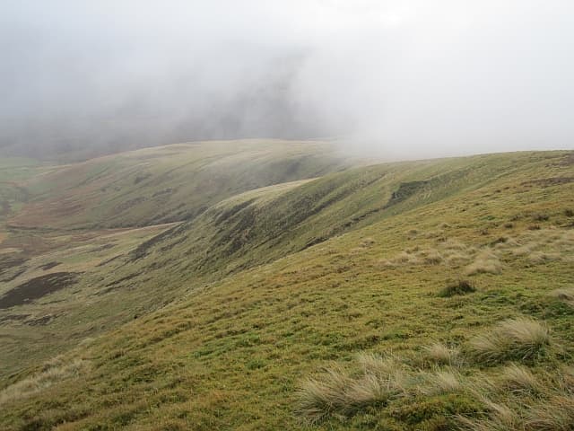
Culter Fell is the highest point in South Lanarkshire, looking down on the Clyde valley and the village of Coulter. A white trig pillar crowns the rounded summit. From the top the eye runs up the Tweed to the Manor Hills and out to Tinto and the western Ochils.
Quick facts
- Height
- 748.4m/ 2455ft
- Prominence
- 350 m
- Distance
- 14 km
- Ascent
- 613 m
- Time
- 4–6 hrs
- Grid ref
- NT052290
- Parking
- NT038157
- Nearest city
- Edinburgh· 49km
- Dogs
- Dogs on lead required near livestockDog-friendly guide ↗
Height and prominence cross-checked against the Database of British and Irish Hills (CC BY).
No GPX track yet
Walked this route? Share your track to help other walkers.
Standard route
heather moorland 60% · grass moorland 30% · rocky summit 10%
The shortest line starts at Birthwood farm in Culter Glen, taking the estate track east and breaking off up the Hudderstone shoulder. The fine ridge continuation south to Chapelgill makes a four-hour horseshoe.
Terrain
Estate track to the col, then heathery grass and a faint quad-bike trace up the broad shoulder. The fence line on the south ridge is a useful guide when the cloud is down on the top.
In winter
Sits high enough to take a proper coat of snow when frontal systems track south. The summit dome is featureless under white-out; ice glazes the trig pillar and the fence wires sing in the wind. Carry full winter gear December to March.
Best time of year
Getting there
- Glasgow1h 24m
- Edinburgh1h 10m
OS maps: OS Landranger 72
Mobile signal: Strong summit reception; EE works well. Prominent Lanarkshire hill with clear sight lines.
Current conditions
Daylight Today
- Sunrise
- 04:49
- Sunset
- 21:51
- Civil dawn
- 03:53
- Civil dusk
- 22:46
NOAA Solar Calculator · 13 July 2026
Pair with
Curated multi-hill combinations from Culter Fell.
Around Culter Fell on the SCOT network
Getting there, basing yourself, and what to do off the hill.
Culter Fell — common questions
- Is Culter Fell a hard climb?
- Culter Fell is rated 3/5 (moderately challenging) on the OutdoorSCOT scale. The standard route covers about 14km with 613m of ascent and takes most walkers 4-6 hours. Ground conditions: Estate track to the col, then heathery grass and a faint quad-bike trace up the broad shoulder.
- How much drop does Culter Fell have?
- The drop is 350m: measured from the summit of Culter Fell down to the saddle joining it to higher terrain.
- Where's the parking for Culter Fell?
- Park at NT038157. Double-check the grid reference on an OS map first; informal laybys here fill early in high season.
- What's the best month to climb Culter Fell?
- Aim for April, May, June, July, August, September, October on Culter Fell. In the remaining months treat it as a winter hill — full kit, solid navigation, and a look at the relevant SAIS avalanche forecast before you go.
- Can dogs go up Culter Fell?
- Dogs are fine on a lead. The route passes livestock or ground-nesting bird habitat, so keep them close throughout.
- Will I get phone signal on Culter Fell?
- Strong summit reception; EE works well. Prominent Lanarkshire hill with clear sight lines.
- Is Culter Fell safe in winter?
- Sits high enough to take a proper coat of snow when frontal systems track south. The summit dome is featureless under white-out; ice glazes the trig pillar and the fence wires sing in the wind. Carry full winter gear December to March.
Get the OutdoorSCOT weekly
One email a week — new route, hill and bothy guides, seasonal conditions and the odd hard-won lesson. No spam, unsubscribe in one click.