Donald · Borders
Chapelgill Hill
Chapelgill is a neat little outlier south of Culter Fell, sandwiched between Culter Glen and the headwaters of the Holms Water. The summit is unmarked — just a patch of trampled bare earth — but the perspective back along the Culter Fell ridge is one of the best in South Lanarkshire.
Quick facts
- Height
- 697.8m/ 2289ft
- Prominence
- 109 m
- Distance
- 13 km
- Ascent
- 572 m
- Time
- 3–6 hrs
- Grid ref
- NT067303
- Parking
- NT056299
- Nearest city
- Edinburgh· 48km
- Dogs
- Dogs on lead required near livestockDog-friendly guide ↗
Height and prominence cross-checked against the Database of British and Irish Hills (CC BY).
No GPX track yet
Walked this route? Share your track to help other walkers.
Standard route
grass moorland 80% · heather patches 15% · summit area 5%
Combine it with Culter Fell in the obvious round from Birthwood, dropping south off Culter's summit over Cardon Hill and Hudderstone to claim Chapelgill, then back down by the Holms Water tributaries.
Terrain
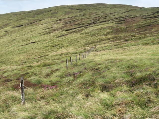
Quad-bike trace links Chapelgill to the parent hill — pleasant going in dry weather. The summit itself is bald earth and short cropped sward where the sheep concentrate.
In winter
A snow-shower magnet in cold polar maritime air — bright squalls of graupel hammer the Culter ridge before sun returns minutes later. Bring waterproof shells and goggles for these conditions.
Best time of year
Getting there
- Glasgow1h 24m
- Edinburgh1h 8m
OS maps: OS Landranger 72
Current conditions
Daylight Today
- Sunrise
- 04:54
- Sunset
- 21:46
- Civil dawn
- 04:01
- Civil dusk
- 22:40
NOAA Solar Calculator · 17 July 2026
Around Chapelgill Hill on the SCOT network
Getting there, basing yourself, and what to do off the hill.
Chapelgill Hill — common questions
- Is Chapelgill Hill a hard climb?
- Chapelgill Hill is rated 3/5 (moderately challenging) on the OutdoorSCOT scale. The standard route covers about 13km with 572m of ascent and takes most walkers 3-6 hours. Terrain: Quad-bike trace links Chapelgill to the parent hill — pleasant going in dry weather.
- How prominent is Chapelgill Hill?
- Chapelgill Hill has 109m of topographic prominence — the height of its summit above the highest col connecting it to higher ground.
- Where should I park to climb Chapelgill Hill?
- Standard parking is at NT056299. Check the parking grid reference on an OS map before travel; informal laybys can fill on summer weekends.
- When should I climb Chapelgill Hill?
- The standard good-weather months for Chapelgill Hill are March, April, May, June, July, August, September, October, November. Outside those months, expect winter conditions on the high ground — full mountain kit, navigation skills, and a check of the SAIS avalanche forecast for the relevant region.
- Can I bring my dog up Chapelgill Hill?
- On a lead only — the route crosses ground with livestock or nesting-bird interest.
- Is Chapelgill Hill safe in winter?
- A snow-shower magnet in cold polar maritime air — bright squalls of graupel hammer the Culter ridge before sun returns minutes later. Bring waterproof shells and goggles for these conditions.
Get the OutdoorSCOT weekly
One email a week — new route, hill and bothy guides, seasonal conditions and the odd hard-won lesson. No spam, unsubscribe in one click.