Donald · Borders
Cramalt Craig
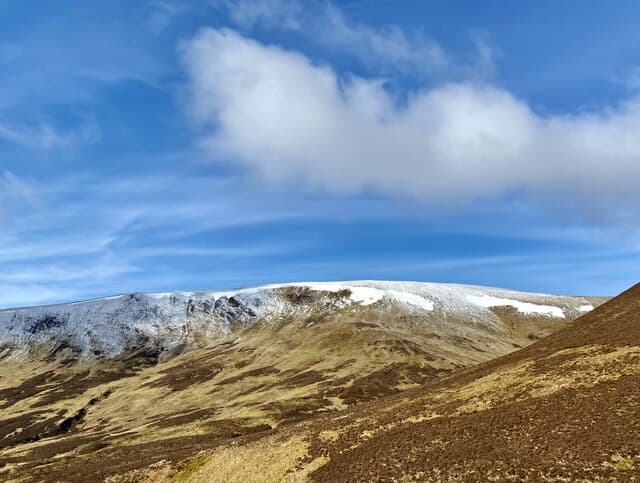
Cramalt Craig is the second-highest summit in the Tweedsmuir Hills, sitting on the long whaleback ridge that runs north from Broad Law above the Megget Reservoir. A cairn beside a fence corner marks the top of an otherwise featureless dome of pale moor grass — wonderful in spring sun, bewildering in cloud.
Quick facts
- Height
- 830.2m/ 2724ft
- Prominence
- 147 m
- Distance
- 15 km
- Ascent
- 730 m
- Time
- 5–7 hrs
- Grid ref
- NT168247
- Parking
- NT158240
- Nearest city
- Edinburgh· 50km
- Dogs
- Dogs on lead required near livestockDog-friendly guide ↗
Height and prominence cross-checked against the Database of British and Irish Hills (CC BY).
No GPX track yet
Walked this route? Share your track to help other walkers.
Standard route
grass moorland 75% · heather patches 20% · summit area 5%
Most parties tag it on a there-and-back walk from the Megget Stone pass, sharing the early ascent with Broad Law before peeling north along the boundary fence. A longer round drops to the Cramalt Burn and returns over Hunt Law.
Terrain
Smooth short grass once on the ridge; the fence acts as a handrail almost all the way. Sphagnum hollows on the col with Broad Law stay wet long after dry spells. No paths to speak of — just sheep tracks parallel to the wire.
In winter
In a hard freeze the moss turns to rock and the going becomes easy and fast. More often the plateau is a slog through soft wet snow with the boundary fence the only certain bearing. Check the SAIS Southern Uplands report and bring a compass.
Best time of year
Getting there
- Glasgow2h 40m
- Edinburgh1h 11m
OS maps: OS Landranger 72
Mobile signal: Reliable up top; EE seldom drops. Broad Tweedsmuir plateau with good sight lines.
Current conditions
Daylight Today
- Sunrise
- 04:48
- Sunset
- 21:50
- Civil dawn
- 03:53
- Civil dusk
- 22:45
NOAA Solar Calculator · 13 July 2026
Pair with
Curated multi-hill combinations from Cramalt Craig.
Around Cramalt Craig on the SCOT network
Getting there, basing yourself, and what to do off the hill.
Cramalt Craig — common questions
- Is Cramalt Craig a hard climb?
- Cramalt Craig is rated 4/5 (challenging) on the OutdoorSCOT scale. The standard route covers about 15km with 730m of ascent and takes most walkers 5-7 hours. Underfoot: Smooth short grass once on the ridge; the fence acts as a handrail almost all the way.
- What is Cramalt Craig's prominence?
- 147m of prominence. That's the vertical drop from the summit to the col that links Cramalt Craig to the next higher ground.
- Where do I park for Cramalt Craig?
- Most walkers start from NT158240. Verify the grid reference on an OS map before you set off — space is tight on busy summer weekends.
- When is the best time to climb Cramalt Craig?
- April, May, June, July, August, September, October give the most reliable conditions on Cramalt Craig. Beyond that window the high ground turns wintry: carry full mountain kit, be confident navigating, and check the SAIS avalanche forecast for the area.
- Is Cramalt Craig dog-friendly?
- Yes, but dogs must be kept on a lead — there is livestock or ground-nesting bird interest on the route.
- Is there mobile signal on Cramalt Craig?
- Reliable up top; EE seldom drops. Broad Tweedsmuir plateau with good sight lines.
- Is Cramalt Craig safe in winter?
- In a hard freeze the moss turns to rock and the going becomes easy and fast. More often the plateau is a slog through soft wet snow with the boundary fence the only certain bearing. Check the SAIS Southern Uplands report and bring a compass.
Get the OutdoorSCOT weekly
One email a week — new route, hill and bothy guides, seasonal conditions and the odd hard-won lesson. No spam, unsubscribe in one click.