Donald · Borders
Andrewhinney Hill
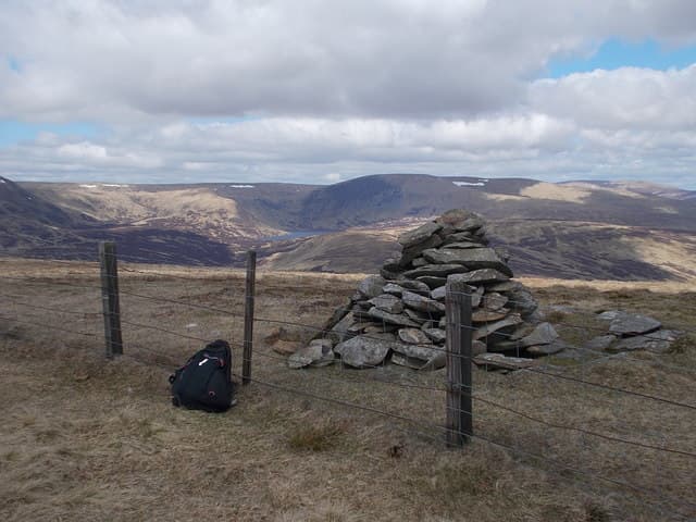
Andrewhinney Hill is the high point of the long ridge that runs north from the head of the Moffat Water towards Ettrick. A small cairn on a slight knoll gives a fine view over Bodesbeck Law and down into the Grey Mare's Tail glen.
Quick facts
- Height
- 677.3m/ 2222ft
- Prominence
- 194 m
- Distance
- 13 km
- Ascent
- 555 m
- Time
- 3–6 hrs
- Grid ref
- NT197138
- Parking
- NT173095
- Nearest city
- Dumfries· 44km
- Dogs
- Dogs on lead required near livestockDog-friendly guide ↗
Height and prominence cross-checked against the Database of British and Irish Hills (CC BY).
No GPX track yet
Walked this route? Share your track to help other walkers.
Standard route
grass moorland 80% · heather patches 15% · summit area 5%
Best taken as part of a Bodesbeck Law traverse from the A708 at the head of Moffat Water. The whole ridge round is about 13km with 800m of climb.
Terrain
Steep initial slope onto the ridge, then easy grass for the rest of the way. A narrow but distinct path runs along most of the watershed.
In winter
Cornice formation on the east-facing edge above the Selcoth corrie is documented after big snow-and-wind events — give the rim a wide berth.
Best time of year
Getting there
- Glasgow2h 53m
- Edinburgh1h 26m
OS maps: OS Landranger 79
Mobile signal: Signal is good; EE works well. Fine views to the Borders.
Current conditions
Daylight Today
- Sunrise
- 04:49
- Sunset
- 21:49
- Civil dawn
- 03:54
- Civil dusk
- 22:44
NOAA Solar Calculator · 13 July 2026
Around Andrewhinney Hill on the SCOT network
Getting there, basing yourself, and what to do off the hill.
Andrewhinney Hill — common questions
- How difficult is Andrewhinney Hill?
- Andrewhinney Hill carries a 3/5 (moderately challenging) grade on the OutdoorSCOT scale. Count on about 13km, 555m of ascent and a 3-6 hour day on the standard route. Underfoot: Steep initial slope onto the ridge, then easy grass for the rest of the way.
- What is Andrewhinney Hill's prominence?
- 194m of prominence. That's the vertical drop from the summit to the col that links Andrewhinney Hill to the next higher ground.
- Where do I park for Andrewhinney Hill?
- Most walkers start from NT173095. Verify the grid reference on an OS map before you set off — space is tight on busy summer weekends.
- When is the best time to climb Andrewhinney Hill?
- March, April, May, June, July, August, September, October, November give the most reliable conditions on Andrewhinney Hill. Beyond that window the high ground turns wintry: carry full mountain kit, be confident navigating, and check the SAIS avalanche forecast for the area.
- Is Andrewhinney Hill dog-friendly?
- Yes, but dogs must be kept on a lead — there is livestock or ground-nesting bird interest on the route.
- Is there mobile signal on Andrewhinney Hill?
- Signal is good; EE works well. Fine views to the Borders.
- Is Andrewhinney Hill safe in winter?
- Cornice formation on the east-facing edge above the Selcoth corrie is documented after big snow-and-wind events — give the rim a wide berth.
Get the OutdoorSCOT weekly
One email a week — new route, hill and bothy guides, seasonal conditions and the odd hard-won lesson. No spam, unsubscribe in one click.