Graham · Glen Coe & Lochaber
Beinn Molurgainn
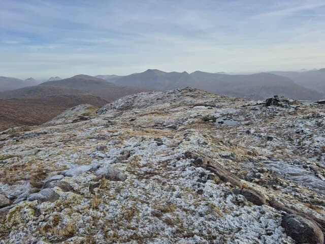
Beinn Molurgainn (688m) is a steep grassy hill at the head of Glen Creran, set in the NN04 square between Beinn Sgulaird and the Lairig Dhomhain. The Gaelic name is obscure but probably refers to a small swelling on the ridge. Its position gives a fine outlook south down Loch Creran and north to Bidean nam Bian.
Quick facts
- Height
- 688.3m/ 2258ft
- Prominence
- 150 m
- Distance
- 13 km
- Ascent
- 564 m
- Time
- 3–6 hrs
- Grid ref
- NN019400
- Parking
- NN019405
- Nearest city
- Oban· 19km
- Dogs
- Dogs on lead required near livestockDog-friendly guide ↗
Height and prominence cross-checked against the Database of British and Irish Hills (CC BY).
No GPX track yet
Walked this route? Share your track to help other walkers.
Standard route
heather moorland 65% · grass slopes 25% · rocky summit 10%
From the road end at Elleric in Glen Creran follow the path north-east up the Allt Mhic Chiarain past the Lairig Dhomhain bothy. Leave the path at the bealach and climb the south-east ridge directly. A broad grassy crest with occasional outcrop leads to the cairn perched on a small rocky knoll.
Terrain
Glen path with frequent bog, then a clear ridge of cropped grass and occasional schist outcrops above 500m. The summit knoll is a tiny rocky platform with steep drops north into Glen Etive. Cropped turf throughout the upper ridge.
In winter
The Glen Creran hills sit on the wet western fringe and snow is intermittent and patchy on Beinn Molurgainn, but the schist slabs glaze quickly under freeze-thaw. The exposed ridge becomes serious in a westerly. SAIS Glencoe forecasts cover this NN04 ground reliably.
This hill is in the Glencoe SAIS forecast area. Check SAIS forecasts in winter (December–April).
Best time of year
Getting there
- Glasgow2h 0m
- Edinburgh3h 59m
OS maps: OS Landranger 50
Mobile signal: Moderate. EE intermittent on upper slopes; better near Loch Awe.
Current conditions
Daylight Today
- Sunrise
- 06:07
- Sunset
- 20:39
- Civil dawn
- 05:26
- Civil dusk
- 21:21
NOAA Solar Calculator · 24 August 2026
Around Beinn Molurgainn on the SCOT network
Getting there, basing yourself, and what to do off the hill.
Getting there: Loch Awe station
East shore Loch Awe; Ben Cruachan; Kilchurn Castle
16km from the hill
tripscot.co.uk
On TripSCOTBase yourself in Oban
Argyll ferry hub — Mull, Lismore, Coll, Tiree, Barra
19km from the hill
tripscot.co.uk
On TasteSCOTAfter the hill: Oban
Oban town centre — tiny two-still distillery bridging Highland and West Coast styles
19km from the hill
tastescot.co.uk
Beinn Molurgainn — common questions
- How hard is Beinn Molurgainn?
- We grade Beinn Molurgainn at 3/5, which puts it in moderately challenging territory. The usual route is around 13km with 564m of climbing; allow 3-6 hours. Terrain: Glen path with frequent bog, then a clear ridge of cropped grass and occasional schist outcrops above 500m.
- How prominent is Beinn Molurgainn?
- Beinn Molurgainn has 150m of topographic prominence — the height of its summit above the highest col connecting it to higher ground.
- Where should I park to climb Beinn Molurgainn?
- Standard parking is at NN019405. Check the parking grid reference on an OS map before travel; informal laybys can fill on summer weekends.
- When should I climb Beinn Molurgainn?
- The standard good-weather months for Beinn Molurgainn are March, April, May, June, July, August, September, October, November. Outside those months, expect winter conditions on the high ground — full mountain kit, navigation skills, and a check of the SAIS avalanche forecast for the relevant region.
- Can I bring my dog up Beinn Molurgainn?
- On a lead only — the route crosses ground with livestock or nesting-bird interest.
- What's mobile reception like on Beinn Molurgainn?
- Moderate. EE intermittent on upper slopes; better near Loch Awe.
- Is Beinn Molurgainn safe in winter?
- The Glen Creran hills sit on the wet western fringe and snow is intermittent and patchy on Beinn Molurgainn, but the schist slabs glaze quickly under freeze-thaw. The exposed ridge becomes serious in a westerly. SAIS Glencoe forecasts cover this NN04 ground reliably.
Get the OutdoorSCOT weekly
One email a week — new route, hill and bothy guides, seasonal conditions and the odd hard-won lesson. No spam, unsubscribe in one click.