Marilyn · Glen Coe & Lochaber
Leathad Mor
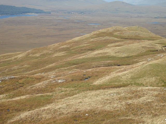
Leathad Mor — the big slope — is a 547m wedge of moor west of Loch Lyon, at NN 378 510 above the head of the loch in the lonely march country between Glen Lyon and Auch. The summit cairn perches on the rim of a long broad ridge that drops east into Glen Mearan and west to the headwaters of the River Coupall.
Gaelic: “big” · Pronunciation: leathad more
Quick facts
- Height
- 547m/ 1795ft
- Prominence
- 210 m
- Grid ref
- NN 37840 51015
- Nearest city
- Fort William· 36km
- Dogs
- Dogs on lead required near livestockDog-friendly guide ↗
Height and prominence cross-checked against the Database of British and Irish Hills (CC BY).
No GPX track yet
Walked this route? Share your track to help other walkers.
Standard route
heather moorland 70% · grass and sedge 20% · rocky outcrops 10%
The shortest line begins at the road end above Loch Lyon dam. Cross the dam embankment, follow the burnt-out estate path north, and once on the open hill climb the eastern shoulder of Leathad Mor directly — there is no continuous footpath, and the route is best done in clear weather.
Terrain
Vast deer-grass and bog-cotton moor with intermittent peat hags; surprisingly few stones underfoot until the small summit cairn. Crossings of the upper Allt Mearan can be awkward in spate.
In winter
A serious half-day in winter — the broad summit is featureless, snow drifts deep on the leeward side, and there is no shelter for nearly 10km. A whiteout-capable navigation plan is essential. Snowshoes occasionally helpful on the peat hags.
This hill is in the Glen Coe SAIS forecast area. Check SAIS forecasts in winter (December–April).
Best time of year
Getting there
- Glasgow2h 13m
- Edinburgh4h 9m
OS maps: OS Landranger 41, OS Explorer 385W
Mobile signal: Poor. EE absent — nearest signal near Aberfeldy or Killin.
Current conditions
Daylight Today
- Sunrise
- 05:15
- Sunset
- 21:35
- Civil dawn
- 04:24
- Civil dusk
- 22:26
NOAA Solar Calculator · 30 July 2026
Around Leathad Mor on the SCOT network
Getting there, basing yourself, and what to do off the hill.
Leathad Mor — common questions
- What difficulty is Leathad Mor?
- On the OutdoorSCOT scale, Leathad Mor comes in at 2/5 — moderate. Ground conditions: Vast deer-grass and bog-cotton moor with intermittent peat hags; surprisingly few stones underfoot until the small summit cairn.
- How much drop does Leathad Mor have?
- The drop is 210m: measured from the summit of Leathad Mor down to the saddle joining it to higher terrain. Passing the 150m-drop threshold on all sides is exactly what makes it a Marilyn.
- What's the best month to climb Leathad Mor?
- Aim for March, April, May, June, July, August, September, October on Leathad Mor. In the remaining months treat it as a winter hill — full kit, solid navigation, and a look at the relevant SAIS avalanche forecast before you go.
- Can dogs go up Leathad Mor?
- Dogs are fine on a lead. The route passes livestock or ground-nesting bird habitat, so keep them close throughout.
- Will I get phone signal on Leathad Mor?
- Poor. EE absent — nearest signal near Aberfeldy or Killin.
- Is Leathad Mor safe in winter?
- A serious half-day in winter — the broad summit is featureless, snow drifts deep on the leeward side, and there is no shelter for nearly 10km. A whiteout-capable navigation plan is essential. Snowshoes occasionally helpful on the peat hags.
Get the OutdoorSCOT weekly
One email a week — new route, hill and bothy guides, seasonal conditions and the odd hard-won lesson. No spam, unsubscribe in one click.