Marilyn · Glen Coe & Lochaber
Sron Smeur
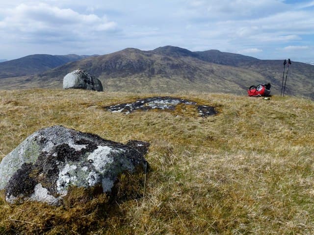
Sron Smeur — the bramble nose — is a 512m Marilyn in NN-square Rannoch, standing above the head of Loch Rannoch at the western end of Loch Eigheach. The summit is the high point of a long ridge above Rannoch station and looks south over the Black Wood of Rannoch.
Quick facts
- Height
- 512.7m/ 1682ft
- Prominence
- 163 m
- Grid ref
- NN 45182 60163
- Nearest city
- Fort William· 37km
- Dogs
- Dogs on lead required near livestockDog-friendly guide ↗
Height and prominence cross-checked against the Database of British and Irish Hills (CC BY).
No GPX track yet
Walked this route? Share your track to help other walkers.
Standard route
heather moorland 65% · grass slopes 25% · rocky summit 10%
A practical start is from Bridge of Gaur or the Rannoch station road, climbing through scattered birch onto the south flank of the ridge. The top end of the ridge is a sloping plateau marked by a small cairn; the bramble-nosed feature for which the hill is named is the steeper north-east spur.
Terrain
Birch scrub and bramble (the smeur of the name) on the lower edge, opening into peat hag and short heather on the broad upper ridge. The north-east nose is craggy but bypassable.
In winter
Rannoch sits in a snow shadow when winds blow from the south-west, but builds drifts behind any easterly. The summit is comparatively low but the wider area is committing — the Rannoch road can be cut off after heavy falls.
This hill is in the Glen Coe SAIS forecast area. Check SAIS forecasts in winter (December–April).
Best time of year
Getting there
- Glasgow2h 18m
- Edinburgh4h 59m
OS maps: OS Landranger 42, OS Explorer 385E
Mobile signal: Poor. A dead zone on all networks on this Perthshire summit.
Current conditions
Daylight Today
- Sunrise
- 05:14
- Sunset
- 21:35
- Civil dawn
- 04:23
- Civil dusk
- 22:26
NOAA Solar Calculator · 30 July 2026
Around Sron Smeur on the SCOT network
Getting there, basing yourself, and what to do off the hill.
Sron Smeur — common questions
- How hard is Sron Smeur?
- We grade Sron Smeur at 2/5, which puts it in moderate territory. Underfoot: Birch scrub and bramble (the smeur of the name) on the lower edge, opening into peat hag and short heather on the broad upper ridge.
- What is Sron Smeur's prominence?
- 163m of prominence. That's the vertical drop from the summit to the col that links Sron Smeur to the next higher ground. That drop is what qualifies it as a Marilyn — a hill with at least 150m of descent on every side.
- When is the best time to climb Sron Smeur?
- March, April, May, June, July, August, September, October give the most reliable conditions on Sron Smeur. Beyond that window the high ground turns wintry: carry full mountain kit, be confident navigating, and check the SAIS avalanche forecast for the area.
- Is Sron Smeur dog-friendly?
- Yes, but dogs must be kept on a lead — there is livestock or ground-nesting bird interest on the route.
- Is there mobile signal on Sron Smeur?
- Poor. A dead zone on all networks on this Perthshire summit.
- Is Sron Smeur safe in winter?
- Rannoch sits in a snow shadow when winds blow from the south-west, but builds drifts behind any easterly. The summit is comparatively low but the wider area is committing — the Rannoch road can be cut off after heavy falls.
Get the OutdoorSCOT weekly
One email a week — new route, hill and bothy guides, seasonal conditions and the odd hard-won lesson. No spam, unsubscribe in one click.