Marilyn · Fife & Perthshire
Meall Chomraidh
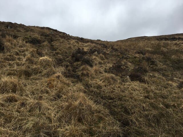
Meall Chomraidh — the hill of the meeting or refuge — is a 466m rounded summit on the north side of Loch Rannoch at NN 483 556. It rises above the Bridge of Ericht and the Camghouran shore, its flanks cloaked in heather and dotted with old shieling sites. From the cairn the whole sweep of Loch Rannoch and the Black Wood is visible.
Quick facts
- Height
- 466.3m/ 1530ft
- Prominence
- 151 m
- Grid ref
- NN 48394 55662
- Nearest city
- Fort William· 42km
- Dogs
- Dogs on lead required near livestockDog-friendly guide ↗
Height and prominence cross-checked against the Database of British and Irish Hills (CC BY).
No GPX track yet
Walked this route? Share your track to help other walkers.
Standard route
heather moorland 65% · grass slopes 25% · rocky summit 10%
Park near Bridge of Ericht on the B846 north-shore Rannoch road. A stalkers' track climbs north into the headwaters of the Allt na Comhraige, then break west off the track and follow the open shoulder onto the heather summit dome.
Terrain
Stalkers' track for the first kilometre, then open heather and short turf. A few peat hags around the summit but generally good going on dry Rannoch moor.
In winter
Winter snow on Loch Rannoch's north shore is patchy but cold easterlies can plaster the upper slopes. The frozen surface of the loch occasionally becomes a hazard for road access — check before driving the B846.
Best time of year
Getting there
- Glasgow2h 10m
- Edinburgh4h 48m
OS maps: OS Landranger 42, OS Landranger 51, OS Explorer 385E
Mobile signal: Poor. EE absent; closest coverage near Killin or Kenmore.
Current conditions
Daylight Today
- Sunrise
- 06:46
- Sunset
- 19:41
- Civil dawn
- 06:08
- Civil dusk
- 20:19
NOAA Solar Calculator · 14 September 2026
Around Meall Chomraidh on the SCOT network
Getting there, basing yourself, and what to do off the hill.
Meall Chomraidh — common questions
- Is Meall Chomraidh a hard climb?
- Meall Chomraidh is rated 1/5 (easy) on the OutdoorSCOT scale. Underfoot: Stalkers' track for the first kilometre, then open heather and short turf.
- What is Meall Chomraidh's prominence?
- 151m of prominence. That's the vertical drop from the summit to the col that links Meall Chomraidh to the next higher ground. That drop is what qualifies it as a Marilyn — a hill with at least 150m of descent on every side.
- When is the best time to climb Meall Chomraidh?
- March, April, May, June, July, August, September, October give the most reliable conditions on Meall Chomraidh. Beyond that window the high ground turns wintry: carry full mountain kit, be confident navigating, and check the SAIS avalanche forecast for the area.
- Is Meall Chomraidh dog-friendly?
- Yes, but dogs must be kept on a lead — there is livestock or ground-nesting bird interest on the route.
- Is there mobile signal on Meall Chomraidh?
- Poor. EE absent; closest coverage near Killin or Kenmore.
- Is Meall Chomraidh safe in winter?
- Winter snow on Loch Rannoch's north shore is patchy but cold easterlies can plaster the upper slopes. The frozen surface of the loch occasionally becomes a hazard for road access — check before driving the B846.
Get the OutdoorSCOT weekly
One email a week — new route, hill and bothy guides, seasonal conditions and the odd hard-won lesson. No spam, unsubscribe in one click.