Marilyn · Glen Coe & Lochaber
Meall Mor
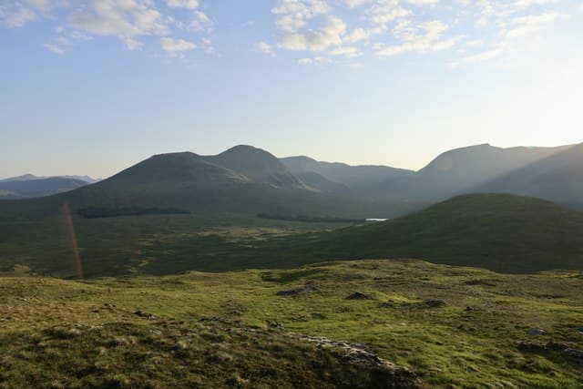
Meall Mor — literally the great lump — is a 492m Marilyn in NN-square Argyll, set above the upper reaches of Glen Kinglass on the moorland north of Loch Tulla. The summit is the high point of the broad watershed dividing the headwaters of the Allt Kinglass from the Abhainn Shira running west to Loch Etive.
Gaelic: “rounded hill, big” · Pronunciation: myowl more
Quick facts
- Height
- 492m/ 1614ft
- Prominence
- 160 m
- Grid ref
- NN 30315 47118
- Nearest city
- Fort William· 33km
- Dogs
- Dogs on lead required near livestockDog-friendly guide ↗
Height and prominence cross-checked against the Database of British and Irish Hills (CC BY).
No GPX track yet
Walked this route? Share your track to help other walkers.
Standard route
heather moorland 65% · grass slopes 25% · rocky summit 10%
Access is easiest from Victoria Bridge at the head of Loch Tulla: take the estate road north past Forest Lodge, then strike west onto open hillside following the line of the Allt Tolaghan. The summit is a long pull on heather and peat with a final dome of mossy grass and a cairn.
Terrain
Deep peat hags low down — locally known as the Black Corries country — give way to short heather and bog cotton on the upper rim. Several burns crossings, none difficult in normal flow.
In winter
Snowfields collect in the corries of the Black Mount to the south, but Meall Mor itself is a windscoured dome that sheds snow quickly. Expect verglas on the peat banks rather than thick cover; an axe is rarely needed.
This hill is in the Glen Coe SAIS forecast area. Check SAIS forecasts in winter (December–April).
Best time of year
Getting there
- Glasgow2h 18m
- Edinburgh4h 23m
OS maps: OS Landranger 50, OS Explorer 377E
Mobile signal: Poor. Remote Highland or Argyll hill; signal absent on all networks.
Current conditions
Daylight Today
- Sunrise
- 05:16
- Sunset
- 21:35
- Civil dawn
- 04:25
- Civil dusk
- 22:26
NOAA Solar Calculator · 30 July 2026
Around Meall Mor on the SCOT network
Getting there, basing yourself, and what to do off the hill.
Meall Mor — common questions
- How difficult is Meall Mor?
- Meall Mor carries a 1/5 (easy) grade on the OutdoorSCOT scale. Ground conditions: Deep peat hags low down — locally known as the Black Corries country — give way to short heather and bog cotton on the upper rim.
- How much drop does Meall Mor have?
- The drop is 160m: measured from the summit of Meall Mor down to the saddle joining it to higher terrain. Passing the 150m-drop threshold on all sides is exactly what makes it a Marilyn.
- What's the best month to climb Meall Mor?
- Aim for March, April, May, June, July, August, September, October on Meall Mor. In the remaining months treat it as a winter hill — full kit, solid navigation, and a look at the relevant SAIS avalanche forecast before you go.
- Can dogs go up Meall Mor?
- Dogs are fine on a lead. The route passes livestock or ground-nesting bird habitat, so keep them close throughout.
- Will I get phone signal on Meall Mor?
- Poor. Remote Highland or Argyll hill; signal absent on all networks.
- Is Meall Mor safe in winter?
- Snowfields collect in the corries of the Black Mount to the south, but Meall Mor itself is a windscoured dome that sheds snow quickly. Expect verglas on the peat banks rather than thick cover; an axe is rarely needed.
Get the OutdoorSCOT weekly
One email a week — new route, hill and bothy guides, seasonal conditions and the odd hard-won lesson. No spam, unsubscribe in one click.