Marilyn · North-West Highlands
An Socach
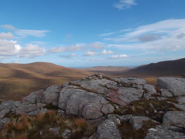
This An Socach — the snout — is the 362m Cape Wrath summit at NC 265 586, one of three Sutherland Marilyns sharing the name. The hill takes its name from a pronounced rocky nose on its eastern flank, jutting out above the surrounding flow country like the snout of an animal.
Quick facts
- Height
- 362m/ 1188ft
- Prominence
- 165 m
- Grid ref
- NC 26548 58601
- Dogs
- Dogs on lead required near livestockDog-friendly guide ↗
Height and prominence cross-checked against the Database of British and Irish Hills (CC BY).
No GPX track yet
Walked this route? Share your track to help other walkers.
Standard route
heather moorland 55% · rocky slopes 30% · grass slopes 15%
Approached from the A838 near Rhiconich, with 5km of walking across open moor before the climb. The eastern snout is best avoided in descent — take the south shoulder for safer going. About 5 hours.
Terrain
Lewisian gneiss with quartzite scree on the eastern snout. The summit area is bare rock pavement with patches of cushion plants; the surrounding bog is wet enough to require gaiters at any season.
In winter
Maritime exposure rather than altitude is the winter problem — the hill is buffeted by Atlantic gales but rarely holds significant snow. Verglas on the quartzite scree of the snout makes descent on that side particularly hazardous.
This hill is in the Torridon SAIS forecast area. Check SAIS forecasts in winter (December–April).
Best time of year
Getting there
- Glasgow7h 2m
- Edinburgh8h 1m
OS maps: OS Landranger 9, OS Explorer 446
Mobile signal: Poor. Signal absent on summit and approach. Inform mountain rescue contact point.
Current conditions
Daylight Today
- Sunrise
- 05:06
- Sunset
- 21:47
- Civil dawn
- 04:09
- Civil dusk
- 22:44
NOAA Solar Calculator · 30 July 2026
Around An Socach on the SCOT network
Getting there, basing yourself, and what to do off the hill.
An Socach — common questions
- Is An Socach a hard climb?
- An Socach is rated 1/5 (easy) on the OutdoorSCOT scale. Underfoot: Lewisian gneiss with quartzite scree on the eastern snout.
- What is An Socach's prominence?
- 165m of prominence. That's the vertical drop from the summit to the col that links An Socach to the next higher ground. That drop is what qualifies it as a Marilyn — a hill with at least 150m of descent on every side.
- When is the best time to climb An Socach?
- March, April, May, June, July, August, September, October give the most reliable conditions on An Socach. Beyond that window the high ground turns wintry: carry full mountain kit, be confident navigating, and check the SAIS avalanche forecast for the area.
- Is An Socach dog-friendly?
- Yes, but dogs must be kept on a lead — there is livestock or ground-nesting bird interest on the route.
- Is there mobile signal on An Socach?
- Poor. Signal absent on summit and approach. Inform mountain rescue contact point.
- Is An Socach safe in winter?
- Maritime exposure rather than altitude is the winter problem — the hill is buffeted by Atlantic gales but rarely holds significant snow. Verglas on the quartzite scree of the snout makes descent on that side particularly hazardous.
Get the OutdoorSCOT weekly
One email a week — new route, hill and bothy guides, seasonal conditions and the odd hard-won lesson. No spam, unsubscribe in one click.